Frost Topo Map Minnesota
To zoom in, hover over the map of Frost
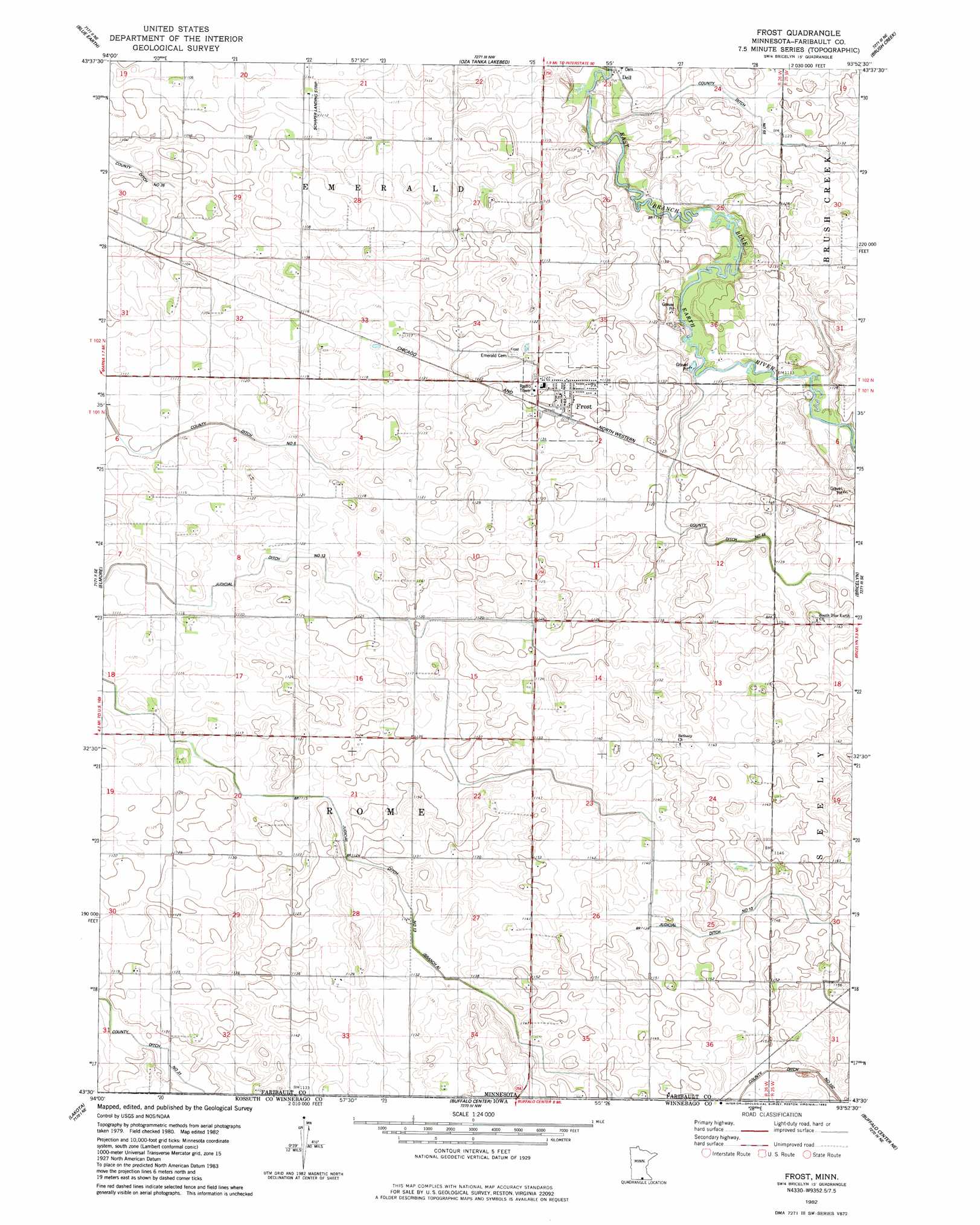
USGS Topo Quad 43093e8 - 1:24,000 scale
| Topo Map Name: | Frost |
| USGS Topo Quad ID: | 43093e8 |
| Print Size: | ca. 21 1/4" wide x 27" high |
| Southeast Coordinates: | 43.5° N latitude / 93.875° W longitude |
| Map Center Coordinates: | 43.5625° N latitude / 93.9375° W longitude |
| U.S. State: | MN |
| Filename: | o43093e8.jpg |
| Download Map JPG Image: | Frost topo map 1:24,000 scale |
| Map Type: | Topographic |
| Topo Series: | 7.5´ |
| Map Scale: | 1:24,000 |
| Source of Map Images: | United States Geological Survey (USGS) |
| Alternate Map Versions: |
Frost MN 1982, updated 1983 Download PDF Buy paper map Frost MN 2010 Download PDF Buy paper map Frost MN 2013 Download PDF Buy paper map Frost MN 2016 Download PDF Buy paper map |
1:24,000 Topo Quads surrounding Frost
Winnebago |
Delavan |
Easton |
Minnesota Lake |
Matawan |
Huntley |
Blue Earth |
Oza Tanka Lakebed |
Brush Creek |
Wells |
Pilot Grove |
Elmore |
Frost |
Bricelyn |
Kiester |
Ledyard |
Lakota |
Buffalo Center |
Buffalo Center Ne |
Vinje |
Bancroft |
German Valley |
Buffalo Center Sw |
Thompson |
Forest City |
> Back to 43093e1 at 1:100,000 scale
> Back to 43092a1 at 1:250,000 scale
> Back to U.S. Topo Maps home
Frost topo map: Gazetteer
Frost: Airports
Schaper Landing Strip elevation 338m 1108′Frost: Canals
County Ditch Number Fiftyfive elevation 341m 1118′County Ditch Number Fortyfour elevation 340m 1115′
County Ditch Number One Hundred Two elevation 351m 1151′
County Ditch Number Thirtyone elevation 338m 1108′
Judicial Ditch Number Thirteen elevation 342m 1122′
Frost: Populated Places
Dell elevation 340m 1115′Frost elevation 344m 1128′
Frost: Post Offices
Dell Post Office (historical) elevation 340m 1115′Frost Post Office elevation 346m 1135′
Frost digital topo map on disk
Buy this Frost topo map showing relief, roads, GPS coordinates and other geographical features, as a high-resolution digital map file on DVD: