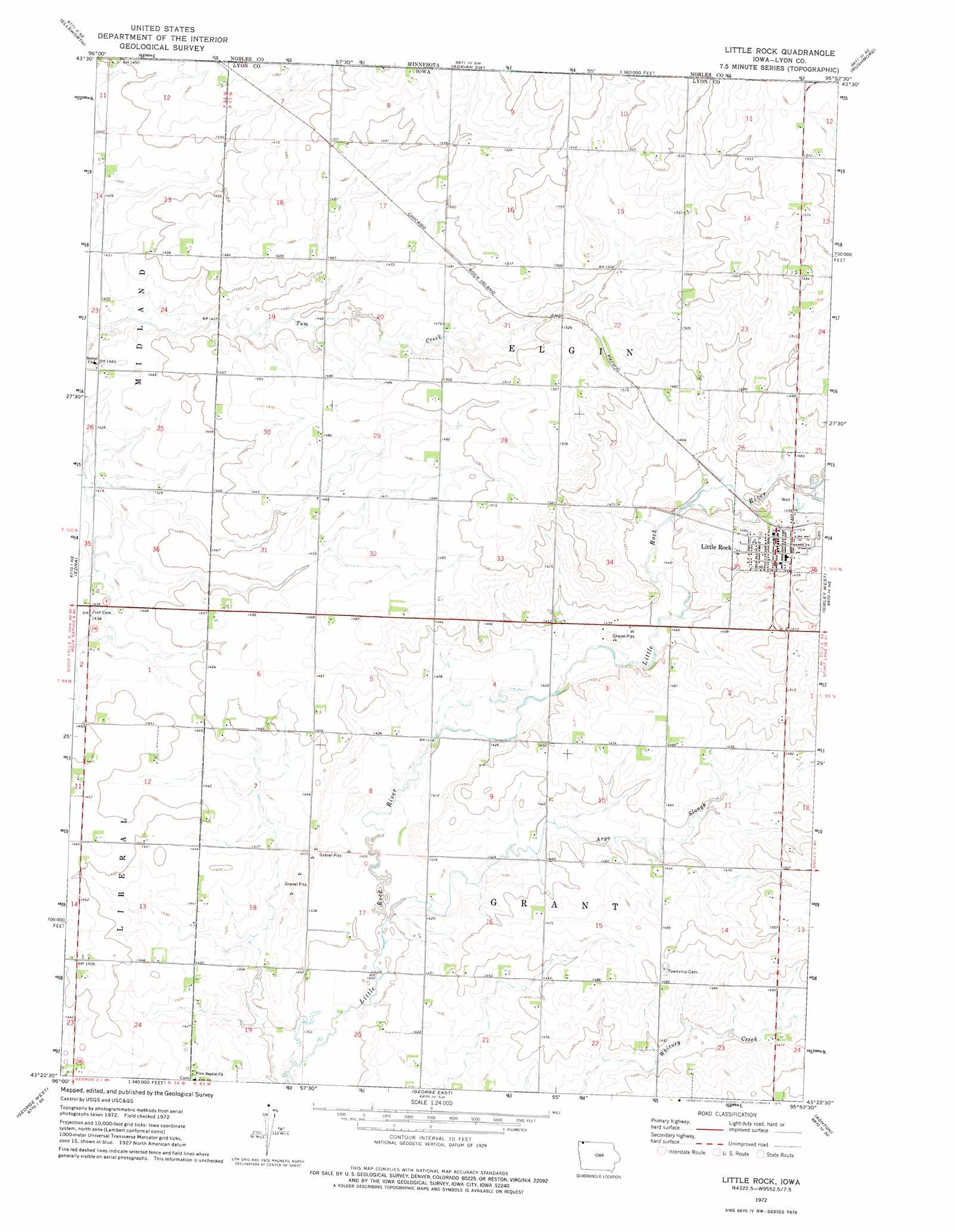
Little Rock Topo Map Iowa
To zoom in, hover over the map of Little Rock
USGS Topo Quad 43095d8 - 1:24,000 scale
| Topo Map Name: | Little Rock |
| USGS Topo Quad ID: | 43095d8 |
| Print Size: | ca. 21 1/4" wide x 27" high |
| Southeast Coordinates: | 43.375° N latitude / 95.875° W longitude |
| Map Center Coordinates: | 43.4375° N latitude / 95.9375° W longitude |
| U.S. State: | IA |
| Filename: | o43095d8.jpg |
| Download Map JPG Image: | Little Rock topo map 1:24,000 scale |
| Map Type: | Topographic |
| Topo Series: | 7.5´ |
| Map Scale: | 1:24,000 |
| Source of Map Images: | United States Geological Survey (USGS) |
| Alternate Map Versions: |
Little Rock IA 1972, updated 1975 Download PDF Buy paper map Little Rock IA 2010 Download PDF Buy paper map Little Rock IA 2013 Download PDF Buy paper map Little Rock IA 2015 Download PDF Buy paper map |
1:24,000 Topo Quads surrounding Little Rock
Luverne |
Magnolia |
Adrian |
Adrian Ne |
Reading |
Ash Creek |
Ellsworth |
Adrian Sw |
Rushmore |
Bigelow |
Rock Rapids |
Edna |
Little Rock |
Sibley West |
Sibley East |
Doon |
George West |
George East |
Ashton |
Cloverdale |
Hull |
Boyden |
Matlock |
Sheldon |
Sanborn |
> Back to 43095a1 at 1:100,000 scale
> Back to 43094a1 at 1:250,000 scale
> Back to U.S. Topo Maps home
Little Rock topo map: Gazetteer
Little Rock: Lakes
Goose Lake (historical) elevation 443m 1453′Little Rock: Parks
Little Rock River Wildlife Area - North Unit elevation 434m 1423′River of Redrock Park elevation 461m 1512′
Little Rock: Populated Places
Little Rock elevation 454m 1489′Little Rock: Post Offices
Little Rock Post Office elevation 454m 1489′Riverview Post Office (historical) elevation 449m 1473′
Willida Post Office (historical) elevation 443m 1453′
Little Rock: Streams
Argo Slough elevation 427m 1400′Little Rock digital topo map on disk
Buy this Little Rock topo map showing relief, roads, GPS coordinates and other geographical features, as a high-resolution digital map file on DVD: