Hamill Ne Topo Map South Dakota
To zoom in, hover over the map of Hamill Ne
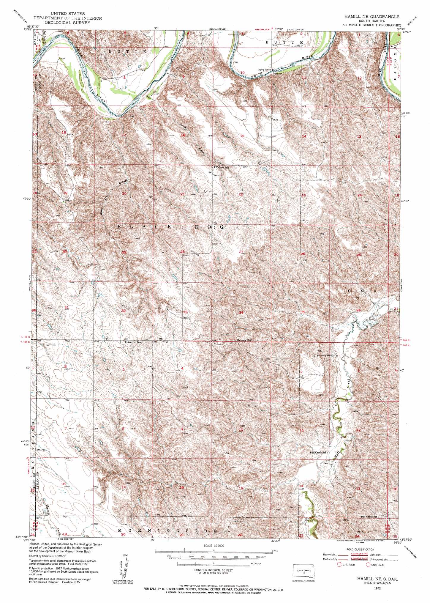
USGS Topo Quad 43099f5 - 1:24,000 scale
| Topo Map Name: | Hamill Ne |
| USGS Topo Quad ID: | 43099f5 |
| Print Size: | ca. 21 1/4" wide x 27" high |
| Southeast Coordinates: | 43.625° N latitude / 99.5° W longitude |
| Map Center Coordinates: | 43.6875° N latitude / 99.5625° W longitude |
| U.S. State: | SD |
| Filename: | o43099f5.jpg |
| Download Map JPG Image: | Hamill Ne topo map 1:24,000 scale |
| Map Type: | Topographic |
| Topo Series: | 7.5´ |
| Map Scale: | 1:24,000 |
| Source of Map Images: | United States Geological Survey (USGS) |
| Alternate Map Versions: |
Hamill NE SD 1952, updated 1954 Download PDF Buy paper map Hamill NE SD 2012 Download PDF Buy paper map Hamill NE SD 2015 Download PDF Buy paper map |
1:24,000 Topo Quads surrounding Hamill Ne
Kennebec |
Lyman |
Reliance |
Short Creek |
Bedashosha Lake |
Kennebec Se |
Reliance Sw |
Reliance Se |
Oacoma |
Chamberlain |
Ideal Ne |
Hamill Nw |
Hamill Ne |
Iona Nw |
Red Lake West |
King Dam |
Hamill |
Hamill Se |
Iona |
Bond Bottom |
Winner North |
Rattlesnake Butte West |
Rattlesnake Butte East |
Dixon |
Dixon Ne |
> Back to 43099e1 at 1:100,000 scale
> Back to 43098a1 at 1:250,000 scale
> Back to U.S. Topo Maps home
Hamill Ne topo map: Gazetteer
Hamill Ne: Dams
DeJong Brothers Number 1 Dam elevation 427m 1400′Walcott Number 1 Dam elevation 489m 1604′
Hamill Ne: Streams
Red Butte Creek elevation 429m 1407′Sand Creek elevation 427m 1400′
Waver Tree Branch elevation 429m 1407′
Hamill Ne digital topo map on disk
Buy this Hamill Ne topo map showing relief, roads, GPS coordinates and other geographical features, as a high-resolution digital map file on DVD:
Eastern North Dakota & Eastern South Dakota
Buy digital topo maps: Eastern North Dakota & Eastern South Dakota