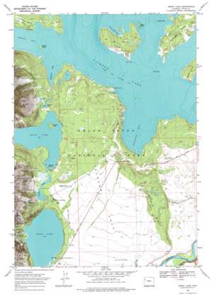
Jenny Lake Topo Map Wyoming
To zoom in, hover over the map of Jenny Lake
USGS Topo Quad 43110g6 - 1:24,000 scale
| Topo Map Name: | Jenny Lake |
| USGS Topo Quad ID: | 43110g6 |
| Print Size: | ca. 21 1/4" wide x 27" high |
| Southeast Coordinates: | 43.75° N latitude / 110.625° W longitude |
| Map Center Coordinates: | 43.8125° N latitude / 110.6875° W longitude |
| U.S. State: | WY |
| Filename: | o43110g6.jpg |
| Download Map JPG Image: | Jenny Lake topo map 1:24,000 scale |
| Map Type: | Topographic |
| Topo Series: | 7.5´ |
| Map Scale: | 1:24,000 |
| Source of Map Images: | United States Geological Survey (USGS) |
| Alternate Map Versions: |
Jenny Lake WY 1968, updated 1972 Download PDF Buy paper map Jenny Lake WY 1968, updated 1975 Download PDF Buy paper map Jenny Lake WY 1968, updated 1975 Download PDF Buy paper map Jenny Lake WY 2012 Download PDF Buy paper map Jenny Lake WY 2015 Download PDF Buy paper map |
| FStopo: | US Forest Service topo Jenny Lake is available: Download FStopo PDF Download FStopo TIF |
1:24,000 Topo Quads surrounding Jenny Lake
> Back to 43110e1 at 1:100,000 scale
> Back to 43110a1 at 1:250,000 scale
> Back to U.S. Topo Maps home
Jenny Lake topo map: Gazetteer
Jenny Lake: Bays
Bearpaw Bay elevation 2065m 6774′Moran Bay elevation 2065m 6774′
North Bar Bay elevation 2065m 6774′
Spalding Bay elevation 2065m 6774′
Jenny Lake: Capes
Deadman Point elevation 2066m 6778′Hermitage Point elevation 2086m 6843′
South Bar elevation 2078m 6817′
Jenny Lake: Cliffs
Inspiration Point elevation 2209m 7247′Jenny Lake: Falls
Ribbon Cascade elevation 2309m 7575′Jenny Lake: Islands
Badger Island elevation 2065m 6774′Boulder Island elevation 2109m 6919′
Dollar Island elevation 2077m 6814′
Donoho Point elevation 2099m 6886′
Elk Island elevation 2095m 6873′
Grassy Island elevation 2070m 6791′
Marie Island elevation 2064m 6771′
Mystic Isle elevation 2109m 6919′
Jenny Lake: Lakes
Bearpaw Lake elevation 2089m 6853′Jenny Lake elevation 2069m 6788′
Laurel Lake elevation 2289m 7509′
Leigh Lake elevation 2097m 6879′
String Lake elevation 2097m 6879′
Trapper Lake elevation 2109m 6919′
Jenny Lake: Parks
Grand Teton National Park elevation 2105m 6906′Jenny Lake: Post Offices
Jenny Lake Post Office (historical) elevation 2100m 6889′Jenny Lake: Ridges
Burned Ridge elevation 2130m 6988′Burnt Ridge elevation 2076m 6811′
Jenny Lake: Streams
Cascade Creek elevation 2069m 6788′North Moran Creek elevation 2065m 6774′
Jenny Lake: Trails
Hidden Falls Horse Trail elevation 2193m 7194′Jenny Lake Moraine Horse Trail elevation 2091m 6860′
Jenny Lake Trail elevation 2091m 6860′
Paintbrush Canyon Trail elevation 2271m 7450′
String Lake Trail elevation 2128m 6981′
Jenny Lake: Valleys
Cascade Canyon elevation 2073m 6801′Hanging Canyon elevation 2070m 6791′
Snowshoe Canyon elevation 2066m 6778′
Jenny Lake digital topo map on disk
Buy this Jenny Lake topo map showing relief, roads, GPS coordinates and other geographical features, as a high-resolution digital map file on DVD:


