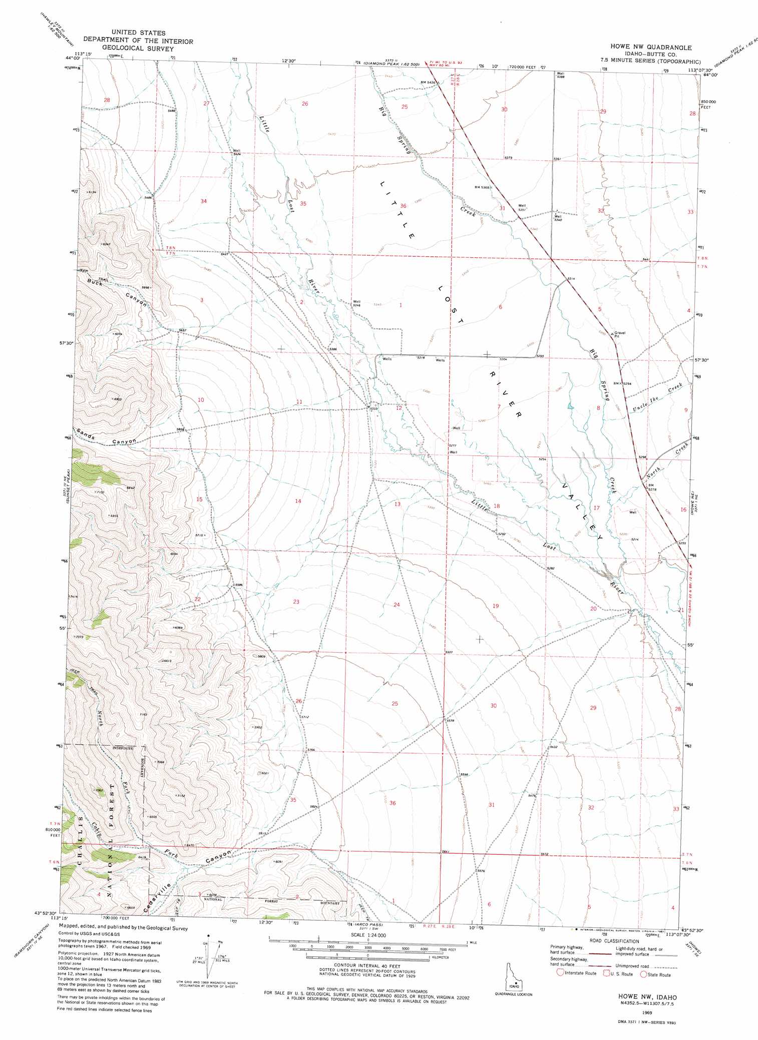
Howe Nw Topo Map Idaho
To zoom in, hover over the map of Howe Nw
USGS Topo Quad 43113h2 - 1:24,000 scale
| Topo Map Name: | Howe Nw |
| USGS Topo Quad ID: | 43113h2 |
| Print Size: | ca. 21 1/4" wide x 27" high |
| Southeast Coordinates: | 43.875° N latitude / 113.125° W longitude |
| Map Center Coordinates: | 43.9375° N latitude / 113.1875° W longitude |
| U.S. State: | ID |
| Filename: | o43113h2.jpg |
| Download Map JPG Image: | Howe Nw topo map 1:24,000 scale |
| Map Type: | Topographic |
| Topo Series: | 7.5´ |
| Map Scale: | 1:24,000 |
| Source of Map Images: | United States Geological Survey (USGS) |
| Alternate Map Versions: |
Howe NW ID 1969, updated 1973 Download PDF Buy paper map Howe NW ID 1969, updated 1981 Download PDF Buy paper map Howe NW ID 2011 Download PDF Buy paper map Howe NW ID 2013 Download PDF Buy paper map |
| FStopo: | US Forest Service topo Howe NW is available: Download FStopo PDF Download FStopo TIF |
1:24,000 Topo Quads surrounding Howe Nw
Red Hills |
Mulkey Bar |
Bell Mountain |
Diamond Peak |
Blue Dome |
Warren Mountain |
Hawley Mountain |
Badger Creek |
Fallert Springs |
Eightmile Canyon |
Methodist Creek |
Sunset Peak |
Howe Nw |
Howe Ne |
Tyler Peak |
Darlington |
Ramshorn Canyon |
Arco Pass |
Howe |
Little Lost River Sinks |
Appendicitis Hill |
Arco North |
Arco Hills |
Howe Peak |
Circular Butte 3 Nw |
> Back to 43113e1 at 1:100,000 scale
> Back to 43112a1 at 1:250,000 scale
> Back to U.S. Topo Maps home
Howe Nw topo map: Gazetteer
Howe Nw: Streams
Big Spring Creek elevation 1583m 5193′Boulder Creek elevation 1655m 5429′
Cabin Fork elevation 1839m 6033′
North Creek elevation 1592m 5223′
North Fork Cabin Fork elevation 1860m 6102′
Uncle Ike Creek elevation 1600m 5249′
Howe Nw: Valleys
Bird Canyon elevation 1678m 5505′Buck Canyon elevation 1697m 5567′
Cedarville Canyon elevation 1760m 5774′
Sands Canyon elevation 1805m 5921′
Howe Nw digital topo map on disk
Buy this Howe Nw topo map showing relief, roads, GPS coordinates and other geographical features, as a high-resolution digital map file on DVD: