Coyote Buttes Topo Map Oregon
To zoom in, hover over the map of Coyote Buttes
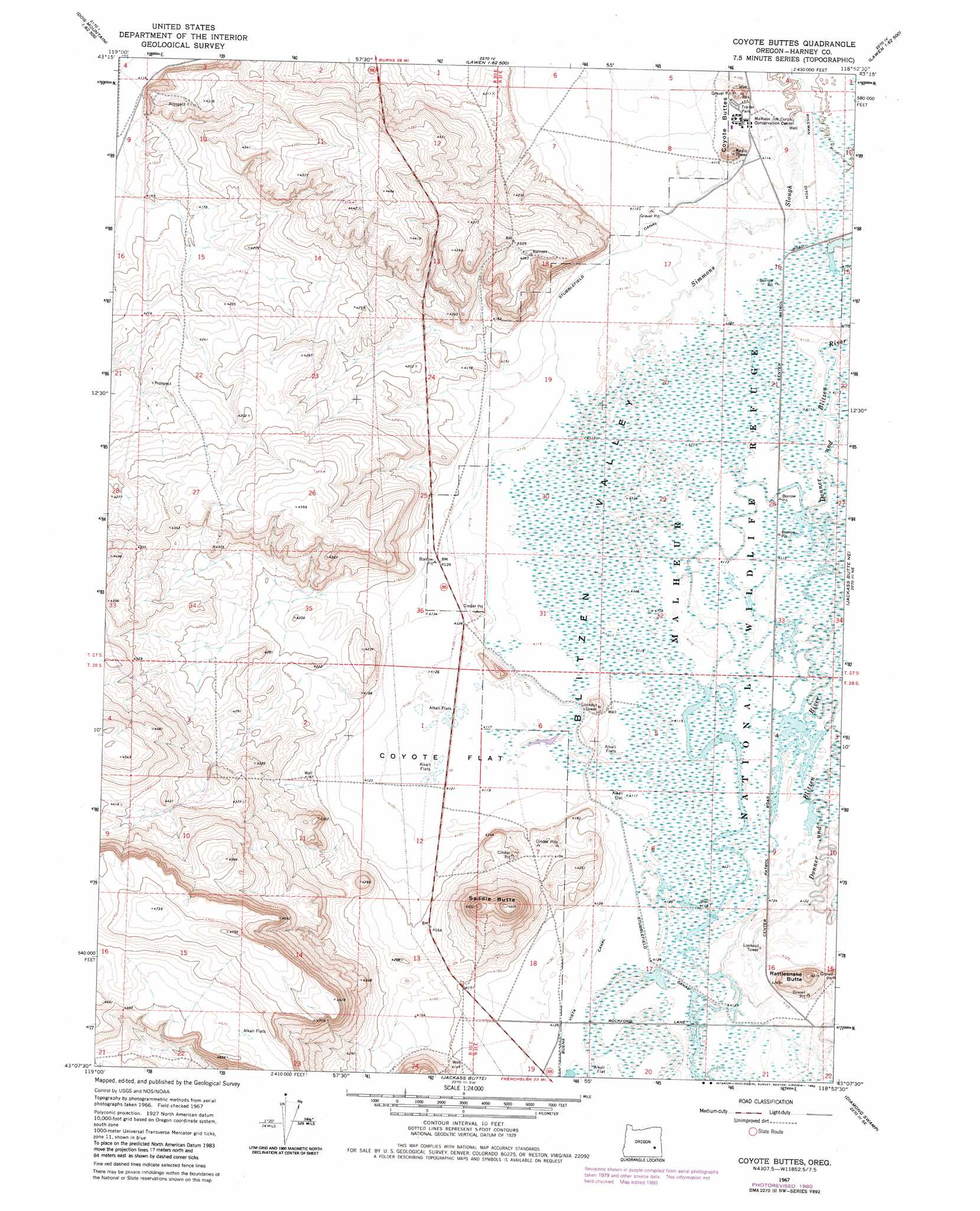
USGS Topo Quad 43118b8 - 1:24,000 scale
| Topo Map Name: | Coyote Buttes |
| USGS Topo Quad ID: | 43118b8 |
| Print Size: | ca. 21 1/4" wide x 27" high |
| Southeast Coordinates: | 43.125° N latitude / 118.875° W longitude |
| Map Center Coordinates: | 43.1875° N latitude / 118.9375° W longitude |
| U.S. State: | OR |
| Filename: | o43118b8.jpg |
| Download Map JPG Image: | Coyote Buttes topo map 1:24,000 scale |
| Map Type: | Topographic |
| Topo Series: | 7.5´ |
| Map Scale: | 1:24,000 |
| Source of Map Images: | United States Geological Survey (USGS) |
| Alternate Map Versions: |
Coyote Buttes OR 1967, updated 1972 Download PDF Buy paper map Coyote Buttes OR 1967, updated 1980 Download PDF Buy paper map Coyote Buttes OR 2011 Download PDF Buy paper map Coyote Buttes OR 2014 Download PDF Buy paper map |
1:24,000 Topo Quads surrounding Coyote Buttes
Weaver Lake |
Dog Mountain |
Redess |
Lawen |
Warm Springs Butte |
Northwest Harney Lake |
Northeast Harney Lake |
The Narrows |
Malheur Lake West |
Malheur Lake East |
Southwest Harney Lake |
Southeast Harney Lake |
Coyote Buttes |
Jackass Butte Ne |
Barton Lake |
Weed Lake Butte |
Twin Buttes |
Jackass Butte |
Diamond Swamp |
Diamond |
Keg Sprs Valley West |
Keg Sprs Valley East |
Irish Lake |
Krumbo Reservoir |
Krumbo Ridge |
> Back to 43118a1 at 1:100,000 scale
> Back to 43118a1 at 1:250,000 scale
> Back to U.S. Topo Maps home
Coyote Buttes topo map: Gazetteer
Coyote Buttes: Canals
Stubblefield Canal elevation 1255m 4117′Coyote Buttes: Flats
Coyote Flat elevation 1257m 4124′Coyote Buttes: Summits
Coyote Butte elevation 1297m 4255′Rattlesnake Butte elevation 1315m 4314′
Saddle Butte elevation 1404m 4606′
Coyote Buttes digital topo map on disk
Buy this Coyote Buttes topo map showing relief, roads, GPS coordinates and other geographical features, as a high-resolution digital map file on DVD: