Algoma Topo Map Wisconsin
To zoom in, hover over the map of Algoma
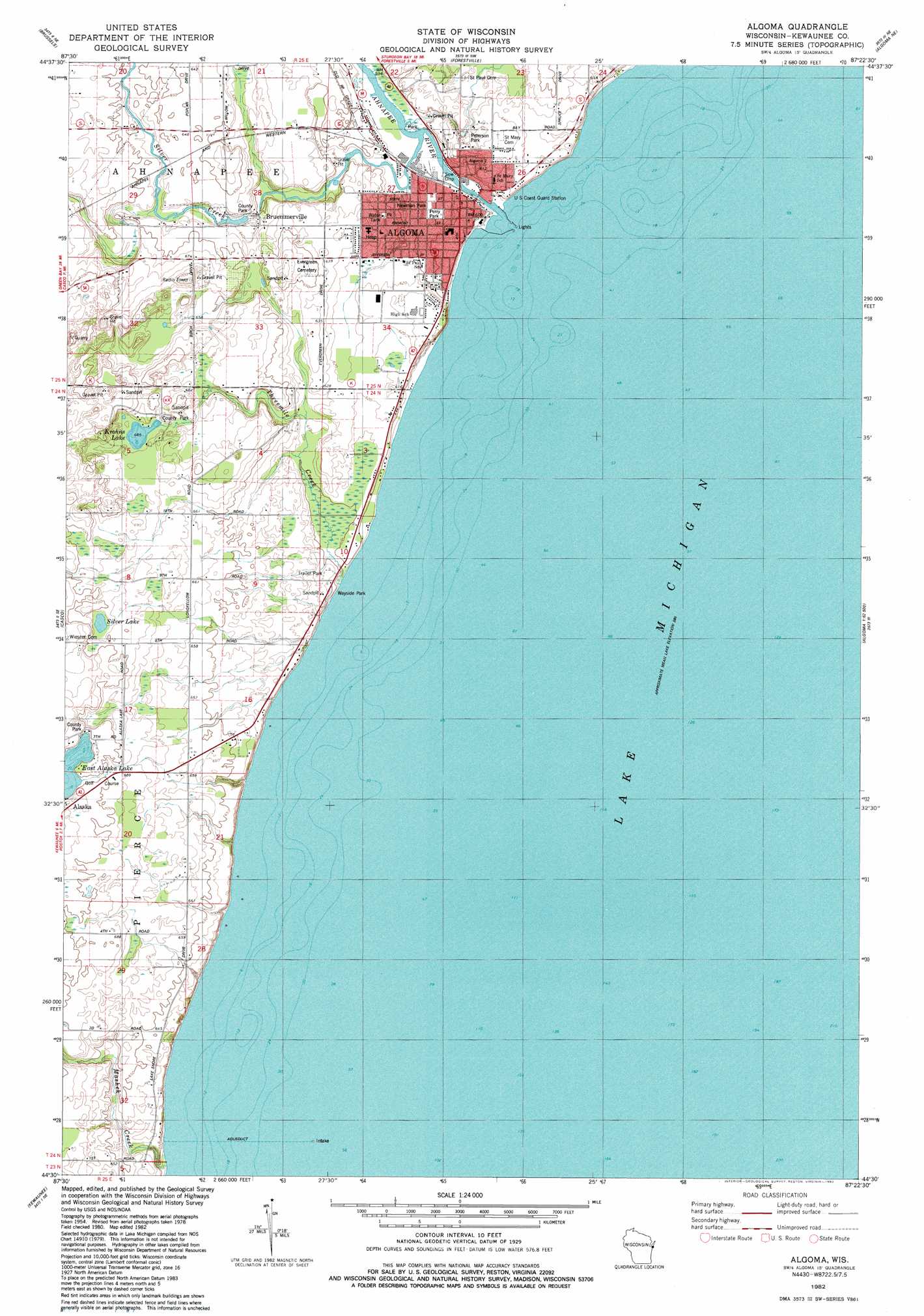
USGS Topo Quad 44087e4 - 1:24,000 scale
| Topo Map Name: | Algoma |
| USGS Topo Quad ID: | 44087e4 |
| Print Size: | ca. 21 1/4" wide x 27" high |
| Southeast Coordinates: | 44.5° N latitude / 87.375° W longitude |
| Map Center Coordinates: | 44.5625° N latitude / 87.4375° W longitude |
| U.S. State: | WI |
| Filename: | o44087e4.jpg |
| Download Map JPG Image: | Algoma topo map 1:24,000 scale |
| Map Type: | Topographic |
| Topo Series: | 7.5´ |
| Map Scale: | 1:24,000 |
| Source of Map Images: | United States Geological Survey (USGS) |
| Alternate Map Versions: |
Algoma WI 1982, updated 1982 Download PDF Buy paper map Algoma WI 2010 Download PDF Buy paper map Algoma WI 2013 Download PDF Buy paper map Algoma WI 2015 Download PDF Buy paper map |
1:24,000 Topo Quads surrounding Algoma
Little Sturgeon Sw |
Little Sturgeon |
Sturgeon Bay West |
Sturgeon Bay East |
Jacksonport Sw |
Namur |
Brussels |
Forestville |
Algoma Ne |
|
Luxemburg |
Casco |
Algoma |
||
Stangelville |
Kewaunee |
|||
Larrabee |
Two Creeks |
> Back to 44087e1 at 1:100,000 scale
> Back to 44086a1 at 1:250,000 scale
> Back to U.S. Topo Maps home
Algoma topo map: Gazetteer
Algoma: Dams
Henry Iwen Dam elevation 180m 590′Algoma: Lakes
Alaska Lake elevation 212m 695′Krohns Lake elevation 203m 666′
Silver Lake elevation 210m 688′
Algoma: Parks
Kewaunee County Park elevation 212m 695′Kewaunee County Park elevation 205m 672′
Newman Park elevation 180m 590′
Perry Park elevation 180m 590′
Peterson Park elevation 185m 606′
Algoma: Populated Places
Algoma elevation 178m 583′Bruemmerville elevation 189m 620′
Algoma: Reservoirs
61 Reservoir elevation 180m 590′Algoma: Streams
Ahnapee River elevation 179m 587′Mashek Creek elevation 177m 580′
Silver Creek elevation 178m 583′
Threemile Creek elevation 177m 580′
Algoma digital topo map on disk
Buy this Algoma topo map showing relief, roads, GPS coordinates and other geographical features, as a high-resolution digital map file on DVD: