Plainview Topo Map Minnesota
To zoom in, hover over the map of Plainview
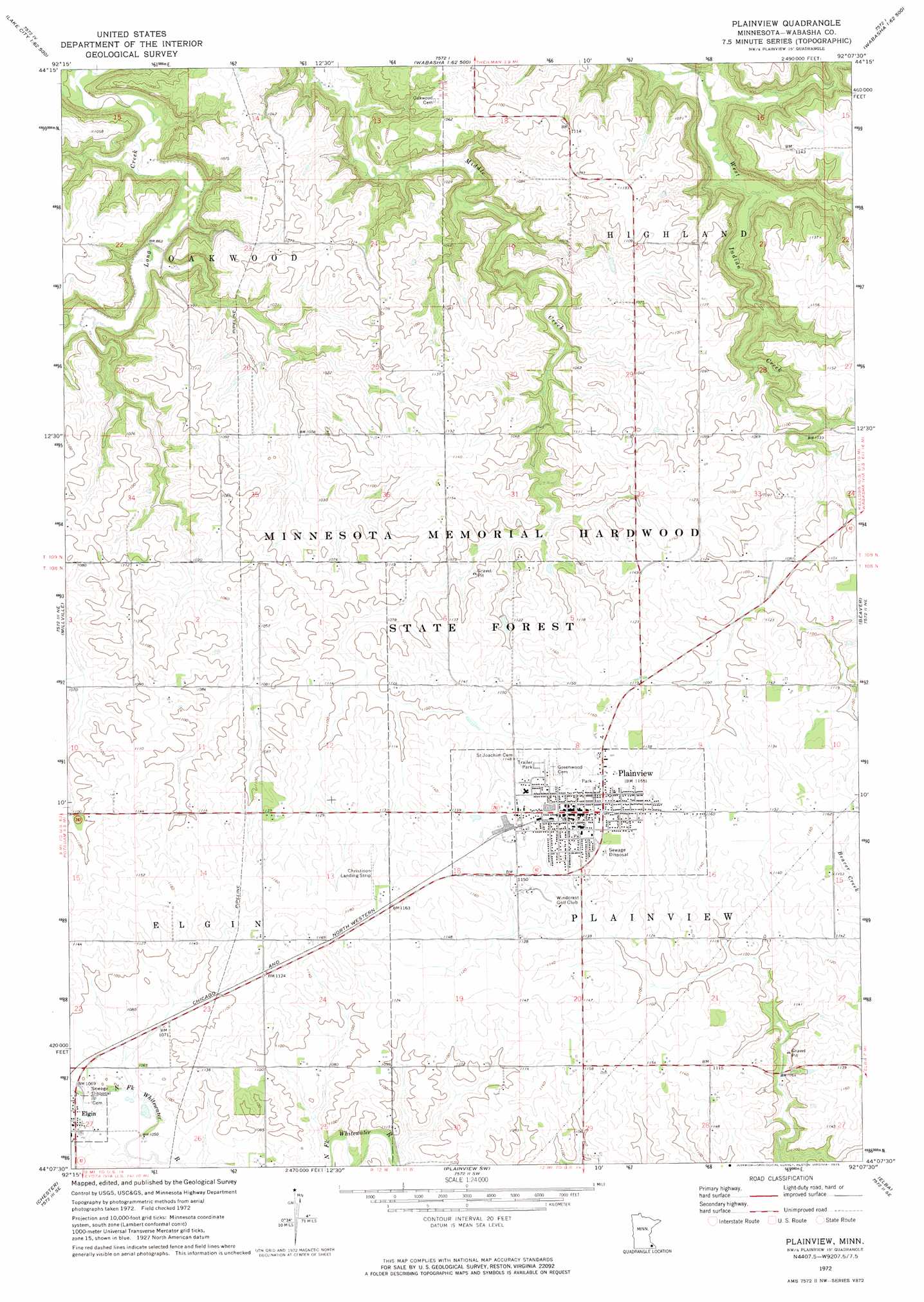
USGS Topo Quad 44092b2 - 1:24,000 scale
| Topo Map Name: | Plainview |
| USGS Topo Quad ID: | 44092b2 |
| Print Size: | ca. 21 1/4" wide x 27" high |
| Southeast Coordinates: | 44.125° N latitude / 92.125° W longitude |
| Map Center Coordinates: | 44.1875° N latitude / 92.1875° W longitude |
| U.S. State: | MN |
| Filename: | o44092b2.jpg |
| Download Map JPG Image: | Plainview topo map 1:24,000 scale |
| Map Type: | Topographic |
| Topo Series: | 7.5´ |
| Map Scale: | 1:24,000 |
| Source of Map Images: | United States Geological Survey (USGS) |
| Alternate Map Versions: |
Plainview MN 1972, updated 1975 Download PDF Buy paper map Plainview MN 2010 Download PDF Buy paper map Plainview MN 2013 Download PDF Buy paper map Plainview MN 2016 Download PDF Buy paper map |
1:24,000 Topo Quads surrounding Plainview
Lake City Nw |
Lake City |
Pepin |
Wabasha North |
Urne |
Zumbro Falls |
West Albany |
Theilman |
Wabasha South |
Alma |
Zumbro Lake |
Millville |
Plainview |
Beaver |
Weaver |
Rochester |
Chester |
Plainview Sw |
Elba |
Altura |
Simpson |
Marion |
Eyota |
Saint Charles |
Utica |
> Back to 44092a1 at 1:100,000 scale
> Back to 44092a1 at 1:250,000 scale
> Back to U.S. Topo Maps home
Plainview topo map: Gazetteer
Plainview: Airports
Christison Airport elevation 353m 1158′Plainview: Dams
Frank Pletsch Dam elevation 337m 1105′Hunter-Sprenger Pooling Agreement Dam elevation 342m 1122′
S Hudell Dam elevation 339m 1112′
Wilmer Schmidt Dam elevation 340m 1115′
Plainview: Parks
Eastwood Park elevation 353m 1158′Eckstein Athletic Field elevation 350m 1148′
Hillcrest Park elevation 348m 1141′
Southwest Park elevation 347m 1138′
Plainview: Populated Places
Plainview elevation 354m 1161′Plainview: Post Offices
Plainview Post Office elevation 354m 1161′Plainview: Streams
Dry Creek elevation 322m 1056′Plainview digital topo map on disk
Buy this Plainview topo map showing relief, roads, GPS coordinates and other geographical features, as a high-resolution digital map file on DVD: