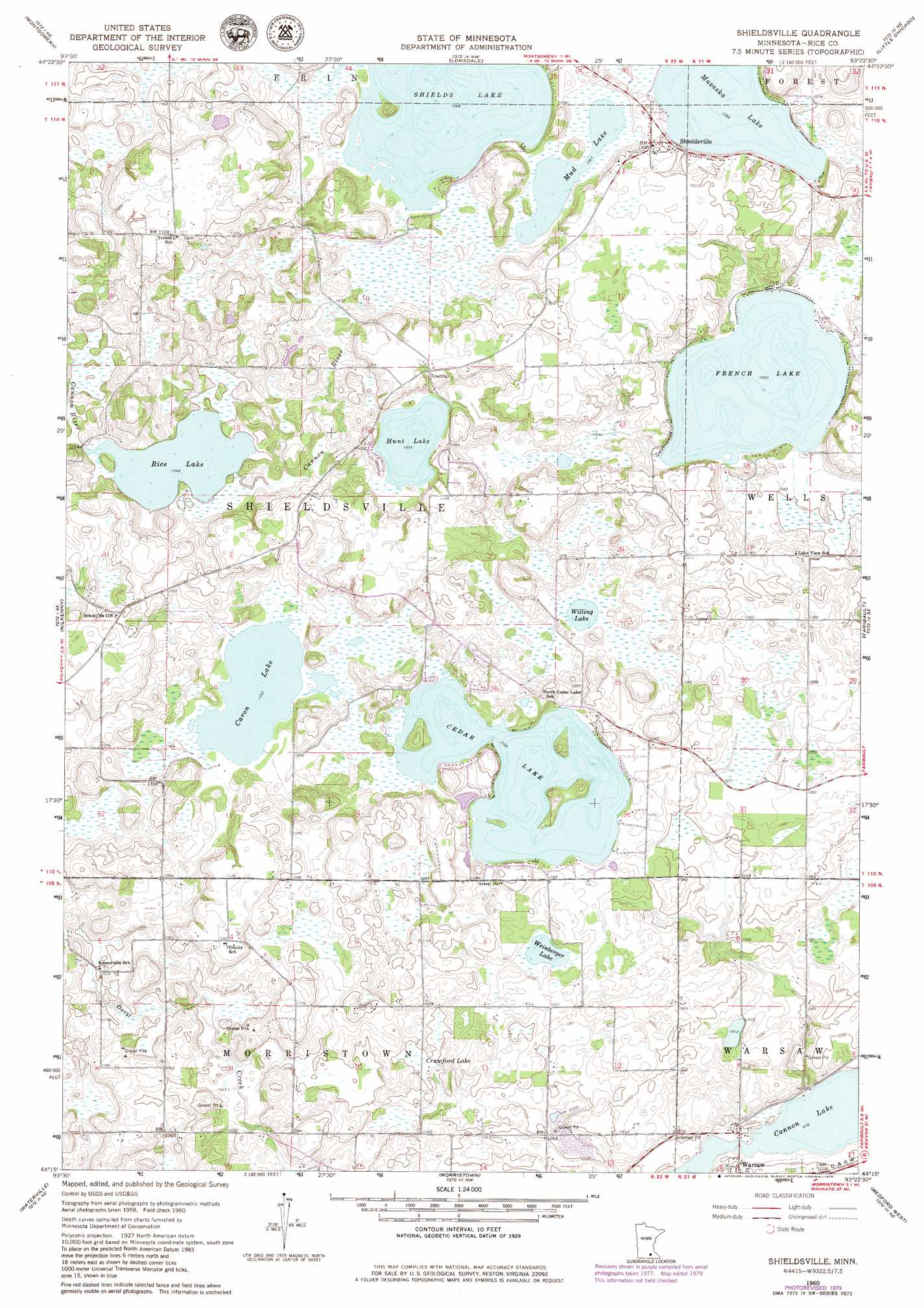
Shieldsville Topo Map Minnesota
To zoom in, hover over the map of Shieldsville
USGS Topo Quad 44093c4 - 1:24,000 scale
| Topo Map Name: | Shieldsville |
| USGS Topo Quad ID: | 44093c4 |
| Print Size: | ca. 21 1/4" wide x 27" high |
| Southeast Coordinates: | 44.25° N latitude / 93.375° W longitude |
| Map Center Coordinates: | 44.3125° N latitude / 93.4375° W longitude |
| U.S. State: | MN |
| Filename: | o44093c4.jpg |
| Download Map JPG Image: | Shieldsville topo map 1:24,000 scale |
| Map Type: | Topographic |
| Topo Series: | 7.5´ |
| Map Scale: | 1:24,000 |
| Source of Map Images: | United States Geological Survey (USGS) |
| Alternate Map Versions: |
Shieldsville MN 1960, updated 1961 Download PDF Buy paper map Shieldsville MN 1960, updated 1974 Download PDF Buy paper map Shieldsville MN 1960, updated 1979 Download PDF Buy paper map Shieldsville MN 2010 Download PDF Buy paper map Shieldsville MN 2013 Download PDF Buy paper map Shieldsville MN 2016 Download PDF Buy paper map |
1:24,000 Topo Quads surrounding Shieldsville
Union Hill |
New Prague |
Veseli |
New Market |
Castle Rock |
Le Center |
Montgomery |
Lonsdale |
Little Chicago |
Northfield |
Cordova |
Kilkenny |
Shieldsville |
Faribault |
Cannon City |
Elysian |
Waterville |
Morristown |
Medford West |
Medford East |
Janesville |
Waseca |
Meriden |
Saco |
Owatonna |
> Back to 44093a1 at 1:100,000 scale
> Back to 44092a1 at 1:250,000 scale
> Back to U.S. Topo Maps home
Shieldsville topo map: Gazetteer
Shieldsville: Dams
Rice Lake Dam elevation 320m 1049′Shieldsville: Lakes
Caron Lake elevation 321m 1053′Cedar Lake elevation 322m 1056′
French Lake elevation 320m 1049′
Hunt Lake elevation 327m 1072′
Mazaska Lake elevation 325m 1066′
Mud Lake elevation 325m 1066′
Rice Lake elevation 319m 1046′
Shields Lake elevation 326m 1069′
Weinberger Lake elevation 325m 1066′
Willing Lake elevation 325m 1066′
Shieldsville: Populated Places
Shieldsville elevation 333m 1092′Shieldsville: Reservoirs
Rice Lake elevation 320m 1049′Shieldsville: Swamps
Crawford Lake elevation 319m 1046′Shieldsville digital topo map on disk
Buy this Shieldsville topo map showing relief, roads, GPS coordinates and other geographical features, as a high-resolution digital map file on DVD: