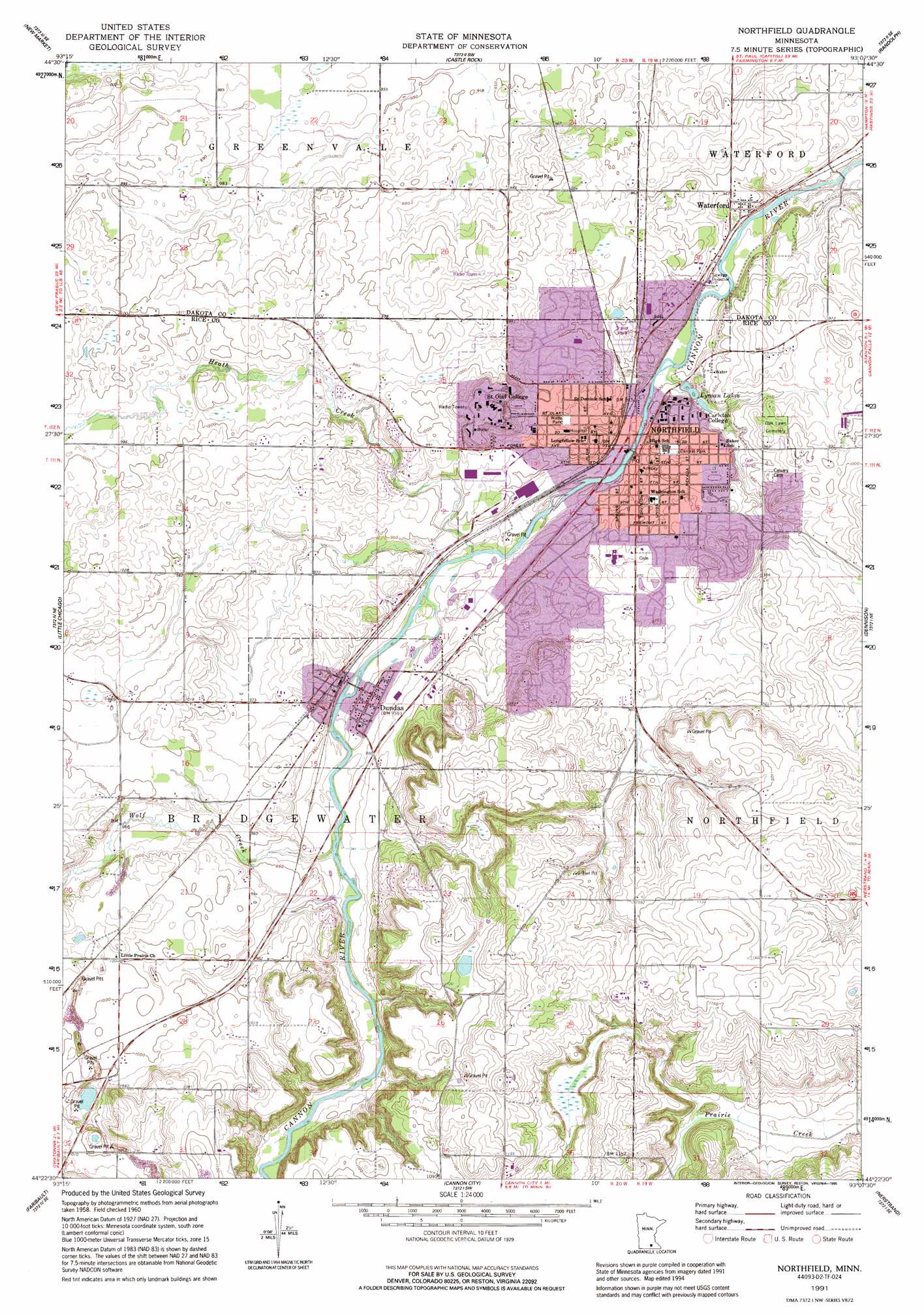
Northfield Topo Map Minnesota
To zoom in, hover over the map of Northfield
USGS Topo Quad 44093d2 - 1:24,000 scale
| Topo Map Name: | Northfield |
| USGS Topo Quad ID: | 44093d2 |
| Print Size: | ca. 21 1/4" wide x 27" high |
| Southeast Coordinates: | 44.375° N latitude / 93.125° W longitude |
| Map Center Coordinates: | 44.4375° N latitude / 93.1875° W longitude |
| U.S. State: | MN |
| Filename: | o44093d2.jpg |
| Download Map JPG Image: | Northfield topo map 1:24,000 scale |
| Map Type: | Topographic |
| Topo Series: | 7.5´ |
| Map Scale: | 1:24,000 |
| Source of Map Images: | United States Geological Survey (USGS) |
| Alternate Map Versions: |
Northfield MN 1960, updated 1961 Download PDF Buy paper map Northfield MN 1960, updated 1973 Download PDF Buy paper map Northfield MN 1991, updated 1995 Download PDF Buy paper map Northfield MN 2010 Download PDF Buy paper map Northfield MN 2013 Download PDF Buy paper map Northfield MN 2016 Download PDF Buy paper map |
1:24,000 Topo Quads surrounding Northfield
Prior Lake |
Orchard Lake |
Farmington |
Coates |
Vermillion |
Veseli |
New Market |
Castle Rock |
Randolph |
Cannon Falls |
Lonsdale |
Little Chicago |
Northfield |
Dennison |
Sogn |
Shieldsville |
Faribault |
Cannon City |
Nerstrand |
Kenyon |
Morristown |
Medford West |
Medford East |
Moland |
West Concord |
> Back to 44093a1 at 1:100,000 scale
> Back to 44092a1 at 1:250,000 scale
> Back to U.S. Topo Maps home
Northfield topo map: Gazetteer
Northfield: Dams
Cannon River Dam elevation 277m 908′Cannon River Dam elevation 275m 902′
Northfield: Lakes
Lyman Lakes elevation 274m 898′Northfield: Parks
Archibald Mill Historical Marker elevation 284m 931′Central Park elevation 292m 958′
John North Park elevation 290m 951′
Thomas Anderson Veblen and Kari Bunde Veblen Farmstead elevation 336m 1102′
Thomas Anderson Veblen and Kari Bunde Veblen Farmstead elevation 336m 1102′
Wade Park elevation 295m 967′
Northfield: Populated Places
Dundas elevation 284m 931′Northfield elevation 278m 912′
Waterford elevation 284m 931′
Northfield: Post Offices
Waterford Post Office (historical) elevation 284m 931′Northfield: Reservoirs
Cannon River Reservoir elevation 277m 908′Cannon River Reservoir elevation 275m 902′
Northfield: Streams
Heath Creek elevation 277m 908′Wolf Creek elevation 281m 921′
Northfield digital topo map on disk
Buy this Northfield topo map showing relief, roads, GPS coordinates and other geographical features, as a high-resolution digital map file on DVD: