Staum Dam Topo Map South Dakota
To zoom in, hover over the map of Staum Dam
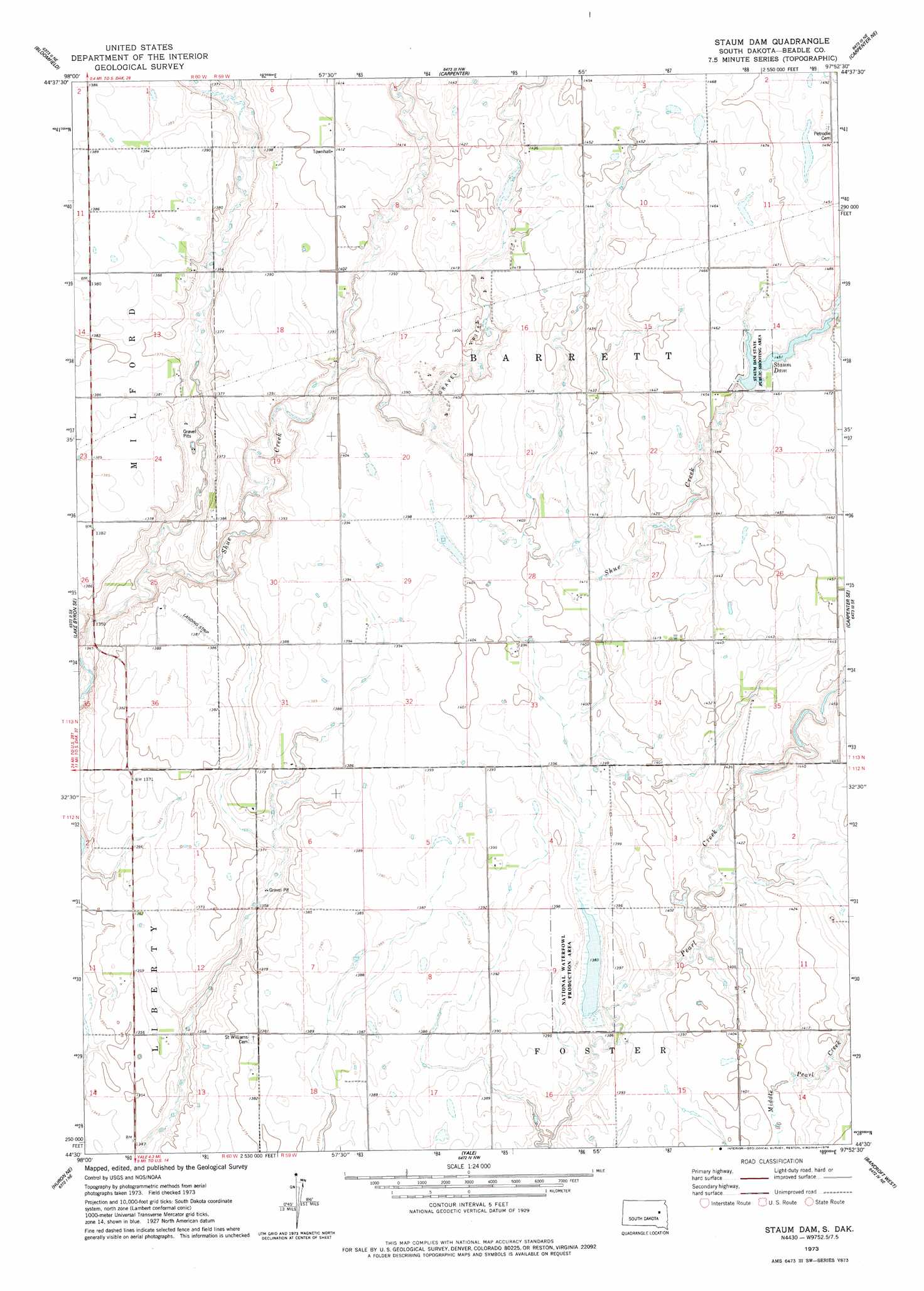
USGS Topo Quad 44097e8 - 1:24,000 scale
| Topo Map Name: | Staum Dam |
| USGS Topo Quad ID: | 44097e8 |
| Print Size: | ca. 21 1/4" wide x 27" high |
| Southeast Coordinates: | 44.5° N latitude / 97.875° W longitude |
| Map Center Coordinates: | 44.5625° N latitude / 97.9375° W longitude |
| U.S. State: | SD |
| Filename: | o44097e8.jpg |
| Download Map JPG Image: | Staum Dam topo map 1:24,000 scale |
| Map Type: | Topographic |
| Topo Series: | 7.5´ |
| Map Scale: | 1:24,000 |
| Source of Map Images: | United States Geological Survey (USGS) |
| Alternate Map Versions: |
Staum Dam SD 1973, updated 1978 Download PDF Buy paper map Staum Dam SD 2012 Download PDF Buy paper map Staum Dam SD 2015 Download PDF Buy paper map |
1:24,000 Topo Quads surrounding Staum Dam
Doland Sw |
Doland Se |
Fordham Dam |
Raymond Se |
Clark South |
Lake Byron Nw |
Bloomfield |
Carpenter |
Carpenter Ne |
Willow Lake |
Lake Byron |
Lake Byron Se |
Staum Dam |
Carpenter Se |
Willow Lake Sw |
Huron Nw |
Huron Ne |
Yale |
Bancroft West |
Bancroft East |
Huron |
Cavour |
Pearl Creek Colony |
Iroquois |
Manchester |
> Back to 44097e1 at 1:100,000 scale
> Back to 44096a1 at 1:250,000 scale
> Back to U.S. Topo Maps home
Staum Dam topo map: Gazetteer
Staum Dam: Dams
Staums Dam elevation 425m 1394′Staum Dam: Parks
Staum Dam State Public Shooting Area elevation 444m 1456′Staum Dam: Reservoirs
Staum Dam elevation 443m 1453′Staum Dam digital topo map on disk
Buy this Staum Dam topo map showing relief, roads, GPS coordinates and other geographical features, as a high-resolution digital map file on DVD:
Eastern North Dakota & Eastern South Dakota
Buy digital topo maps: Eastern North Dakota & Eastern South Dakota