Joe Creek Topo Map South Dakota
To zoom in, hover over the map of Joe Creek
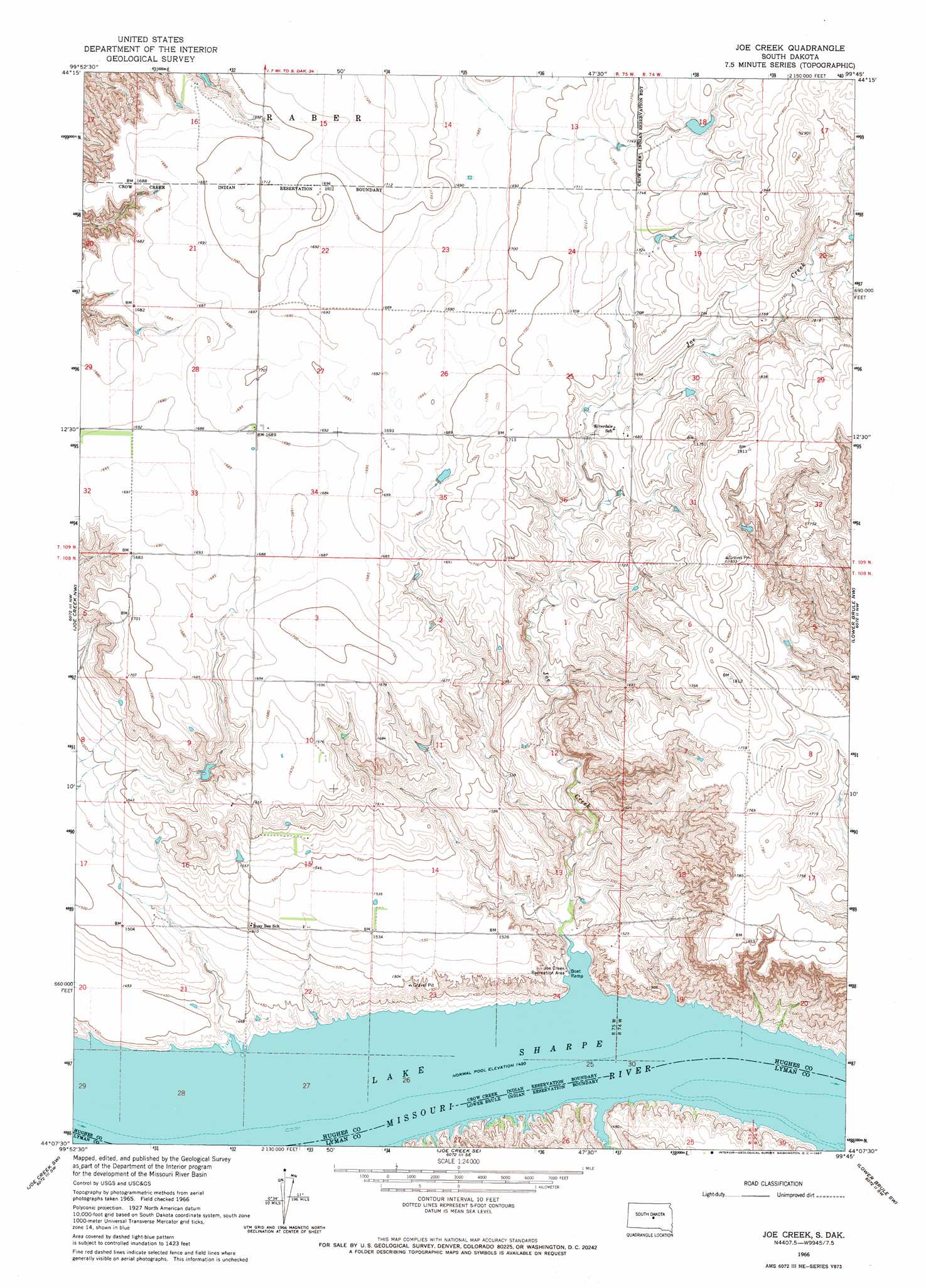
USGS Topo Quad 44099b7 - 1:24,000 scale
| Topo Map Name: | Joe Creek |
| USGS Topo Quad ID: | 44099b7 |
| Print Size: | ca. 21 1/4" wide x 27" high |
| Southeast Coordinates: | 44.125° N latitude / 99.75° W longitude |
| Map Center Coordinates: | 44.1875° N latitude / 99.8125° W longitude |
| U.S. State: | SD |
| Filename: | o44099b7.jpg |
| Download Map JPG Image: | Joe Creek topo map 1:24,000 scale |
| Map Type: | Topographic |
| Topo Series: | 7.5´ |
| Map Scale: | 1:24,000 |
| Source of Map Images: | United States Geological Survey (USGS) |
| Alternate Map Versions: |
Joe Creek SD 1966, updated 1967 Download PDF Buy paper map Joe Creek SD 2012 Download PDF Buy paper map Joe Creek SD 2015 Download PDF Buy paper map |
1:24,000 Topo Quads surrounding Joe Creek
Canning |
De Grey Nw |
De Grey Ne |
Chapelle Lake Nw |
Chapelle Lake |
Rousseau |
De Grey |
De Grey Se |
Chapelle Lake Sw |
Chapelle Lake Se |
Fort George Butte |
Joe Creek Nw |
Joe Creek |
Lower Brule Nw |
Lower Brule Ne |
Fort George Butte Se |
Joe Creek Sw |
Joe Creek Se |
Lower Brule Sw |
Lower Brule |
Presho |
Brakke Dam |
Kennebec |
Lyman |
Reliance |
> Back to 44099a1 at 1:100,000 scale
> Back to 44098a1 at 1:250,000 scale
> Back to U.S. Topo Maps home
Joe Creek topo map: Gazetteer
Joe Creek: Parks
Joe Creek Recreation Area elevation 434m 1423′Joe Creek: Streams
Joe Creek elevation 433m 1420′Joe Creek digital topo map on disk
Buy this Joe Creek topo map showing relief, roads, GPS coordinates and other geographical features, as a high-resolution digital map file on DVD:
Eastern North Dakota & Eastern South Dakota
Buy digital topo maps: Eastern North Dakota & Eastern South Dakota