Sansarc Ne Topo Map South Dakota
To zoom in, hover over the map of Sansarc Ne
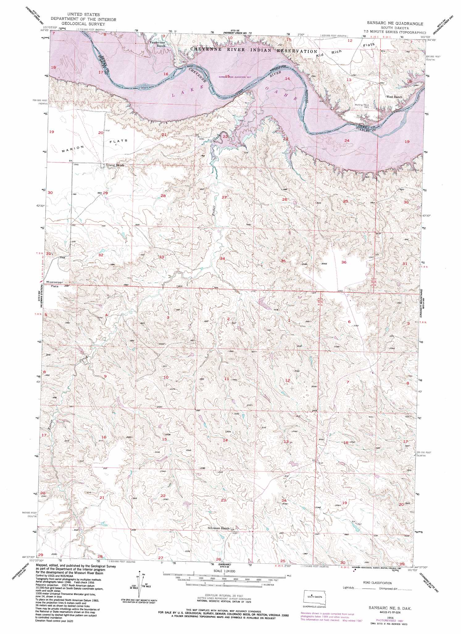
USGS Topo Quad 44101f1 - 1:24,000 scale
| Topo Map Name: | Sansarc Ne |
| USGS Topo Quad ID: | 44101f1 |
| Print Size: | ca. 21 1/4" wide x 27" high |
| Southeast Coordinates: | 44.625° N latitude / 101° W longitude |
| Map Center Coordinates: | 44.6875° N latitude / 101.0625° W longitude |
| U.S. State: | SD |
| Filename: | o44101f1.jpg |
| Download Map JPG Image: | Sansarc Ne topo map 1:24,000 scale |
| Map Type: | Topographic |
| Topo Series: | 7.5´ |
| Map Scale: | 1:24,000 |
| Source of Map Images: | United States Geological Survey (USGS) |
| Alternate Map Versions: |
Sansarc NE SD 1956, updated 1957 Download PDF Buy paper map Sansarc NE SD 1956, updated 1982 Download PDF Buy paper map Sansarc NE SD 1956, updated 1987 Download PDF Buy paper map Sansarc NE SD 2012 Download PDF Buy paper map Sansarc NE SD 2015 Download PDF Buy paper map |
1:24,000 Topo Quads surrounding Sansarc Ne
High Elk Hill |
Herbert Creek |
Herbert Creek Ne |
Rousseau Creek Nw |
Charlie Creek |
High Elk Hill Se |
Herbert Creek Sw |
Herbert Creek Se |
Rousseau Creek Sw |
Rousseau Creek |
Carlin Flat |
Alleman Station |
Sansarc Ne |
Crokett Mountains |
Mission Ridge |
Kirley |
Whiteman Ranch |
Sansarc |
Standing Butte Sw |
Standing Butte |
Moenville |
Bentley Ranch |
Hayes North |
Princes Ranch |
> Back to 44101e1 at 1:100,000 scale
> Back to 44100a1 at 1:250,000 scale
> Back to U.S. Topo Maps home
Sansarc Ne topo map: Gazetteer
Sansarc Ne: Dams
Gaylord Norman Number 1 Dam elevation 618m 2027′Gaylord Norman Number 2 Dam elevation 623m 2043′
Norman Number 1 Dam elevation 563m 1847′
Sansarc Ne: Flats
Marion Flats elevation 562m 1843′Sansarc Ne: Streams
Foster Creek elevation 474m 1555′Sansarc Ne digital topo map on disk
Buy this Sansarc Ne topo map showing relief, roads, GPS coordinates and other geographical features, as a high-resolution digital map file on DVD:
Eastern North Dakota & Eastern South Dakota
Buy digital topo maps: Eastern North Dakota & Eastern South Dakota