Kirley Topo Map South Dakota
To zoom in, hover over the map of Kirley
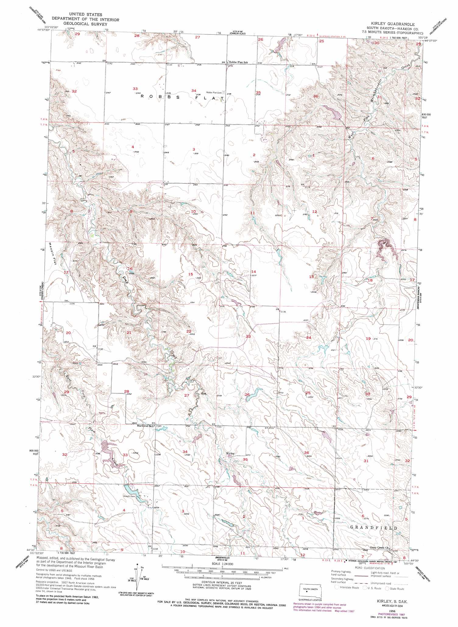
USGS Topo Quad 44101e3 - 1:24,000 scale
| Topo Map Name: | Kirley |
| USGS Topo Quad ID: | 44101e3 |
| Print Size: | ca. 21 1/4" wide x 27" high |
| Southeast Coordinates: | 44.5° N latitude / 101.25° W longitude |
| Map Center Coordinates: | 44.5625° N latitude / 101.3125° W longitude |
| U.S. State: | SD |
| Filename: | o44101e3.jpg |
| Download Map JPG Image: | Kirley topo map 1:24,000 scale |
| Map Type: | Topographic |
| Topo Series: | 7.5´ |
| Map Scale: | 1:24,000 |
| Source of Map Images: | United States Geological Survey (USGS) |
| Alternate Map Versions: |
Kirley SD 1956, updated 1957 Download PDF Buy paper map Kirley SD 1956, updated 1978 Download PDF Buy paper map Kirley SD 1956, updated 1987 Download PDF Buy paper map Kirley SD 2012 Download PDF Buy paper map Kirley SD 2015 Download PDF Buy paper map |
1:24,000 Topo Quads surrounding Kirley
Sears Dam |
High Elk Hill Sw |
High Elk Hill Se |
Herbert Creek Sw |
Herbert Creek Se |
Rattlesnake Lake Ne |
Cherry Creek Nw |
Carlin Flat |
Alleman Station |
Sansarc Ne |
Rattlesnake Lake Se |
Cherry Creek |
Kirley |
Whiteman Ranch |
Sansarc |
Murray Draw |
Middle Draw |
Moenville |
Bentley Ranch |
Hayes North |
Tornado Ranch |
Mule Creek |
Pheba 2 Se |
May Ranch |
Hayes South |
> Back to 44101e1 at 1:100,000 scale
> Back to 44100a1 at 1:250,000 scale
> Back to U.S. Topo Maps home
Kirley topo map: Gazetteer
Kirley: Dams
Hamilton Irrigation Dam elevation 651m 2135′Roseth Dam elevation 669m 2194′
School Section Number 5 Dam elevation 649m 2129′
Kirley: Flats
Robbs Flat elevation 651m 2135′Kirley: Populated Places
Kirley elevation 655m 2148′Kirley digital topo map on disk
Buy this Kirley topo map showing relief, roads, GPS coordinates and other geographical features, as a high-resolution digital map file on DVD:
Eastern North Dakota & Eastern South Dakota
Buy digital topo maps: Eastern North Dakota & Eastern South Dakota