Leola Topo Map South Dakota
To zoom in, hover over the map of Leola
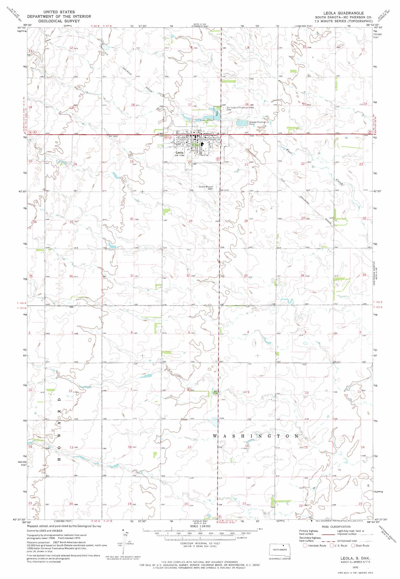
USGS Topo Quad 45098f8 - 1:24,000 scale
| Topo Map Name: | Leola |
| USGS Topo Quad ID: | 45098f8 |
| Print Size: | ca. 21 1/4" wide x 27" high |
| Southeast Coordinates: | 45.625° N latitude / 98.875° W longitude |
| Map Center Coordinates: | 45.6875° N latitude / 98.9375° W longitude |
| U.S. State: | SD |
| Filename: | o45098f8.jpg |
| Download Map JPG Image: | Leola topo map 1:24,000 scale |
| Map Type: | Topographic |
| Topo Series: | 7.5´ |
| Map Scale: | 1:24,000 |
| Source of Map Images: | United States Geological Survey (USGS) |
| Alternate Map Versions: |
Leola SD 1970, updated 1973 Download PDF Buy paper map Leola SD 2012 Download PDF Buy paper map Leola SD 2015 Download PDF Buy paper map |
1:24,000 Topo Quads surrounding Leola
Long Lake Nw |
Long Lake Ne |
Forbes Nw |
Forbes |
Frederick Nw |
Long Lake |
Long Lake Se |
Forbes Sw |
Forbes Se |
Frederick Sw |
Plainview Colony Nw |
Plainview Colony Ne |
Leola |
Wetonka North |
Richmond Nw |
Plainview Colony Sw |
Plainview Colony |
Leola Sw |
Wetonka South |
Richmond Sw |
Beebe |
Ipswich |
Mina Nw |
Mina |
Lake Parmley |
> Back to 45098e1 at 1:100,000 scale
> Back to 45098a1 at 1:250,000 scale
> Back to U.S. Topo Maps home
Leola topo map: Gazetteer
Leola: Dams
Leola Dam elevation 489m 1604′Leola: Populated Places
Leola elevation 485m 1591′Leola: Reservoirs
Lake Lundquist elevation 489m 1604′Leola digital topo map on disk
Buy this Leola topo map showing relief, roads, GPS coordinates and other geographical features, as a high-resolution digital map file on DVD:
Eastern North Dakota & Eastern South Dakota
Buy digital topo maps: Eastern North Dakota & Eastern South Dakota