Lower Seymour Lake Topo Map Montana
To zoom in, hover over the map of Lower Seymour Lake
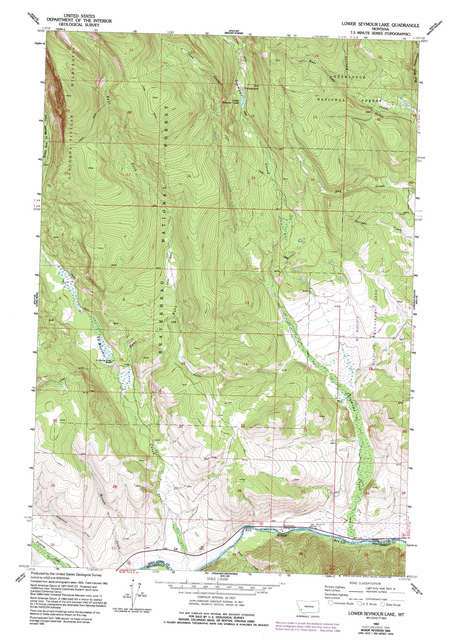
USGS Topo Quad 45113h2 - 1:24,000 scale
| Topo Map Name: | Lower Seymour Lake |
| USGS Topo Quad ID: | 45113h2 |
| Print Size: | ca. 21 1/4" wide x 27" high |
| Southeast Coordinates: | 45.875° N latitude / 113.125° W longitude |
| Map Center Coordinates: | 45.9375° N latitude / 113.1875° W longitude |
| U.S. State: | MT |
| Filename: | o45113h2.jpg |
| Download Map JPG Image: | Lower Seymour Lake topo map 1:24,000 scale |
| Map Type: | Topographic |
| Topo Series: | 7.5´ |
| Map Scale: | 1:24,000 |
| Source of Map Images: | United States Geological Survey (USGS) |
| Alternate Map Versions: |
Lower Seymour Lake MT 1962, updated 1964 Download PDF Buy paper map Lower Seymour Lake MT 1962, updated 1989 Download PDF Buy paper map Lower Seymour Lake MT 1962, updated 1994 Download PDF Buy paper map Lower Seymour Lake MT 1997, updated 2002 Download PDF Buy paper map Lower Seymour Lake MT 2011 Download PDF Buy paper map Lower Seymour Lake MT 2014 Download PDF Buy paper map |
| FStopo: | US Forest Service topo Lower Seymour Lake is available: Download FStopo PDF Download FStopo TIF |
1:24,000 Topo Quads surrounding Lower Seymour Lake
Potato Lakes |
Georgetown Lake |
Silver Lake |
West Valley |
Anaconda North |
Carpp Ridge |
Storm Lake |
Mount Evans |
Mount Haggin |
Anaconda South |
Warren Peak |
Long Peak |
Lower Seymour Lake |
Lincoln Gulch |
Dickie Peak |
Pintlar Lake |
Pine Hill |
Foolhen Mountain |
Dickie Hills |
Wise River |
Mud Lake |
Proposal Rock |
Shaw Mountain |
Stine Mountain |
Vipond Park |
> Back to 45113e1 at 1:100,000 scale
> Back to 45112a1 at 1:250,000 scale
> Back to U.S. Topo Maps home
Lower Seymour Lake topo map: Gazetteer
Lower Seymour Lake: Canals
Anderson Ditch elevation 1861m 6105′Bacon Ditch elevation 1963m 6440′
Lower Seymour Lake: Lakes
Lower Seymour Lake elevation 2060m 6758′Lower Seymour Lake: Streams
Chub Creek elevation 2064m 6771′East Fork La Marche Creek elevation 1860m 6102′
Pony Creek elevation 1772m 5813′
Seymour Creek elevation 1763m 5784′
Lower Seymour Lake: Valleys
Bear Trap Gulch elevation 2025m 6643′Lower Seymour Lake: Wells
02N13W16DDC_01 Well elevation 1894m 6213′Lower Seymour Lake digital topo map on disk
Buy this Lower Seymour Lake topo map showing relief, roads, GPS coordinates and other geographical features, as a high-resolution digital map file on DVD: