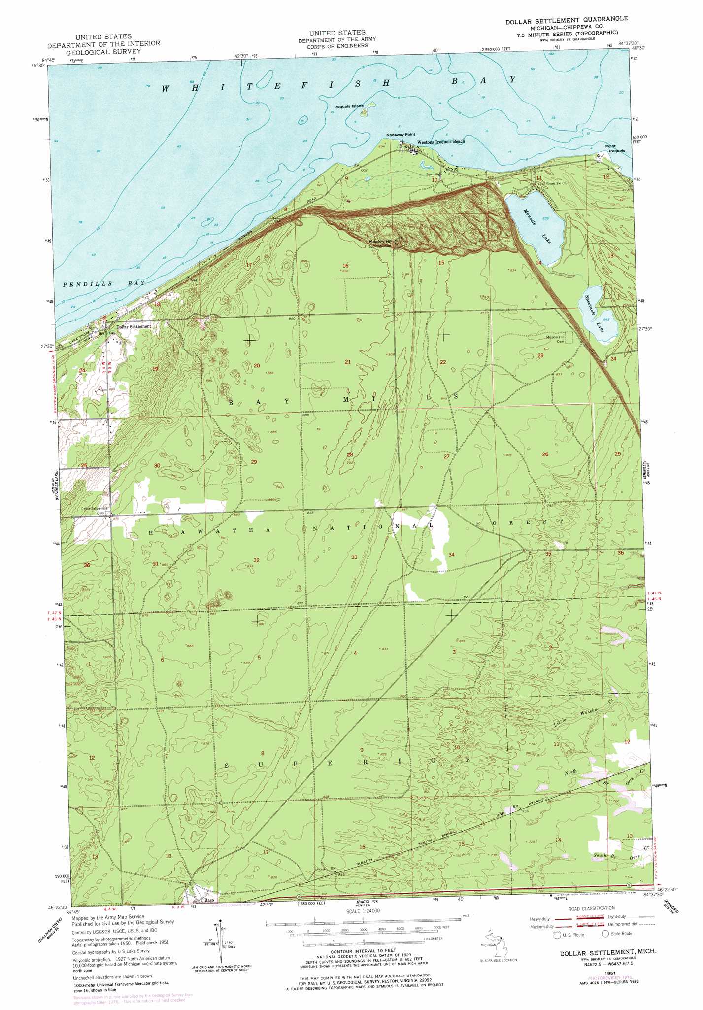
Dollar Settlement Topo Map Michigan
To zoom in, hover over the map of Dollar Settlement
USGS Topo Quad 46084d6 - 1:24,000 scale
| Topo Map Name: | Dollar Settlement |
| USGS Topo Quad ID: | 46084d6 |
| Print Size: | ca. 21 1/4" wide x 27" high |
| Southeast Coordinates: | 46.375° N latitude / 84.625° W longitude |
| Map Center Coordinates: | 46.4375° N latitude / 84.6875° W longitude |
| U.S. State: | MI |
| Filename: | o46084d6.jpg |
| Download Map JPG Image: | Dollar Settlement topo map 1:24,000 scale |
| Map Type: | Topographic |
| Topo Series: | 7.5´ |
| Map Scale: | 1:24,000 |
| Source of Map Images: | United States Geological Survey (USGS) |
| Alternate Map Versions: |
Dollar Settlement MI 1951, updated 1955 Download PDF Buy paper map Dollar Settlement MI 1951, updated 1978 Download PDF Buy paper map Dollar Settlement MI 2011 Download PDF Buy paper map Dollar Settlement MI 2014 Download PDF Buy paper map Dollar Settlement MI 2017 Download PDF Buy paper map |
| FStopo: | US Forest Service topo Dollar Settlement is available: Download FStopo PDF Download FStopo TIF |
1:24,000 Topo Quads surrounding Dollar Settlement
Whitefish Point |
||||
Mcnearney Lake |
Pendills Lake |
Dollar Settlement |
Brimley |
Shallows |
Strongs |
Sullivan Creek |
Raco |
Kinross |
Dafter |
Ozark |
Ozark Ne |
Fibre |
Rudyard |
Pickford Nw |
> Back to 46084a1 at 1:100,000 scale
> Back to 46084a1 at 1:250,000 scale
> Back to U.S. Topo Maps home
Dollar Settlement topo map: Gazetteer
Dollar Settlement: Capes
Nadoway Point elevation 184m 603′Point Iroquois elevation 185m 606′
Dollar Settlement: Islands
Iroquois Island elevation 185m 606′Dollar Settlement: Lakes
Monocle Lake elevation 195m 639′Spectacle Lake elevation 196m 643′
Dollar Settlement: Populated Places
Dollar Settlement elevation 192m 629′Raco elevation 255m 836′
Westons Iroquois Beach elevation 186m 610′
Dollar Settlement: Post Offices
Iroquois Post Office (historical) elevation 184m 603′Wellsburg Post Office (historical) elevation 225m 738′
Dollar Settlement: Summits
Mission Hill elevation 308m 1010′Dollar Settlement digital topo map on disk
Buy this Dollar Settlement topo map showing relief, roads, GPS coordinates and other geographical features, as a high-resolution digital map file on DVD: