Freda Topo Map North Dakota
To zoom in, hover over the map of Freda
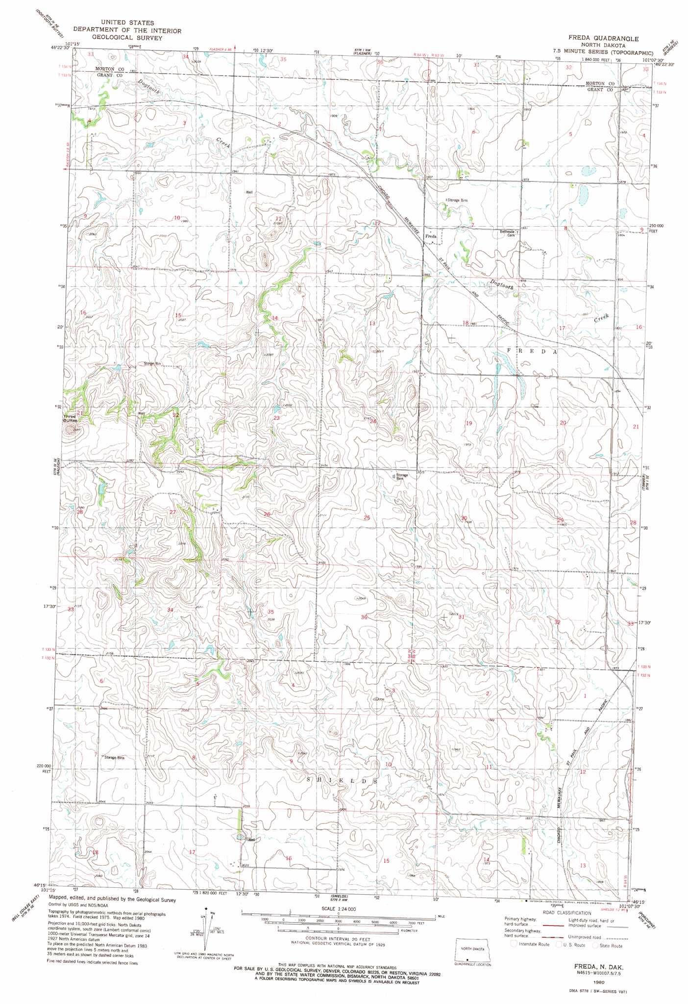
USGS Topo Quad 46101c2 - 1:24,000 scale
| Topo Map Name: | Freda |
| USGS Topo Quad ID: | 46101c2 |
| Print Size: | ca. 21 1/4" wide x 27" high |
| Southeast Coordinates: | 46.25° N latitude / 101.125° W longitude |
| Map Center Coordinates: | 46.3125° N latitude / 101.1875° W longitude |
| U.S. State: | ND |
| Filename: | O46101C2.jpg |
| Download Map JPG Image: | Freda topo map 1:24,000 scale |
| Map Type: | Topographic |
| Topo Series: | 7.5´ |
| Map Scale: | 1:24,000 |
| Source of Map Images: | United States Geological Survey (USGS) |
| Alternate Map Versions: |
Freda ND 1980, updated 1980 Download PDF Buy paper map Freda ND 2011 Download PDF Buy paper map Freda ND 2014 Download PDF Buy paper map |
1:24,000 Topo Quads surrounding Freda
Otter Creek West |
Otter Creek East |
Nygren Dam |
Fallon |
Saint Anthony |
Lark |
Dogtooth Buttes |
Flasher |
Burgess |
Breien |
Brisbane |
Raleigh |
Freda |
Timmer |
Solen Sw |
Bell Coulee West |
Bell Coulee East |
Shields |
Porcupine |
Froelich Dam |
Lookout Butte |
Lookout Butte Se |
Shields Sw |
Pamplin Hills |
Selfridge |
> Back to 46101a1 at 1:100,000 scale
> Back to 46100a1 at 1:250,000 scale
> Back to U.S. Topo Maps home
Freda topo map: Gazetteer
Freda: Populated Places
Freda elevation 575m 1886′Freda: Ranges
Three Buttes elevation 655m 2148′Freda digital topo map on disk
Buy this Freda topo map showing relief, roads, GPS coordinates and other geographical features, as a high-resolution digital map file on DVD:
Eastern North Dakota & Eastern South Dakota
Buy digital topo maps: Eastern North Dakota & Eastern South Dakota