Bell Coulee West Topo Map North Dakota
To zoom in, hover over the map of Bell Coulee West
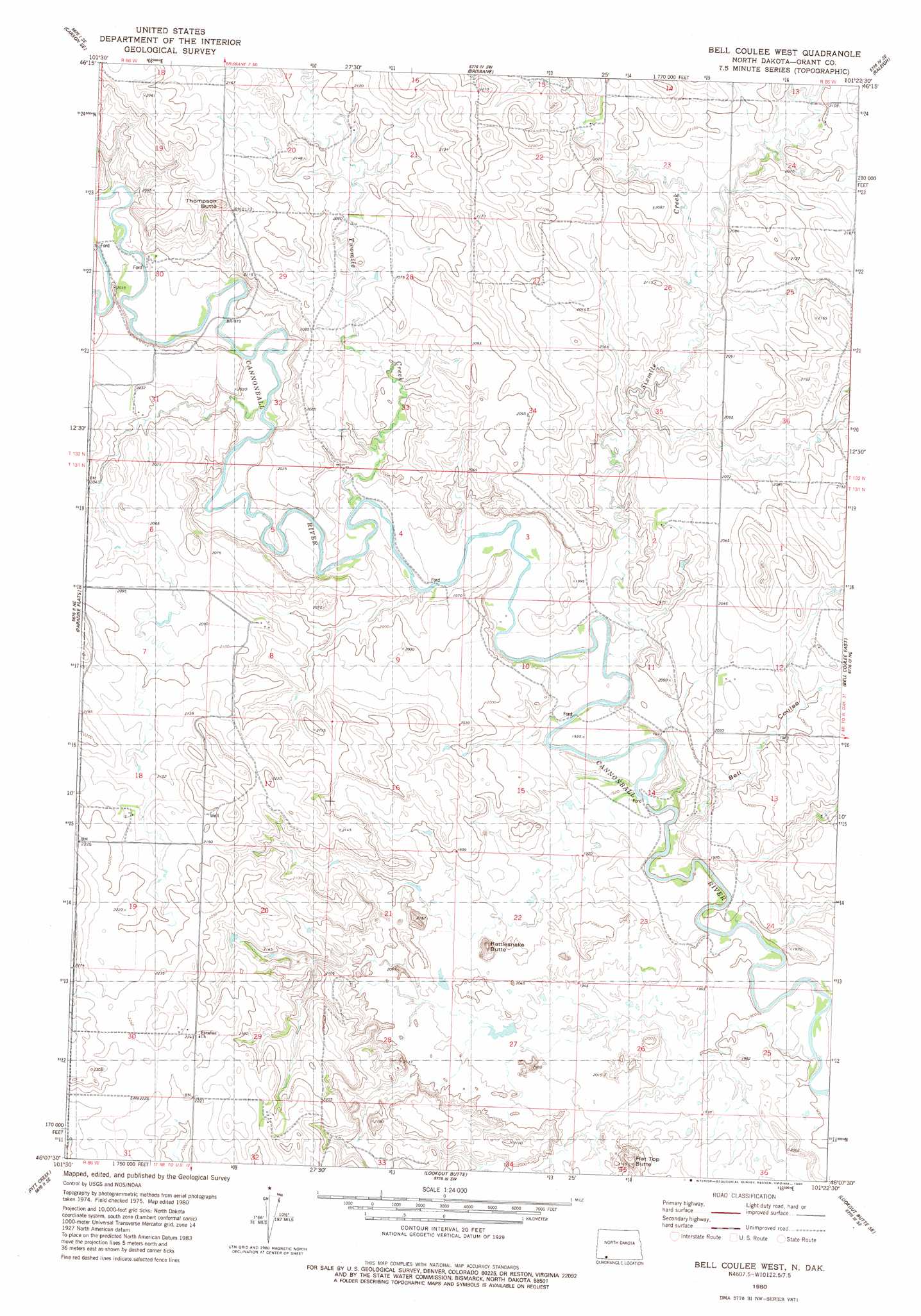
USGS Topo Quad 46101b4 - 1:24,000 scale
| Topo Map Name: | Bell Coulee West |
| USGS Topo Quad ID: | 46101b4 |
| Print Size: | ca. 21 1/4" wide x 27" high |
| Southeast Coordinates: | 46.125° N latitude / 101.375° W longitude |
| Map Center Coordinates: | 46.1875° N latitude / 101.4375° W longitude |
| U.S. State: | ND |
| Filename: | O46101B4.jpg |
| Download Map JPG Image: | Bell Coulee West topo map 1:24,000 scale |
| Map Type: | Topographic |
| Topo Series: | 7.5´ |
| Map Scale: | 1:24,000 |
| Source of Map Images: | United States Geological Survey (USGS) |
| Alternate Map Versions: |
Bell Coulee West ND 1980, updated 1980 Download PDF Buy paper map Bell Coulee West ND 2011 Download PDF Buy paper map Bell Coulee West ND 2014 Download PDF Buy paper map |
1:24,000 Topo Quads surrounding Bell Coulee West
Heil |
Carson |
Lark |
Dogtooth Buttes |
Flasher |
Leith |
Carson Se |
Brisbane |
Raleigh |
Freda |
Wheeler Hills |
Paradise Flats |
Bell Coulee West |
Bell Coulee East |
Shields |
Parks Hills |
Pitt Creek |
Lookout Butte |
Lookout Butte Se |
Shields Sw |
Morristown |
Watauga |
Hump Butte |
Mcintosh |
Tatanka Lake |
> Back to 46101a1 at 1:100,000 scale
> Back to 46100a1 at 1:250,000 scale
> Back to U.S. Topo Maps home
Bell Coulee West topo map: Gazetteer
Bell Coulee West: Streams
Sixmile Creek elevation 586m 1922′Bell Coulee West: Valleys
Bell Coulee elevation 586m 1922′Bell Coulee West digital topo map on disk
Buy this Bell Coulee West topo map showing relief, roads, GPS coordinates and other geographical features, as a high-resolution digital map file on DVD:
Eastern North Dakota & Eastern South Dakota
Buy digital topo maps: Eastern North Dakota & Eastern South Dakota