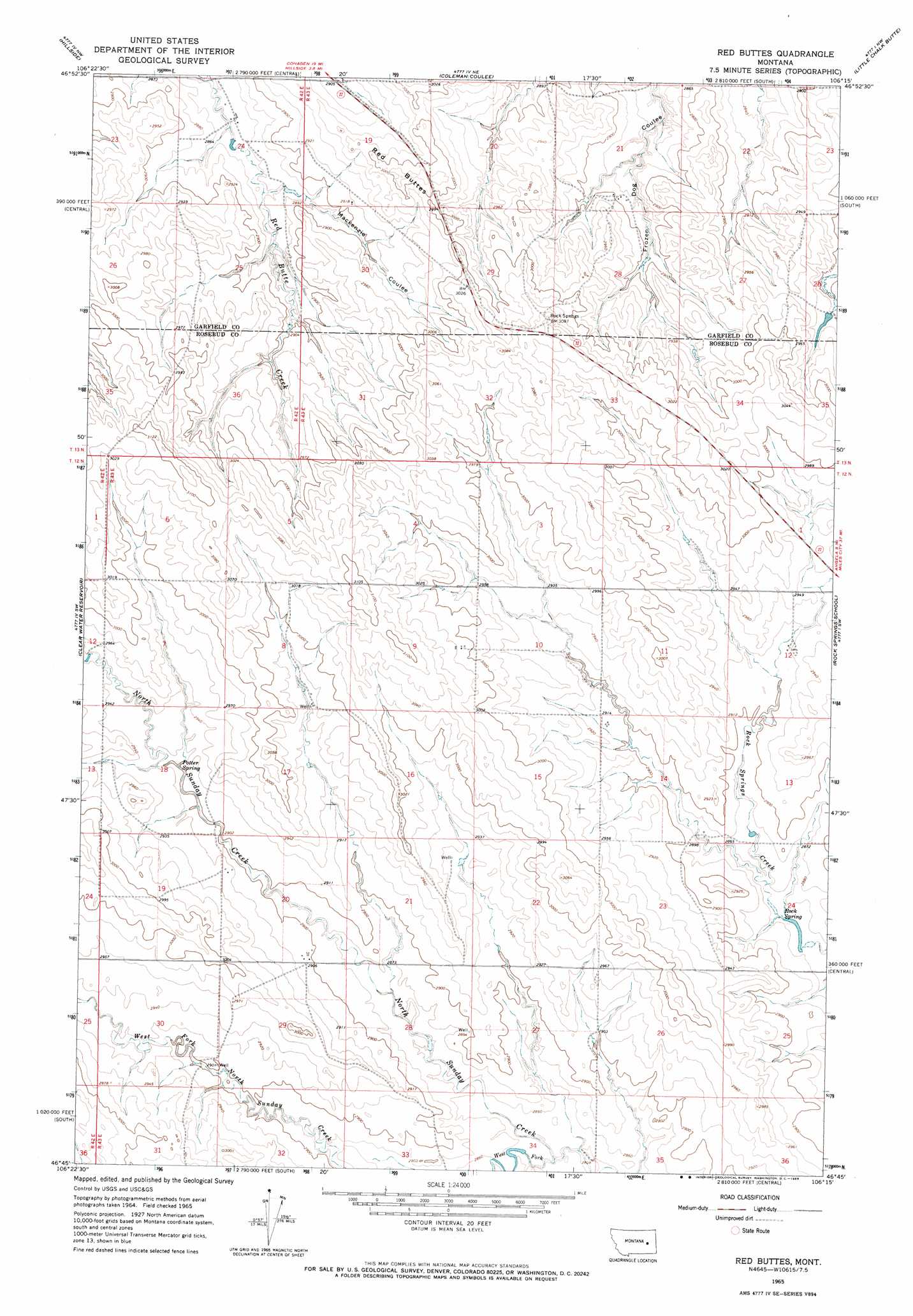
Red Buttes Topo Map Montana
To zoom in, hover over the map of Red Buttes
USGS Topo Quad 46106g3 - 1:24,000 scale
| Topo Map Name: | Red Buttes |
| USGS Topo Quad ID: | 46106g3 |
| Print Size: | ca. 21 1/4" wide x 27" high |
| Southeast Coordinates: | 46.75° N latitude / 106.25° W longitude |
| Map Center Coordinates: | 46.8125° N latitude / 106.3125° W longitude |
| U.S. State: | MT |
| Filename: | o46106g3.jpg |
| Download Map JPG Image: | Red Buttes topo map 1:24,000 scale |
| Map Type: | Topographic |
| Topo Series: | 7.5´ |
| Map Scale: | 1:24,000 |
| Source of Map Images: | United States Geological Survey (USGS) |
| Alternate Map Versions: |
Red Buttes MT 1965, updated 1969 Download PDF Buy paper map Red Buttes MT 2011 Download PDF Buy paper map Red Buttes MT 2014 Download PDF Buy paper map |
1:24,000 Topo Quads surrounding Red Buttes
Cohagen |
Calamity Coulee |
Sleepy Hollow |
Tree Coulee School |
Hedstrom Lake Se |
Christenson Reservoir |
Hillside |
Coleman Coulee |
Little Chalk Butte |
Crow Rock |
Needle Butte |
Clear Water Reservoir |
Red Buttes |
Rock Springs School |
Crow Rock Se |
Rough Creek Ne |
Van Burton Creek |
Alkali Creek |
Angela |
Angela Ne |
Rough Creek Se |
Wild Horse Pass |
Wild Horse Pass Se |
Hobo Coulee |
N Bar Coulee |
> Back to 46106e1 at 1:100,000 scale
> Back to 46106a1 at 1:250,000 scale
> Back to U.S. Topo Maps home
Red Buttes topo map: Gazetteer
Red Buttes: Post Offices
Satchwell Post Office (historical) elevation 899m 2949′Red Buttes: Springs
Potter Spring elevation 890m 2919′Rock Spring elevation 871m 2857′
Red Buttes: Streams
West Fork North Sunday Creek elevation 865m 2837′Red Buttes: Summits
Red Buttes elevation 924m 3031′Red Buttes: Valleys
Mackenzie Coulee elevation 876m 2874′Red Buttes: Wells
13N43E29ADAA01 Well elevation 899m 2949′Red Buttes digital topo map on disk
Buy this Red Buttes topo map showing relief, roads, GPS coordinates and other geographical features, as a high-resolution digital map file on DVD:
Eastern Montana & Western North Dakota
Buy digital topo maps: Eastern Montana & Western North Dakota