Antelope Creek Topo Map Montana
To zoom in, hover over the map of Antelope Creek
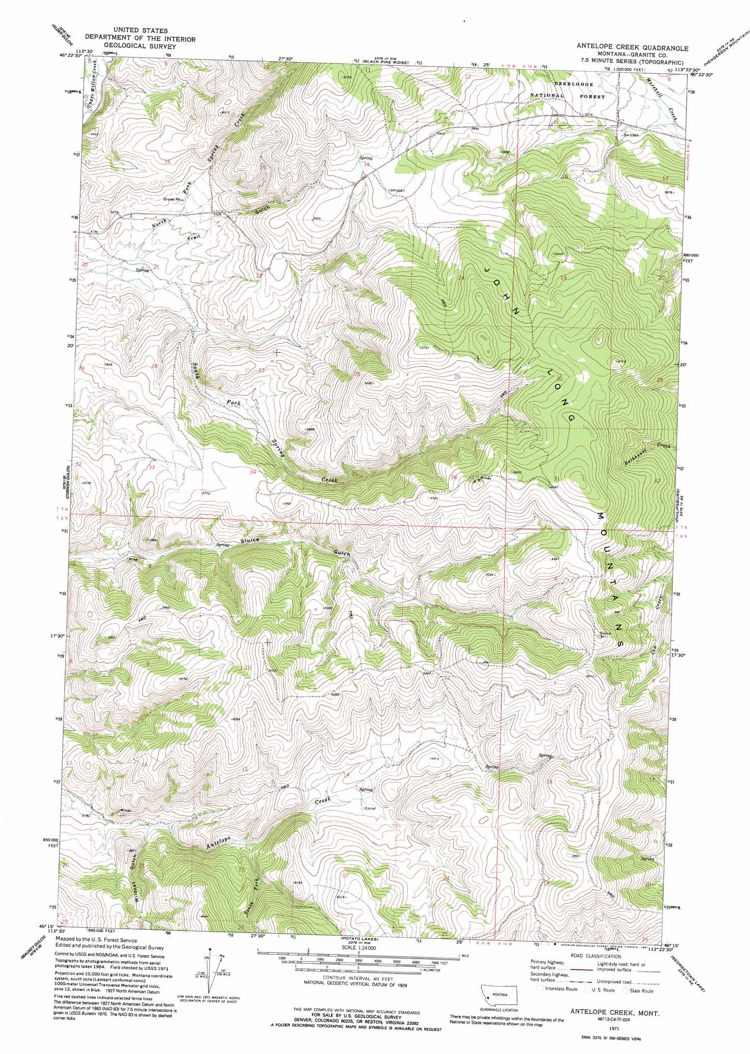
USGS Topo Quad 46113c4 - 1:24,000 scale
| Topo Map Name: | Antelope Creek |
| USGS Topo Quad ID: | 46113c4 |
| Print Size: | ca. 21 1/4" wide x 27" high |
| Southeast Coordinates: | 46.25° N latitude / 113.375° W longitude |
| Map Center Coordinates: | 46.3125° N latitude / 113.4375° W longitude |
| U.S. State: | MT |
| Filename: | o46113c4.jpg |
| Download Map JPG Image: | Antelope Creek topo map 1:24,000 scale |
| Map Type: | Topographic |
| Topo Series: | 7.5´ |
| Map Scale: | 1:24,000 |
| Source of Map Images: | United States Geological Survey (USGS) |
| Alternate Map Versions: |
Antelope Creek MT 1971, updated 1973 Download PDF Buy paper map Antelope Creek MT 1971, updated 1991 Download PDF Buy paper map Antelope Creek MT 1996, updated 1998 Download PDF Buy paper map Antelope Creek MT 2011 Download PDF Buy paper map Antelope Creek MT 2014 Download PDF Buy paper map |
| FStopo: | US Forest Service topo Antelope Creek is available: Download FStopo PDF Download FStopo TIF |
1:24,000 Topo Quads surrounding Antelope Creek
Grizzly Point |
Spink Point |
Harvey Point |
Nirling Hill |
Hall |
Quigg Peak |
Alder Gulch |
Black Pine Ridge |
Henderson Mountain |
Maxville |
Stony Creek |
Cornish Gulch |
Antelope Creek |
Philipsburg |
Fred Burr Lake |
Mount Emerine |
Maukey Gulch |
Potato Lakes |
Georgetown Lake |
Silver Lake |
Whetstone Ridge |
Moose Lake |
Carpp Ridge |
Storm Lake |
Mount Evans |
> Back to 46113a1 at 1:100,000 scale
> Back to 46112a1 at 1:250,000 scale
> Back to U.S. Topo Maps home
Antelope Creek topo map: Gazetteer
Antelope Creek: Mines
Hawkeye Mine elevation 2009m 6591′Lori Number 13 Mine elevation 1667m 5469′
Russian Smith Mine elevation 1606m 5269′
Shakesphere Mine elevation 1661m 5449′
Antelope Creek: Populated Places
Corral elevation 1742m 5715′Antelope Creek: Streams
North Fork Spring Creek elevation 1537m 5042′South Fork Antelope Creek elevation 1668m 5472′
South Fork Spring Creek elevation 1537m 5042′
Antelope Creek: Valleys
Trail Gulch elevation 1557m 5108′Wildcat Gulch elevation 1605m 5265′
Antelope Creek digital topo map on disk
Buy this Antelope Creek topo map showing relief, roads, GPS coordinates and other geographical features, as a high-resolution digital map file on DVD: