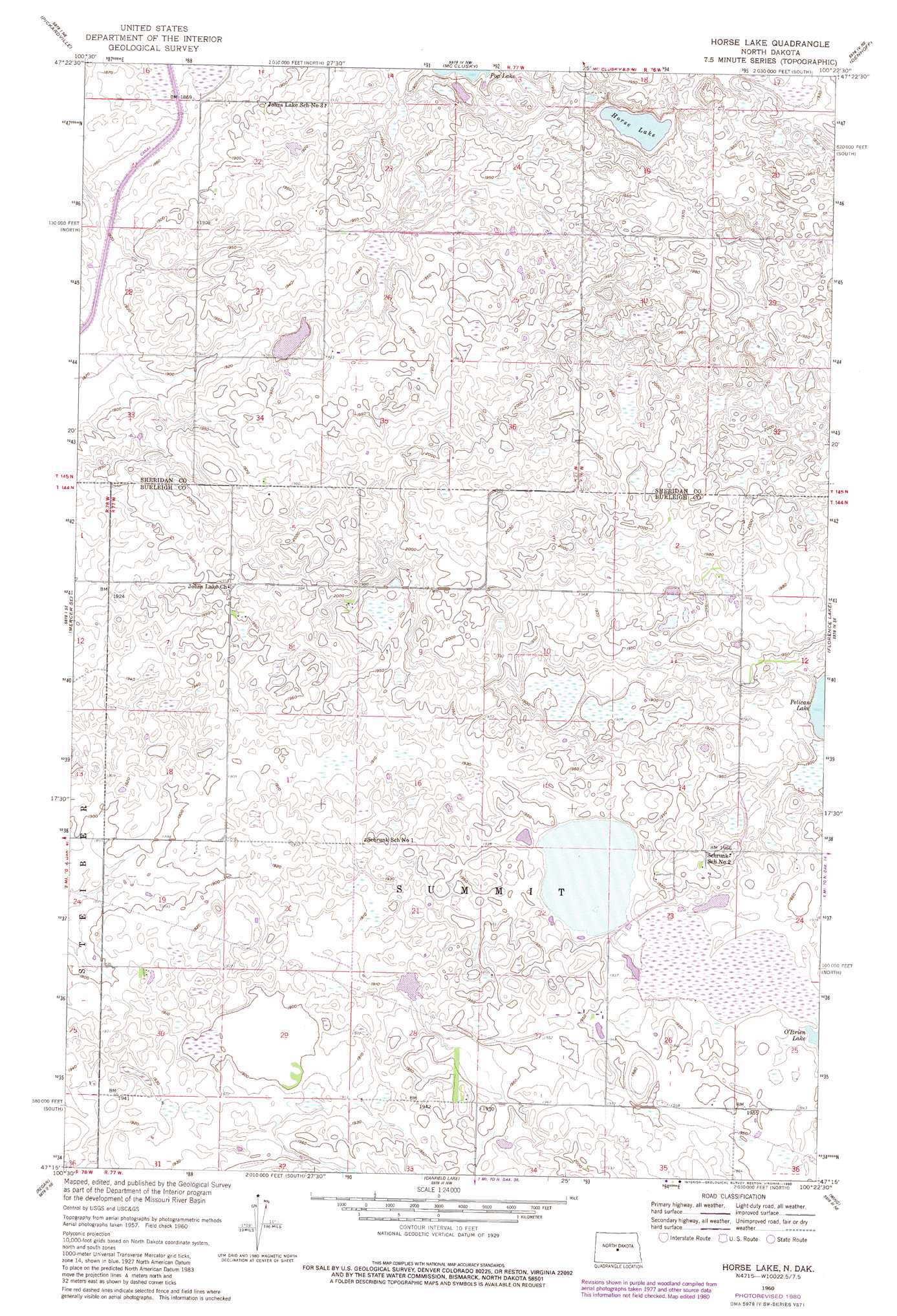
Horse Lake Topo Map North Dakota
To zoom in, hover over the map of Horse Lake
USGS Topo Quad 47100c4 - 1:24,000 scale
| Topo Map Name: | Horse Lake |
| USGS Topo Quad ID: | 47100c4 |
| Print Size: | ca. 21 1/4" wide x 27" high |
| Southeast Coordinates: | 47.25° N latitude / 100.375° W longitude |
| Map Center Coordinates: | 47.3125° N latitude / 100.4375° W longitude |
| U.S. State: | ND |
| Filename: | O47100C4.jpg |
| Download Map JPG Image: | Horse Lake topo map 1:24,000 scale |
| Map Type: | Topographic |
| Topo Series: | 7.5´ |
| Map Scale: | 1:24,000 |
| Source of Map Images: | United States Geological Survey (USGS) |
| Alternate Map Versions: |
Horse Lake ND 1960, updated 1961 Download PDF Buy paper map Horse Lake ND 1960, updated 1980 Download PDF Buy paper map Horse Lake ND 2011 Download PDF Buy paper map Horse Lake ND 2014 Download PDF Buy paper map |
1:24,000 Topo Quads surrounding Horse Lake
Pelican Lake |
Pelican Lake Se |
Lincoln Valley Sw |
Lincoln Valley Se |
Mertz Slough |
Mercer |
Pickardville |
Mcclusky |
Denhoff |
Goodrich West |
Mercer Sw |
Mercer Se |
Horse Lake |
Florence Lake |
Goodrich Sw |
Grass Lake |
Regan |
Canfield Lake |
Wing |
Arena |
Baldwin |
Regan Se |
Wing Sw |
Wing Se |
Harriet Lake |
> Back to 47100a1 at 1:100,000 scale
> Back to 47100a1 at 1:250,000 scale
> Back to U.S. Topo Maps home
Horse Lake digital topo map on disk
Buy this Horse Lake topo map showing relief, roads, GPS coordinates and other geographical features, as a high-resolution digital map file on DVD:
Eastern North Dakota & Eastern South Dakota
Buy digital topo maps: Eastern North Dakota & Eastern South Dakota