Goodrich West Topo Map North Dakota
To zoom in, hover over the map of Goodrich West
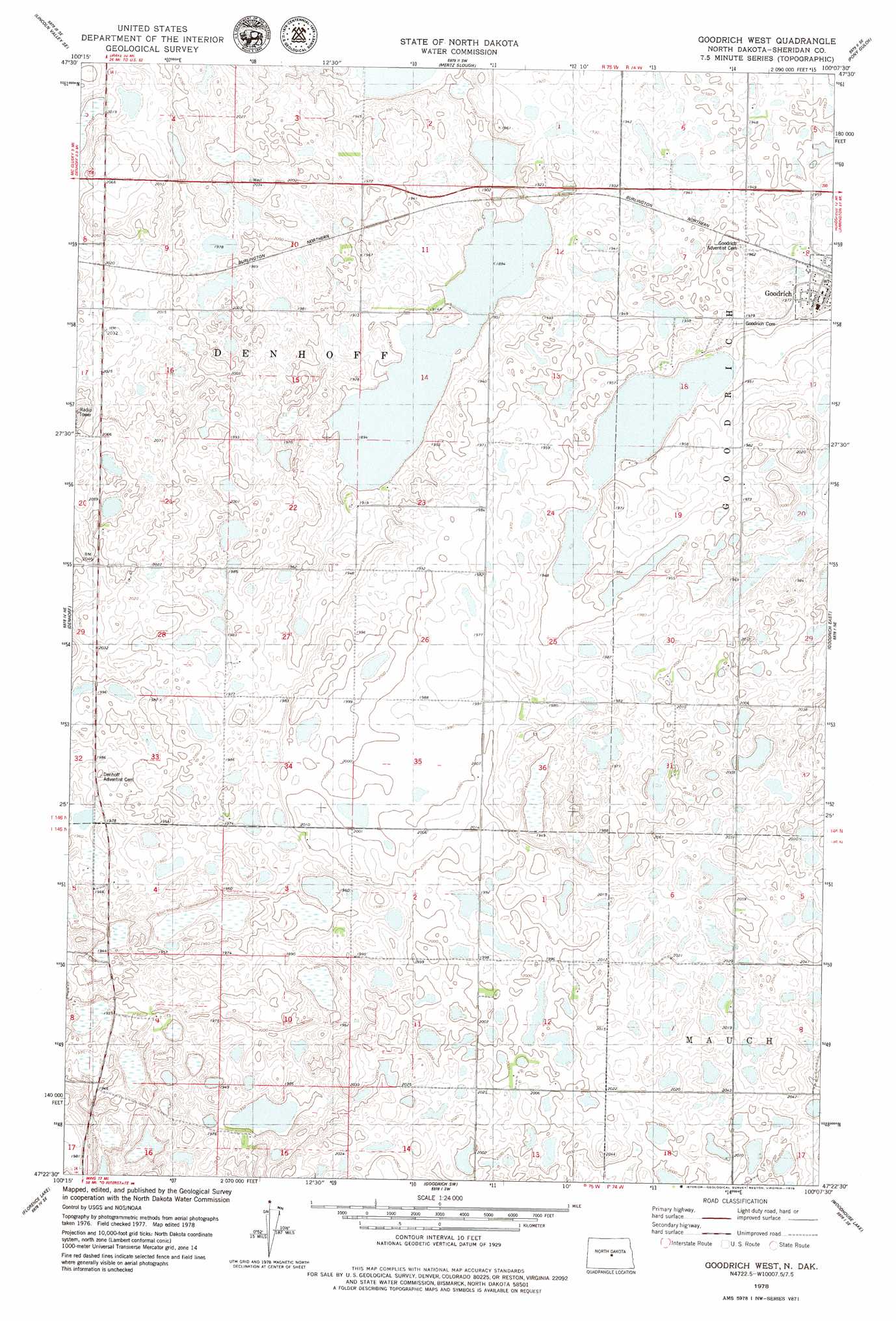
USGS Topo Quad 47100d2 - 1:24,000 scale
| Topo Map Name: | Goodrich West |
| USGS Topo Quad ID: | 47100d2 |
| Print Size: | ca. 21 1/4" wide x 27" high |
| Southeast Coordinates: | 47.375° N latitude / 100.125° W longitude |
| Map Center Coordinates: | 47.4375° N latitude / 100.1875° W longitude |
| U.S. State: | ND |
| Filename: | O47100D2.jpg |
| Download Map JPG Image: | Goodrich West topo map 1:24,000 scale |
| Map Type: | Topographic |
| Topo Series: | 7.5´ |
| Map Scale: | 1:24,000 |
| Source of Map Images: | United States Geological Survey (USGS) |
| Alternate Map Versions: |
Goodrich West ND 1978, updated 1979 Download PDF Buy paper map Goodrich West ND 2011 Download PDF Buy paper map Goodrich West ND 2014 Download PDF Buy paper map |
1:24,000 Topo Quads surrounding Goodrich West
Lincoln Valley Nw |
Lincoln Valley |
Sheyenne Lake |
Sheyenne Lake Ne |
Manfred Nw |
Lincoln Valley Sw |
Lincoln Valley Se |
Mertz Slough |
Pony Gulch |
Manfred Sw |
Mcclusky |
Denhoff |
Goodrich West |
Goodrich East |
Hurdsfield |
Horse Lake |
Florence Lake |
Goodrich Sw |
Woodhouse Lake |
Senior Lake |
Canfield Lake |
Wing |
Arena |
Lake Helen |
Tuttle |
> Back to 47100a1 at 1:100,000 scale
> Back to 47100a1 at 1:250,000 scale
> Back to U.S. Topo Maps home
Goodrich West digital topo map on disk
Buy this Goodrich West topo map showing relief, roads, GPS coordinates and other geographical features, as a high-resolution digital map file on DVD:
Eastern North Dakota & Eastern South Dakota
Buy digital topo maps: Eastern North Dakota & Eastern South Dakota