Robinson Coulee Topo Map North Dakota
To zoom in, hover over the map of Robinson Coulee
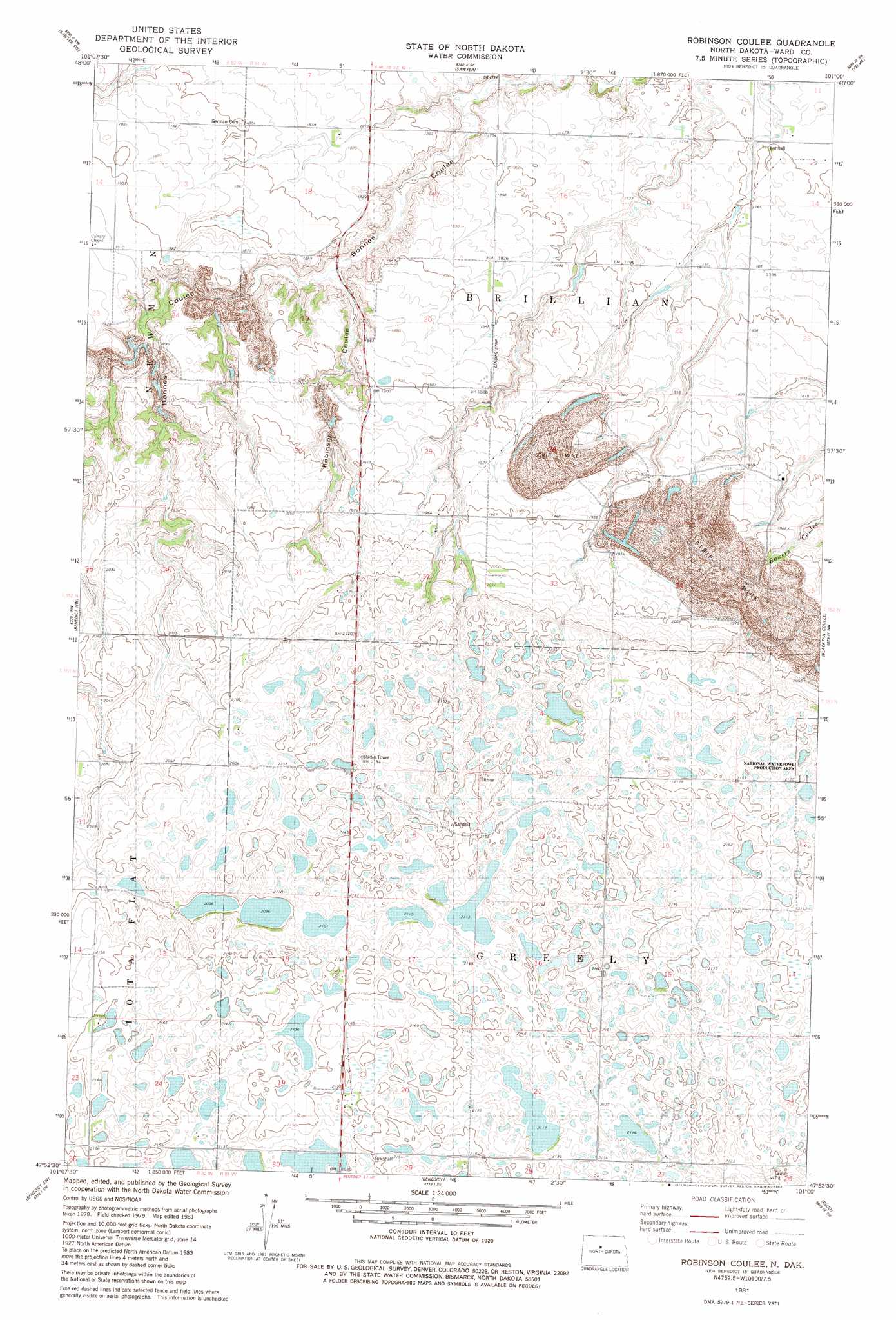
USGS Topo Quad 47101h1 - 1:24,000 scale
| Topo Map Name: | Robinson Coulee |
| USGS Topo Quad ID: | 47101h1 |
| Print Size: | ca. 21 1/4" wide x 27" high |
| Southeast Coordinates: | 47.875° N latitude / 101° W longitude |
| Map Center Coordinates: | 47.9375° N latitude / 101.0625° W longitude |
| U.S. State: | ND |
| Filename: | O47101H1.jpg |
| Download Map JPG Image: | Robinson Coulee topo map 1:24,000 scale |
| Map Type: | Topographic |
| Topo Series: | 7.5´ |
| Map Scale: | 1:24,000 |
| Source of Map Images: | United States Geological Survey (USGS) |
| Alternate Map Versions: |
Benedict NE ND 1974, updated 1975 Download PDF Buy paper map Robinson Coulee ND 1981, updated 1982 Download PDF Buy paper map Robinson Coulee ND 2011 Download PDF Buy paper map Robinson Coulee ND 2014 Download PDF Buy paper map |
1:24,000 Topo Quads surrounding Robinson Coulee
Minot |
Surrey |
Sawyer Ne |
Norwich |
Simcoe |
South Prairie |
Sawyer Sw |
Sawyer |
Velva |
Voltaire |
Max Ne |
Benedict Nw |
Robinson Coulee |
Blacktail Coulee |
Kongsberg Ne |
Max |
Benedict Sw |
Benedict |
Ruso |
Kongsberg |
Garrison Ne |
Coleharbor Nw |
Coleharbor Ne |
Horseshoe Valley |
Long Lake |
> Back to 47101e1 at 1:100,000 scale
> Back to 47100a1 at 1:250,000 scale
> Back to U.S. Topo Maps home
Robinson Coulee digital topo map on disk
Buy this Robinson Coulee topo map showing relief, roads, GPS coordinates and other geographical features, as a high-resolution digital map file on DVD:
Eastern North Dakota & Eastern South Dakota
Buy digital topo maps: Eastern North Dakota & Eastern South Dakota