New Town Sw Topo Map North Dakota
To zoom in, hover over the map of New Town Sw
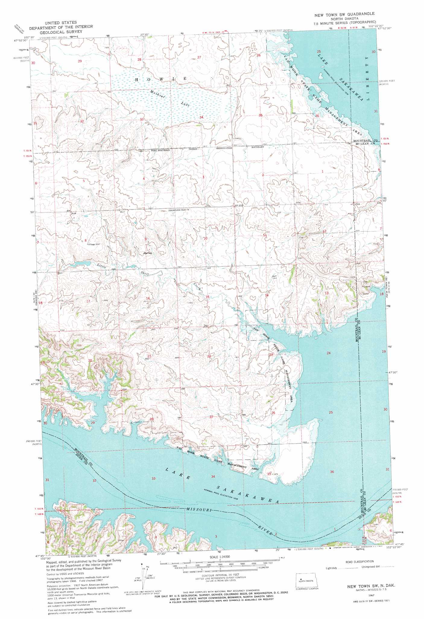
USGS Topo Quad 47102g4 - 1:24,000 scale
| Topo Map Name: | New Town Sw |
| USGS Topo Quad ID: | 47102g4 |
| Print Size: | ca. 21 1/4" wide x 27" high |
| Southeast Coordinates: | 47.75° N latitude / 102.375° W longitude |
| Map Center Coordinates: | 47.8125° N latitude / 102.4375° W longitude |
| U.S. State: | ND |
| Filename: | O47102G4.jpg |
| Download Map JPG Image: | New Town Sw topo map 1:24,000 scale |
| Map Type: | Topographic |
| Topo Series: | 7.5´ |
| Map Scale: | 1:24,000 |
| Source of Map Images: | United States Geological Survey (USGS) |
| Alternate Map Versions: |
New Town SW ND 1967, updated 1970 Download PDF Buy paper map New Town SW ND 2011 Download PDF Buy paper map New Town SW ND 2014 Download PDF Buy paper map |
1:24,000 Topo Quads surrounding New Town Sw
Rat Lake Sw |
Rat Lake Se |
Belden Sw |
Belden Se |
Epworth |
Sanish Nw |
Sanish |
New Town |
Shell Creek Bay |
Parshall |
Sanish Sw |
Sanish Se |
New Town Sw |
New Town Se |
Parshall Sw |
Mandaree |
Mandaree Ne |
String Buttes |
Saddle Butte |
Raub Nw |
Mandaree Sw |
Mandaree Se |
Saddle Butte Sw |
Hay Flat |
Twin Buttes |
> Back to 47102e1 at 1:100,000 scale
> Back to 47102a1 at 1:250,000 scale
> Back to U.S. Topo Maps home
New Town Sw topo map: Gazetteer
New Town Sw: Bends
Fort Maneury Bend (historical) elevation 561m 1840′The Narrows (historical) elevation 561m 1840′
New Town Sw: Parks
Van Hook State Game Management Area elevation 573m 1879′New Town Sw: Streams
Little Shell Creek elevation 561m 1840′New Town Sw: Swamps
Muskrat Lake elevation 574m 1883′New Town Sw digital topo map on disk
Buy this New Town Sw topo map showing relief, roads, GPS coordinates and other geographical features, as a high-resolution digital map file on DVD:
Eastern Montana & Western North Dakota
Buy digital topo maps: Eastern Montana & Western North Dakota