Saddle Butte Topo Map North Dakota
To zoom in, hover over the map of Saddle Butte
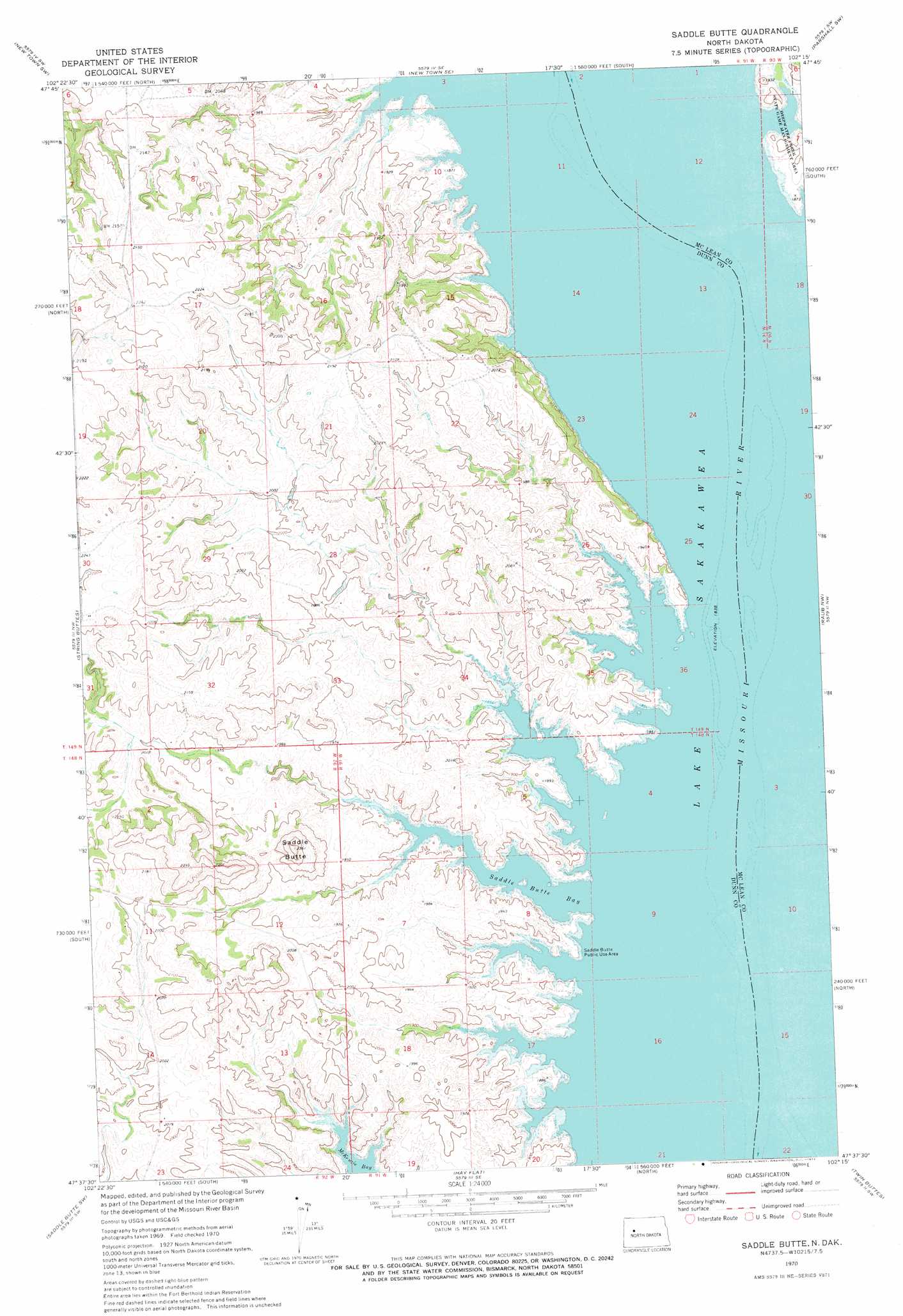
USGS Topo Quad 47102f3 - 1:24,000 scale
| Topo Map Name: | Saddle Butte |
| USGS Topo Quad ID: | 47102f3 |
| Print Size: | ca. 21 1/4" wide x 27" high |
| Southeast Coordinates: | 47.625° N latitude / 102.25° W longitude |
| Map Center Coordinates: | 47.6875° N latitude / 102.3125° W longitude |
| U.S. State: | ND |
| Filename: | O47102F3.jpg |
| Download Map JPG Image: | Saddle Butte topo map 1:24,000 scale |
| Map Type: | Topographic |
| Topo Series: | 7.5´ |
| Map Scale: | 1:24,000 |
| Source of Map Images: | United States Geological Survey (USGS) |
| Alternate Map Versions: |
Saddle Butte ND 1970, updated 1973 Download PDF Buy paper map Saddle Butte ND 2011 Download PDF Buy paper map Saddle Butte ND 2014 Download PDF Buy paper map |
1:24,000 Topo Quads surrounding Saddle Butte
Sanish |
New Town |
Shell Creek Bay |
Parshall |
Parshall Ne |
Sanish Se |
New Town Sw |
New Town Se |
Parshall Sw |
Parshall Se |
Mandaree Ne |
String Buttes |
Saddle Butte |
Raub Nw |
Raub |
Mandaree Se |
Saddle Butte Sw |
Hay Flat |
Twin Buttes |
Raub Se |
Dunn Center Ne |
Halliday Nw |
Halliday Ne |
Golden Valley Nw |
Golden Valley Ne |
> Back to 47102e1 at 1:100,000 scale
> Back to 47102a1 at 1:250,000 scale
> Back to U.S. Topo Maps home
Saddle Butte topo map: Gazetteer
Saddle Butte: Bays
Saddle Butte Bay elevation 561m 1840′Saddle Butte: Islands
Goldfinch Towhead (historical) elevation 561m 1840′Saddle Butte: Parks
Saddle Butte Public Use Area elevation 569m 1866′Saddle Butte: Summits
Saddle Butte elevation 720m 2362′Saddle Butte digital topo map on disk
Buy this Saddle Butte topo map showing relief, roads, GPS coordinates and other geographical features, as a high-resolution digital map file on DVD:
Eastern Montana & Western North Dakota
Buy digital topo maps: Eastern Montana & Western North Dakota