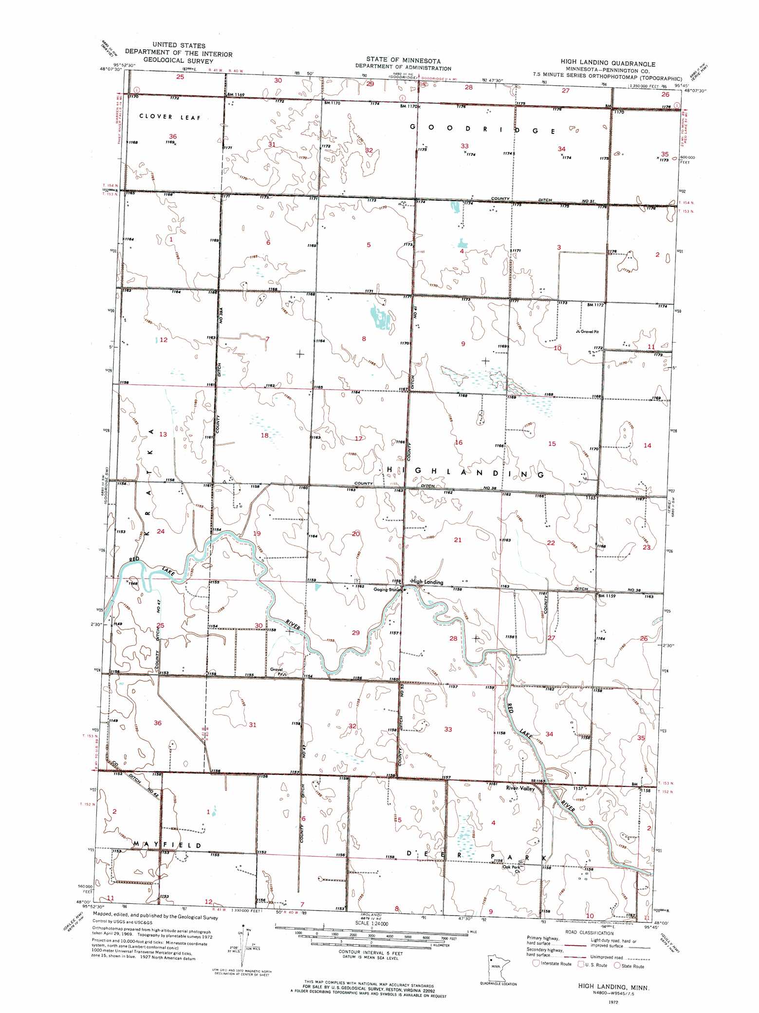
High Landing Topo Map Minnesota
To zoom in, hover over the map of High Landing
USGS Topo Quad 48095a7 - 1:24,000 scale
| Topo Map Name: | High Landing |
| USGS Topo Quad ID: | 48095a7 |
| Print Size: | ca. 21 1/4" wide x 27" high |
| Southeast Coordinates: | 48° N latitude / 95.75° W longitude |
| Map Center Coordinates: | 48.0625° N latitude / 95.8125° W longitude |
| U.S. State: | MN |
| Filename: | p48095a7.jpg |
| Download Map JPG Image: | High Landing topo map 1:24,000 scale |
| Map Type: | Orthophoto |
| Topo Series: | 7.5´ |
| Map Scale: | 1:24,000 |
| Source of Map Images: | United States Geological Survey (USGS) |
| Alternate Map Versions: |
High Landing MN 1972, updated 1976 Download PDF Buy paper map High Landing MN 2010 Download PDF Buy paper map High Landing MN 2013 Download PDF Buy paper map High Landing MN 2016 Download PDF Buy paper map |
1:24,000 Topo Quads surrounding High Landing
Middle River Se |
Gatzke Sw |
Gatzke Se |
Grygla Sw |
Grygla |
Thief River Falls Ne |
Mavie |
Goodridge |
Erie Nw |
Erie Ne |
Hazel |
Goodridge Sw |
High Landing |
Erie |
Good Lake |
Plummer |
Oklee Nw |
Roland |
Gully Nw |
Gully Ne |
Brooks |
Oklee Sw |
Oklee |
Trail |
Gully |
> Back to 48095a1 at 1:100,000 scale
> Back to 48094a1 at 1:250,000 scale
> Back to U.S. Topo Maps home
High Landing topo map: Gazetteer
High Landing: Airports
Swanson Airport elevation 357m 1171′High Landing: Canals
County Ditch Number Fiftyone elevation 357m 1171′County Ditch Number Fiftythree elevation 351m 1151′
County Ditch Number Fortyone elevation 356m 1167′
County Ditch Number Fortyseven elevation 352m 1154′
County Ditch Number Thirtynine A elevation 353m 1158′
High Landing: Populated Places
High Landing elevation 352m 1154′River Valley elevation 353m 1158′
High Landing: Post Offices
Brunkeberg Post Office (historical) elevation 356m 1167′High Landing Post Office (historical) elevation 352m 1154′
Kuehnel Post Office (historical) elevation 354m 1161′
Malone Post Office (historical) elevation 351m 1151′
Sunbeam Post Office (historical) elevation 353m 1158′
High Landing digital topo map on disk
Buy this High Landing topo map showing relief, roads, GPS coordinates and other geographical features, as a high-resolution digital map file on DVD: