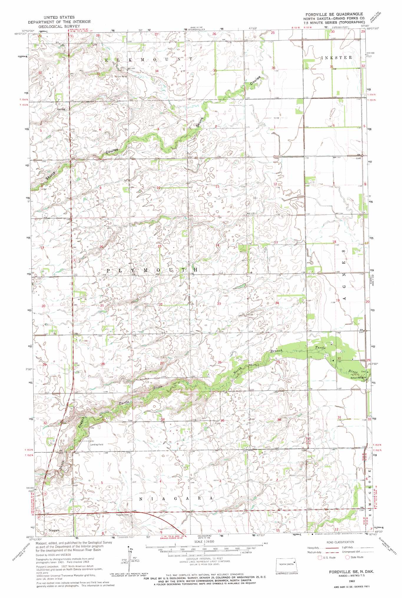
Fordville Se Topo Map North Dakota
To zoom in, hover over the map of Fordville Se
USGS Topo Quad 48097a7 - 1:24,000 scale
| Topo Map Name: | Fordville Se |
| USGS Topo Quad ID: | 48097a7 |
| Print Size: | ca. 21 1/4" wide x 27" high |
| Southeast Coordinates: | 48° N latitude / 97.75° W longitude |
| Map Center Coordinates: | 48.0625° N latitude / 97.8125° W longitude |
| U.S. State: | ND |
| Filename: | O48097A7.jpg |
| Download Map JPG Image: | Fordville Se topo map 1:24,000 scale |
| Map Type: | Topographic |
| Topo Series: | 7.5´ |
| Map Scale: | 1:24,000 |
| Source of Map Images: | United States Geological Survey (USGS) |
| Alternate Map Versions: |
Fordville SE ND 1963, updated 1964 Download PDF Buy paper map Fordville SE ND 2011 Download PDF Buy paper map Fordville SE ND 2014 Download PDF Buy paper map |
1:24,000 Topo Quads surrounding Fordville Se
Adams Se |
Lankin |
Pleasant Valley |
Pisek |
Veseleyville |
Whitman |
Dahlen |
Fordville |
Inkster |
Inkster Ne |
Michigan East |
Fordville Sw |
Fordville Se |
Orr |
Inkster Se |
Lambs Lake |
Lake Pickard |
Niagara |
Larimore West |
Larimore East |
Mcville Se |
Niagara Sw |
Logan Center |
Larimore Sw |
Kempton |
> Back to 48097a1 at 1:100,000 scale
> Back to 48096a1 at 1:250,000 scale
> Back to U.S. Topo Maps home
Fordville Se topo map: Gazetteer
Fordville Se: Airports
Janice Field elevation 350m 1148′Fordville Se: Dams
Upper Turtle River Number 2 Dam elevation 412m 1351′Fordville Se digital topo map on disk
Buy this Fordville Se topo map showing relief, roads, GPS coordinates and other geographical features, as a high-resolution digital map file on DVD:
Eastern North Dakota & Eastern South Dakota
Buy digital topo maps: Eastern North Dakota & Eastern South Dakota