Lake Upsilon Se Topo Map North Dakota
To zoom in, hover over the map of Lake Upsilon Se
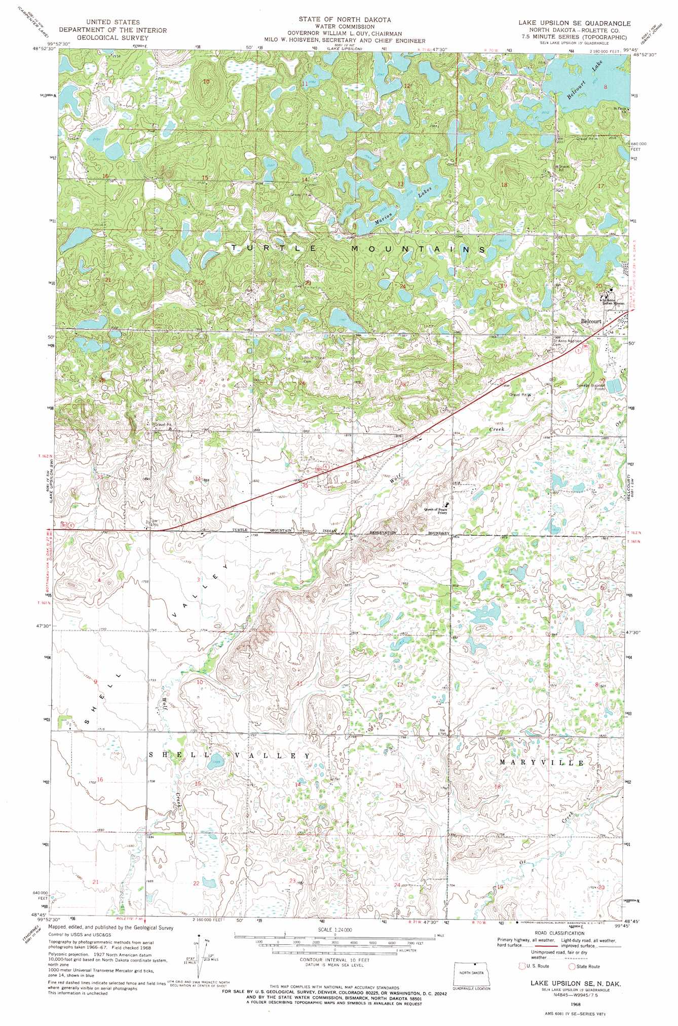
USGS Topo Quad 48099g7 - 1:24,000 scale
| Topo Map Name: | Lake Upsilon Se |
| USGS Topo Quad ID: | 48099g7 |
| Print Size: | ca. 21 1/4" wide x 27" high |
| Southeast Coordinates: | 48.75° N latitude / 99.75° W longitude |
| Map Center Coordinates: | 48.8125° N latitude / 99.8125° W longitude |
| U.S. State: | ND |
| Filename: | O48099G7.jpg |
| Download Map JPG Image: | Lake Upsilon Se topo map 1:24,000 scale |
| Map Type: | Topographic |
| Topo Series: | 7.5´ |
| Map Scale: | 1:24,000 |
| Source of Map Images: | United States Geological Survey (USGS) |
| Alternate Map Versions: |
Lake Upsilon SE ND 1968, updated 1968 Download PDF Buy paper map Lake Upsilon SE ND 2011 Download PDF Buy paper map Lake Upsilon SE ND 2014 Download PDF Buy paper map |
1:24,000 Topo Quads surrounding Lake Upsilon Se
International Peace Garden |
Carpenter Lake |
Lake Upsilon |
Saint John |
Rolla Ne |
Dunseith |
Lake Upsilon Sw |
Lake Upsilon Se |
Belcourt |
Rolla |
Fonda |
Thorne |
Rolette |
Mylo Nw |
Mylo |
Overly Se |
Rolette Sw |
Nanson |
Island Lake |
Mylo Se |
> Back to 48099e1 at 1:100,000 scale
> Back to 48098a1 at 1:250,000 scale
> Back to U.S. Topo Maps home
Lake Upsilon Se topo map: Gazetteer
Lake Upsilon Se: Lakes
Belcourt Lake elevation 614m 2014′Marion Lakes elevation 620m 2034′
Lake Upsilon Se: Populated Places
Shell Valley elevation 539m 1768′Lake Upsilon Se: Valleys
Shell Valley elevation 510m 1673′Lake Upsilon Se digital topo map on disk
Buy this Lake Upsilon Se topo map showing relief, roads, GPS coordinates and other geographical features, as a high-resolution digital map file on DVD:
Eastern North Dakota & Eastern South Dakota
Buy digital topo maps: Eastern North Dakota & Eastern South Dakota