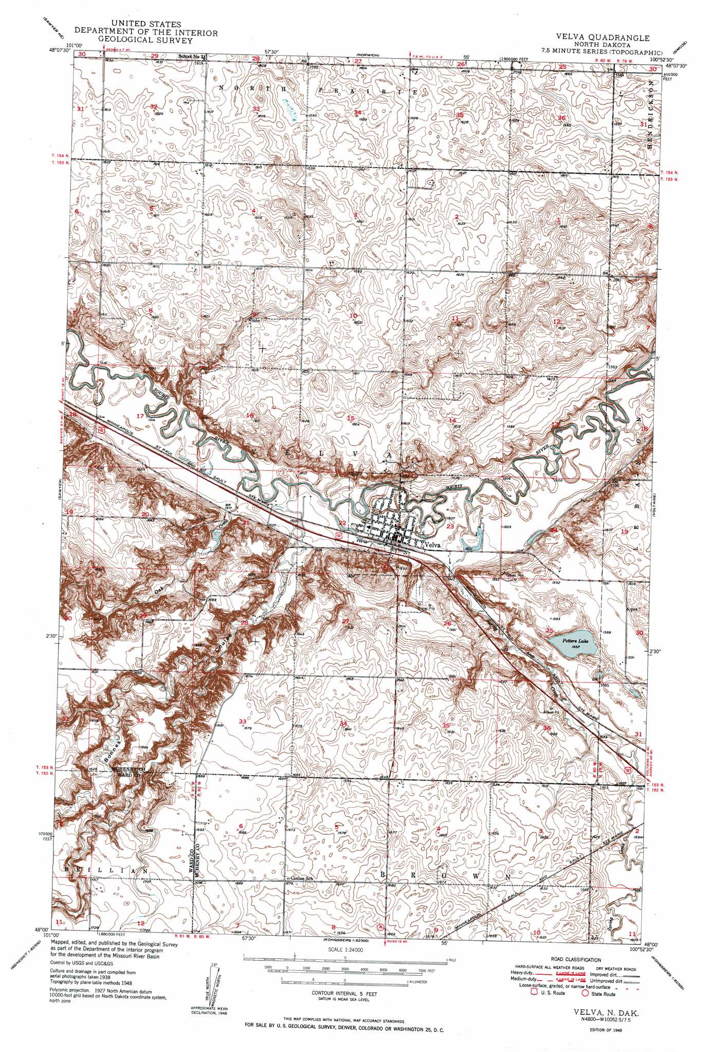
Velva Topo Map North Dakota
To zoom in, hover over the map of Velva
USGS Topo Quad 48100a8 - 1:24,000 scale
| Topo Map Name: | Velva |
| USGS Topo Quad ID: | 48100a8 |
| Print Size: | ca. 21 1/4" wide x 27" high |
| Southeast Coordinates: | 48° N latitude / 100.875° W longitude |
| Map Center Coordinates: | 48.0625° N latitude / 100.9375° W longitude |
| U.S. State: | ND |
| Filename: | O48100A8.jpg |
| Download Map JPG Image: | Velva topo map 1:24,000 scale |
| Map Type: | Topographic |
| Topo Series: | 7.5´ |
| Map Scale: | 1:24,000 |
| Source of Map Images: | United States Geological Survey (USGS) |
| Alternate Map Versions: |
Velva ND 1949, updated 1949 Download PDF Buy paper map Velva ND 1949, updated 1999 Download PDF Buy paper map Velva ND 2011 Download PDF Buy paper map Velva ND 2014 Download PDF Buy paper map |
1:24,000 Topo Quads surrounding Velva
Deering Sw |
Deering Se |
Granville Sw |
Granville |
Riga |
Surrey |
Sawyer Ne |
Norwich |
Simcoe |
Karlsruhe Nw |
Sawyer Sw |
Sawyer |
Velva |
Voltaire |
Bergen |
Benedict Nw |
Robinson Coulee |
Blacktail Coulee |
Kongsberg Ne |
Balfour Nw |
Benedict Sw |
Benedict |
Ruso |
Kongsberg |
Butte |
> Back to 48100a1 at 1:100,000 scale
> Back to 48100a1 at 1:250,000 scale
> Back to U.S. Topo Maps home
Velva topo map: Gazetteer
Velva: Lakes
Potters Lake elevation 476m 1561′Velva: Populated Places
Velva elevation 461m 1512′Velva: Streams
Oak Creek elevation 457m 1499′Spring Creek elevation 455m 1492′
Velva: Valleys
Bonnes Coulee elevation 462m 1515′Velva digital topo map on disk
Buy this Velva topo map showing relief, roads, GPS coordinates and other geographical features, as a high-resolution digital map file on DVD:
Eastern North Dakota & Eastern South Dakota
Buy digital topo maps: Eastern North Dakota & Eastern South Dakota