Sawyer Topo Map North Dakota
To zoom in, hover over the map of Sawyer
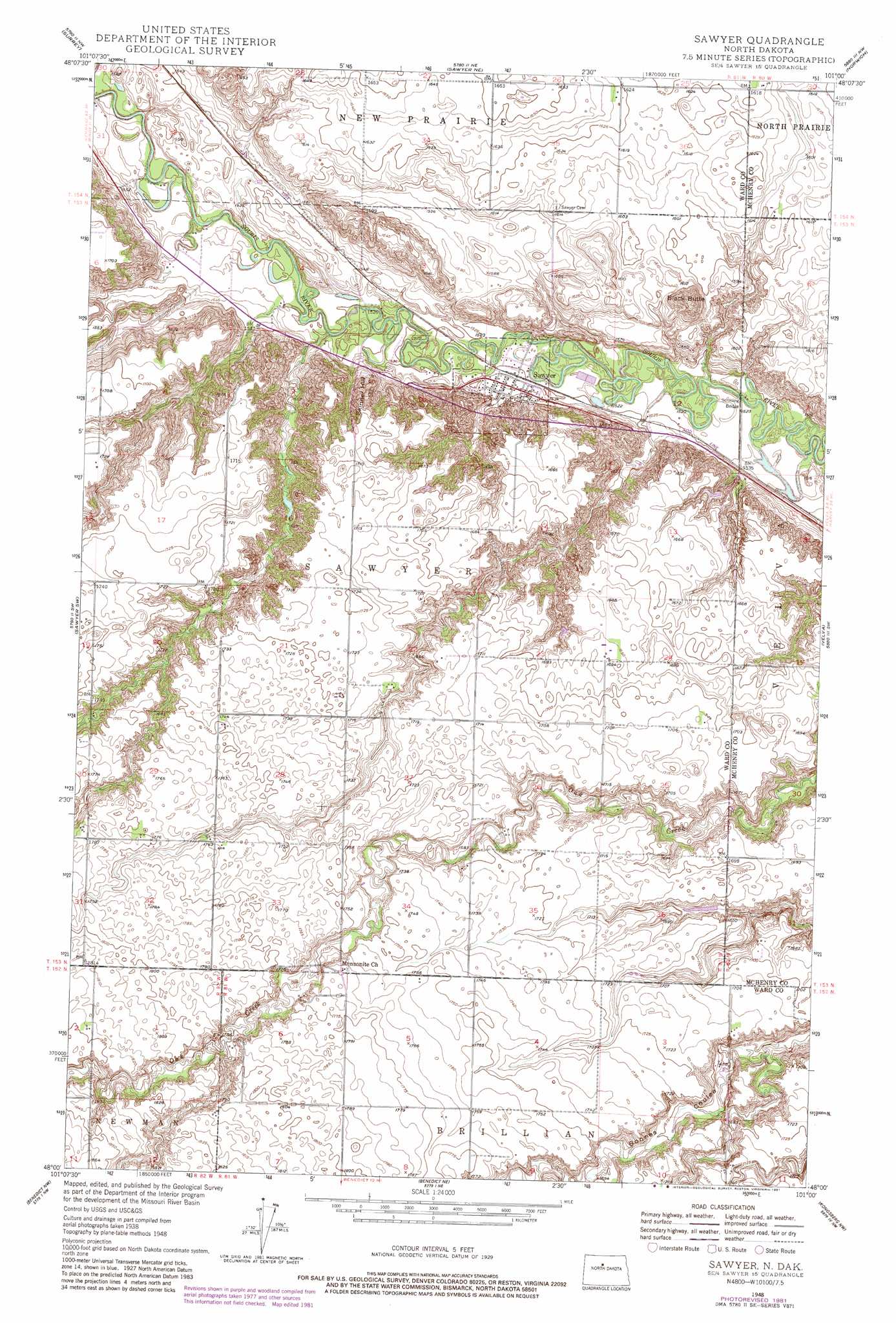
USGS Topo Quad 48101a1 - 1:24,000 scale
| Topo Map Name: | Sawyer |
| USGS Topo Quad ID: | 48101a1 |
| Print Size: | ca. 21 1/4" wide x 27" high |
| Southeast Coordinates: | 48° N latitude / 101° W longitude |
| Map Center Coordinates: | 48.0625° N latitude / 101.0625° W longitude |
| U.S. State: | ND |
| Filename: | O48101A1.jpg |
| Download Map JPG Image: | Sawyer topo map 1:24,000 scale |
| Map Type: | Topographic |
| Topo Series: | 7.5´ |
| Map Scale: | 1:24,000 |
| Source of Map Images: | United States Geological Survey (USGS) |
| Alternate Map Versions: |
Sawyer ND 1948, updated 1966 Download PDF Buy paper map Sawyer ND 1949 Download PDF Buy paper map Sawyer ND 1981, updated 1981 Download PDF Buy paper map Sawyer ND 2011 Download PDF Buy paper map Sawyer ND 2014 Download PDF Buy paper map |
1:24,000 Topo Quads surrounding Sawyer
Burlington Se |
Deering Sw |
Deering Se |
Granville Sw |
Granville |
Minot |
Surrey |
Sawyer Ne |
Norwich |
Simcoe |
South Prairie |
Sawyer Sw |
Sawyer |
Velva |
Voltaire |
Max Ne |
Benedict Nw |
Robinson Coulee |
Blacktail Coulee |
Kongsberg Ne |
Max |
Benedict Sw |
Benedict |
Ruso |
Kongsberg |
> Back to 48101a1 at 1:100,000 scale
> Back to 48100a1 at 1:250,000 scale
> Back to U.S. Topo Maps home
Sawyer topo map: Gazetteer
Sawyer: Bridges
Schilling Bridge elevation 458m 1502′Sawyer: Populated Places
Sawyer elevation 468m 1535′Sawyer: Summits
Black Butte elevation 523m 1715′Skinner Hill elevation 512m 1679′
Sawyer: Valleys
Blackwater Coulee elevation 468m 1535′Sawyer digital topo map on disk
Buy this Sawyer topo map showing relief, roads, GPS coordinates and other geographical features, as a high-resolution digital map file on DVD:
Eastern North Dakota & Eastern South Dakota
Buy digital topo maps: Eastern North Dakota & Eastern South Dakota