Down Reservoir Nw Topo Map Montana
To zoom in, hover over the map of Down Reservoir Nw
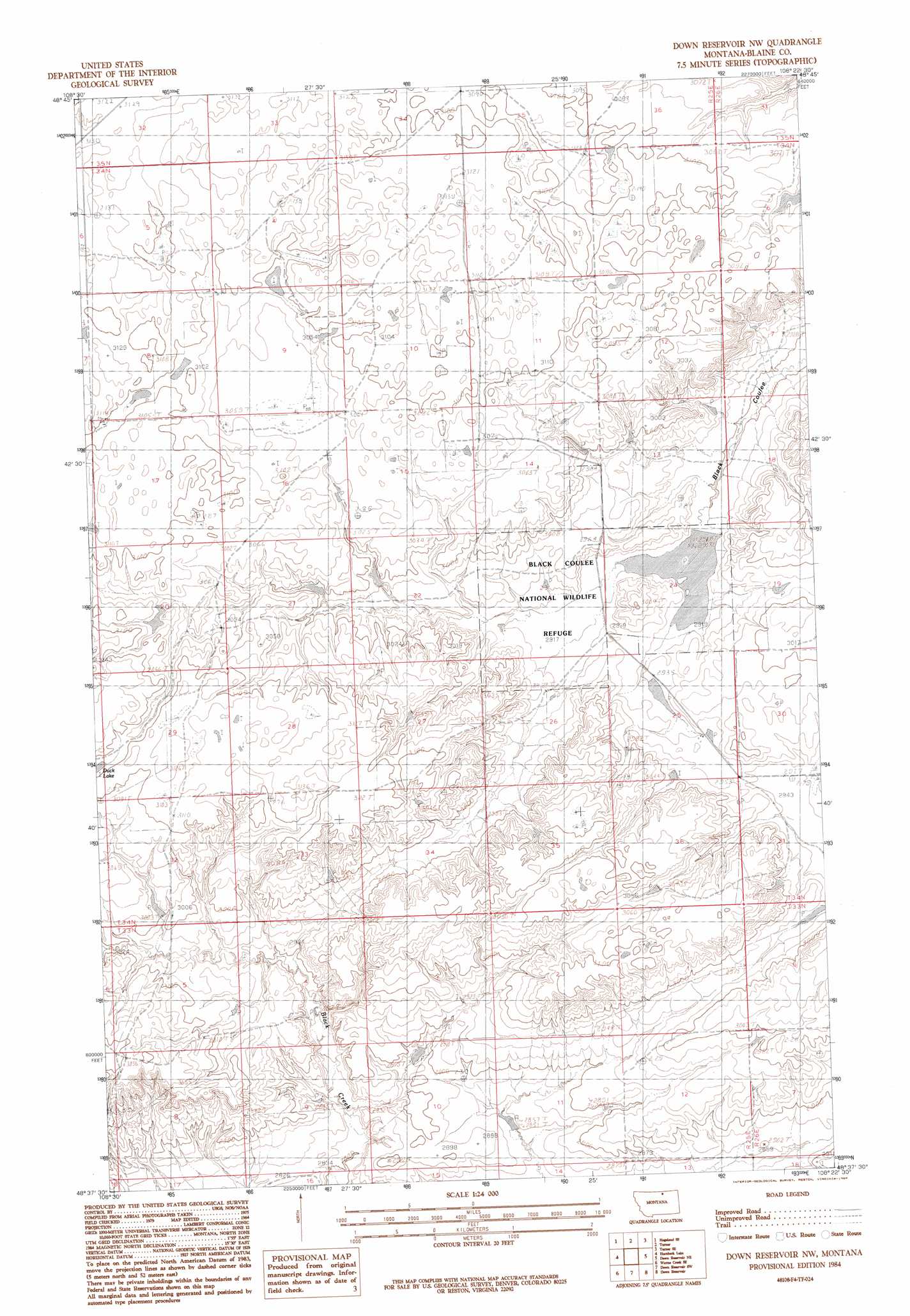
USGS Topo Quad 48108f4 - 1:24,000 scale
| Topo Map Name: | Down Reservoir Nw |
| USGS Topo Quad ID: | 48108f4 |
| Print Size: | ca. 21 1/4" wide x 27" high |
| Southeast Coordinates: | 48.625° N latitude / 108.375° W longitude |
| Map Center Coordinates: | 48.6875° N latitude / 108.4375° W longitude |
| U.S. State: | MT |
| Filename: | o48108f4.jpg |
| Download Map JPG Image: | Down Reservoir Nw topo map 1:24,000 scale |
| Map Type: | Topographic |
| Topo Series: | 7.5´ |
| Map Scale: | 1:24,000 |
| Source of Map Images: | United States Geological Survey (USGS) |
| Alternate Map Versions: |
Down Reservoir NW MT 1984, updated 1984 Download PDF Buy paper map Down Reservoir NW MT 2011 Download PDF Buy paper map Down Reservoir NW MT 2014 Download PDF Buy paper map |
1:24,000 Topo Quads surrounding Down Reservoir Nw
Hogeland Nw |
Mosquito Springs |
Turner Nw |
Turner Ne |
Chapman Nw |
Hogeland |
Hogeland Se |
Turner |
Turner Se |
Chapman |
Wayne Creek Nw |
Hornbeck Lake |
Down Reservoir Nw |
Down Reservoir Ne |
Emerick Bench |
Grable Coulee |
Wayne Creek Se |
Down Reservoir Sw |
Down Reservoir |
Hubert Hill Sw |
Threemile Reservoir |
Savoy |
Coburg |
Dodson Dam |
Dodson |
> Back to 48108e1 at 1:100,000 scale
> Back to 48108a1 at 1:250,000 scale
> Back to U.S. Topo Maps home
Down Reservoir Nw topo map: Gazetteer
Down Reservoir Nw: Dams
Black Coulee Dam elevation 886m 2906′Down Reservoir Nw: Parks
Black Coulee National Wildlife Refuge elevation 889m 2916′Down Reservoir Nw: Reservoirs
Black Coulee elevation 886m 2906′Down Reservoir Nw digital topo map on disk
Buy this Down Reservoir Nw topo map showing relief, roads, GPS coordinates and other geographical features, as a high-resolution digital map file on DVD: