Turner Nw Topo Map Montana
To zoom in, hover over the map of Turner Nw
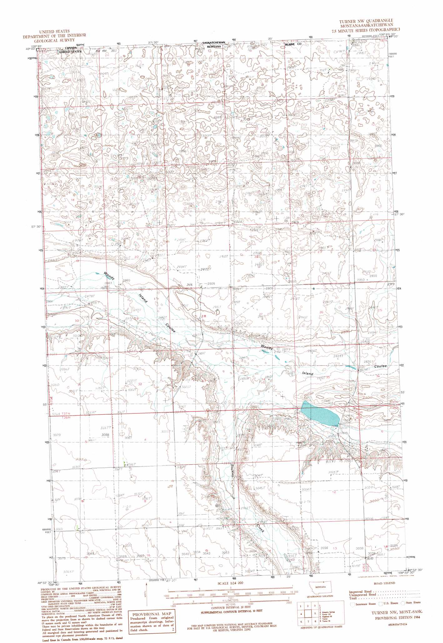
USGS Topo Quad 48108h4 - 1:24,000 scale
| Topo Map Name: | Turner Nw |
| USGS Topo Quad ID: | 48108h4 |
| Print Size: | ca. 21 1/4" wide x 27" high |
| Southeast Coordinates: | 48.875° N latitude / 108.375° W longitude |
| Map Center Coordinates: | 48.9375° N latitude / 108.4375° W longitude |
| U.S. State: | MT |
| Filename: | o48108h4.jpg |
| Download Map JPG Image: | Turner Nw topo map 1:24,000 scale |
| Map Type: | Topographic |
| Topo Series: | 7.5´ |
| Map Scale: | 1:24,000 |
| Source of Map Images: | United States Geological Survey (USGS) |
| Alternate Map Versions: |
Turner NW MT 1984, updated 1984 Download PDF Buy paper map Turner NW MT 2011 Download PDF Buy paper map Turner NW MT 2014 Download PDF Buy paper map |
1:24,000 Topo Quads surrounding Turner Nw
Hogeland Nw |
Mosquito Springs |
Turner Nw |
Turner Ne |
Chapman Nw |
Hogeland |
Hogeland Se |
Turner |
Turner Se |
Chapman |
Wayne Creek Nw |
Hornbeck Lake |
Down Reservoir Nw |
Down Reservoir Ne |
Emerick Bench |
> Back to 48108e1 at 1:100,000 scale
> Back to 48108a1 at 1:250,000 scale
> Back to U.S. Topo Maps home
Turner Nw topo map: Gazetteer
Turner Nw: Dams
Petri Dam elevation 902m 2959′Turner Nw: Streams
Buckley Creek elevation 860m 2821′Turner Nw digital topo map on disk
Buy this Turner Nw topo map showing relief, roads, GPS coordinates and other geographical features, as a high-resolution digital map file on DVD: