Quartz Mountain Topo Map Idaho
To zoom in, hover over the map of Quartz Mountain
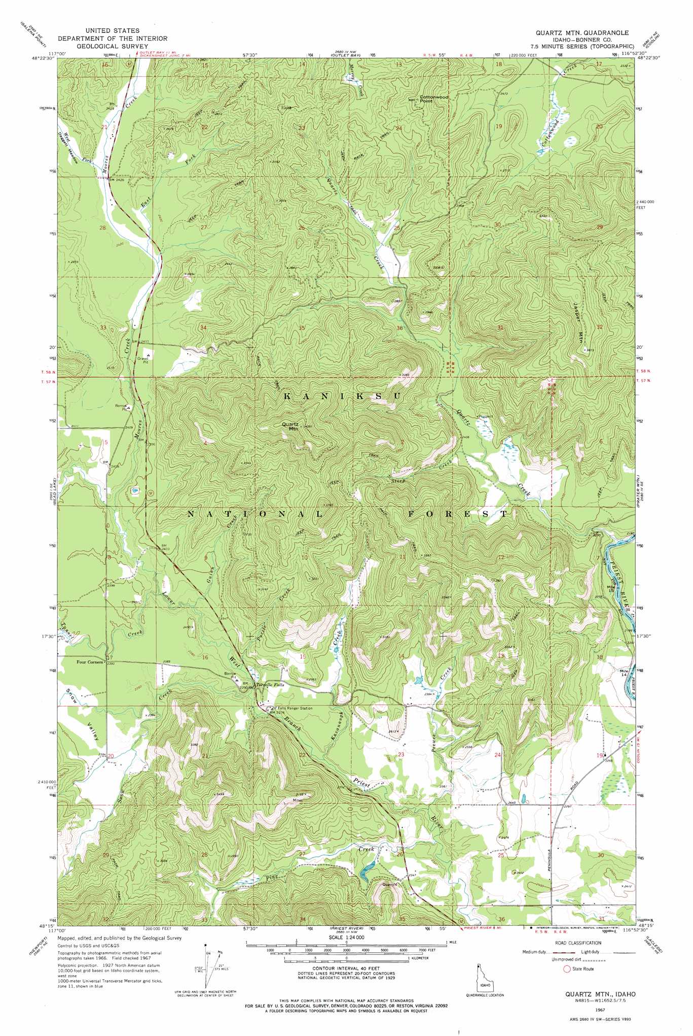
USGS Topo Quad 48116c8 - 1:24,000 scale
| Topo Map Name: | Quartz Mountain |
| USGS Topo Quad ID: | 48116c8 |
| Print Size: | ca. 21 1/4" wide x 27" high |
| Southeast Coordinates: | 48.25° N latitude / 116.875° W longitude |
| Map Center Coordinates: | 48.3125° N latitude / 116.9375° W longitude |
| U.S. State: | ID |
| Filename: | o48116c8.jpg |
| Download Map JPG Image: | Quartz Mountain topo map 1:24,000 scale |
| Map Type: | Topographic |
| Topo Series: | 7.5´ |
| Map Scale: | 1:24,000 |
| Source of Map Images: | United States Geological Survey (USGS) |
| Alternate Map Versions: |
Quartz Mtn ID 1967, updated 1971 Download PDF Buy paper map Quartz Mtn ID 1967, updated 1978 Download PDF Buy paper map Quartz Mountain ID 1996, updated 1999 Download PDF Buy paper map Quartz Mountain ID 2011 Download PDF Buy paper map Quartz Mountain ID 2013 Download PDF Buy paper map |
| FStopo: | US Forest Service topo Quartz Mountain is available: Download FStopo PDF Download FStopo TIF |
1:24,000 Topo Quads surrounding Quartz Mountain
North Baldy |
Gleason Mountain |
Priest Lake Sw |
Priest Lake Se |
Mount Roothaan |
Browns Lake |
Galena Point |
Outlet Bay |
Coolin |
Mount Casey |
Skookum Creek |
Bead Lake |
Quartz Mountain |
Prater Mountain |
Happy Fork Gap |
Diamond Lake |
Newport |
Priest River |
Laclede |
Morton |
Camden |
Tweedie |
Blanchard |
Edgemere |
Careywood |
> Back to 48116a1 at 1:100,000 scale
> Back to 48116a1 at 1:250,000 scale
> Back to U.S. Topo Maps home
Quartz Mountain topo map: Gazetteer
Quartz Mountain: Falls
Torrelle Falls elevation 697m 2286′Quartz Mountain: Flats
Snow Valley elevation 730m 2395′Quartz Mountain: Populated Places
Four Corners elevation 729m 2391′Quartz Mountain: Streams
East Fork Moores Creek elevation 735m 2411′Guinn Creek elevation 707m 2319′
Kavanaugh Creek elevation 690m 2263′
Moores Creek elevation 713m 2339′
Peewee Creek elevation 681m 2234′
Pine Creek elevation 679m 2227′
Puzzle Creek elevation 704m 2309′
Quartz Creek elevation 677m 2221′
Snow Creek elevation 696m 2283′
Steep Creek elevation 725m 2378′
Tunnel Creek elevation 733m 2404′
Tunnel Creek elevation 708m 2322′
West Fork Moores Creek elevation 738m 2421′
Quartz Mountain: Summits
Cottonwood Point elevation 935m 3067′Jasper Mountain elevation 1176m 3858′
Pewee Peak elevation 1099m 3605′
Quartz Mountain elevation 1251m 4104′
Quartz Mountain digital topo map on disk
Buy this Quartz Mountain topo map showing relief, roads, GPS coordinates and other geographical features, as a high-resolution digital map file on DVD: