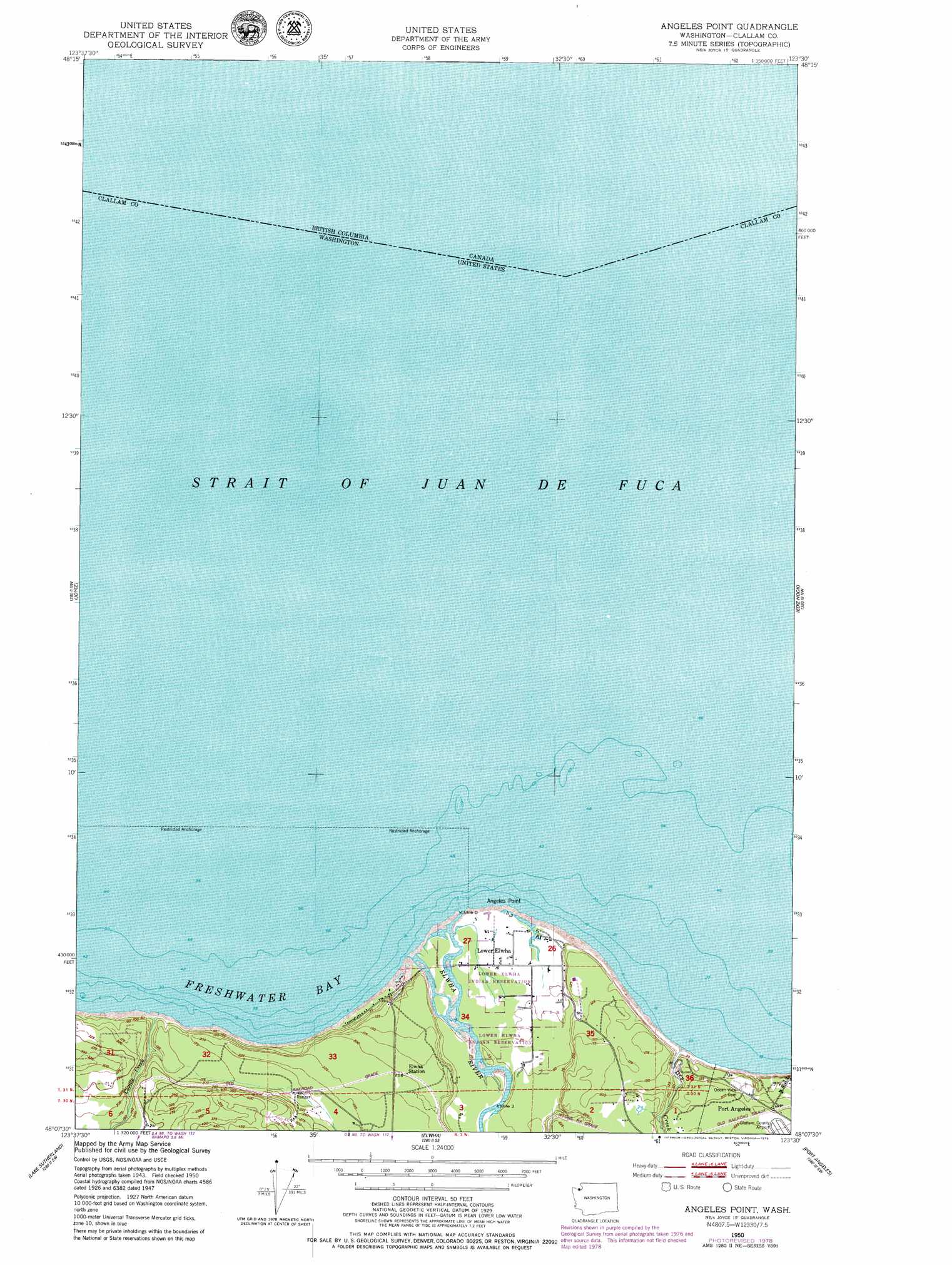
Angeles Point Topo Map Washington
To zoom in, hover over the map of Angeles Point
USGS Topo Quad 48123b5 - 1:24,000 scale
| Topo Map Name: | Angeles Point |
| USGS Topo Quad ID: | 48123b5 |
| Print Size: | ca. 21 1/4" wide x 27" high |
| Southeast Coordinates: | 48.125° N latitude / 123.5° W longitude |
| Map Center Coordinates: | 48.1875° N latitude / 123.5625° W longitude |
| U.S. State: | WA |
| Filename: | o48123b5.jpg |
| Download Map JPG Image: | Angeles Point topo map 1:24,000 scale |
| Map Type: | Topographic |
| Topo Series: | 7.5´ |
| Map Scale: | 1:24,000 |
| Source of Map Images: | United States Geological Survey (USGS) |
| Alternate Map Versions: |
Angeles Point WA 1950, updated 1955 Download PDF Buy paper map Angeles Point WA 1950, updated 1979 Download PDF Buy paper map Angeles Point WA 2011 Download PDF Buy paper map Angeles Point WA 2014 Download PDF Buy paper map |
1:24,000 Topo Quads surrounding Angeles Point
Disque |
Joyce |
Angeles Point |
Ediz Hook |
|
Lake Crescent |
Lake Sutherland |
Elwha |
Port Angeles |
Morse Creek |
Bogachiel Peak |
Mount Carrie |
Hurricane Hill |
Mount Angeles |
Maiden Peak |
> Back to 48123a1 at 1:100,000 scale
> Back to 48122a1 at 1:250,000 scale
> Back to U.S. Topo Maps home
Angeles Point topo map: Gazetteer
Angeles Point: Bays
Freshwater Bay elevation 0m 0′Angeles Point: Capes
Angeles Point elevation 1m 3′Angeles Point: Channels
Strait of Juan de Fuca elevation 0m 0′Angeles Point: Lakes
Beach Lake elevation 4m 13′Angeles Point: Populated Places
Lower Elwha elevation 6m 19′Angeles Point: Streams
Coville Creek elevation 4m 13′Dry Creek elevation 0m 0′
Elwha River elevation 1m 3′
Hancock Brook elevation 3m 9′
Angeles Point digital topo map on disk
Buy this Angeles Point topo map showing relief, roads, GPS coordinates and other geographical features, as a high-resolution digital map file on DVD: