Denver City Se Topo Map Texas
To zoom in, hover over the map of Denver City Se
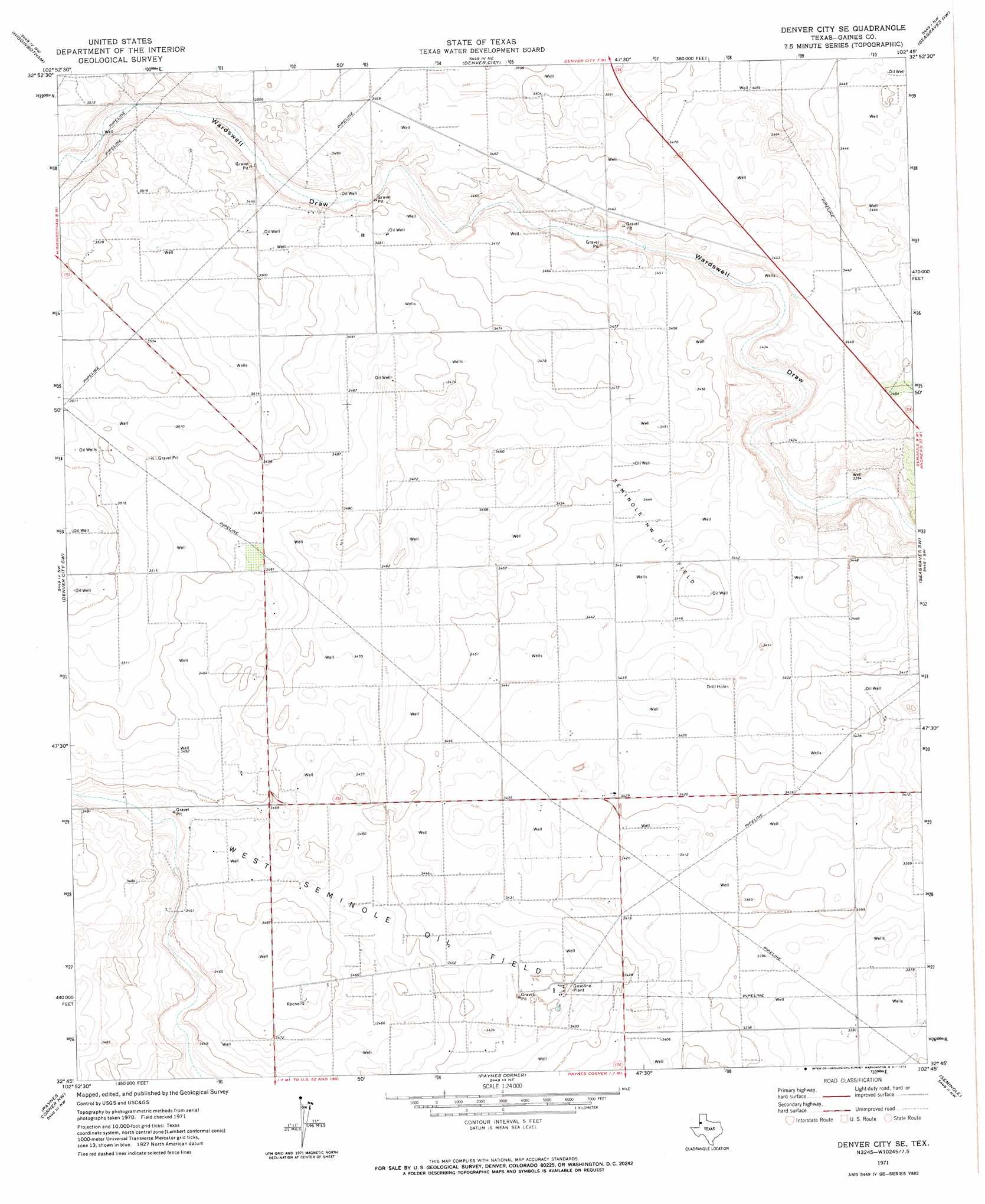
USGS Topo Quad 32102g7 - 1:24,000 scale
| Topo Map Name: | Denver City Se |
| USGS Topo Quad ID: | 32102g7 |
| Print Size: | ca. 21 1/4" wide x 27" high |
| Southeast Coordinates: | 32.75° N latitude / 102.75° W longitude |
| Map Center Coordinates: | 32.8125° N latitude / 102.8125° W longitude |
| U.S. State: | TX |
| Filename: | o32102g7.jpg |
| Download Map JPG Image: | Denver City Se topo map 1:24,000 scale |
| Map Type: | Topographic |
| Topo Series: | 7.5´ |
| Map Scale: | 1:24,000 |
| Source of Map Images: | United States Geological Survey (USGS) |
| Alternate Map Versions: |
Denver City SE TX 1971, updated 1974 Download PDF Buy paper map Denver City SE TX 2010 Download PDF Buy paper map Denver City SE TX 2012 Download PDF Buy paper map Denver City SE TX 2016 Download PDF Buy paper map |
1:24,000 Topo Quads surrounding Denver City Se
Prairieview Se |
Ink Basin |
Plains Se |
Pleasant Hill |
Tokio Se |
Humble City Ne |
Higginbotham |
Denver City |
Seagraves Nw |
Seagraves |
Humble City Se |
Denver City Sw |
Denver City Se |
Seagraves Sw |
Seagraves Se |
Hobbs East |
Paynes Corner Nw |
Paynes Corner |
Seminole |
Seminole Ne |
Hobbs Se |
Brinson Ranch |
Paynes Corner Se |
Seminole Sw |
Seminole Se |
> Back to 32102e1 at 1:100,000 scale
> Back to 32102a1 at 1:250,000 scale
> Back to U.S. Topo Maps home
Denver City Se topo map: Gazetteer
Denver City Se: Oilfields
Seminole Northwest Oil Field elevation 1049m 3441′West Seminole Oil Field elevation 1050m 3444′
Denver City Se digital topo map on disk
Buy this Denver City Se topo map showing relief, roads, GPS coordinates and other geographical features, as a high-resolution digital map file on DVD: