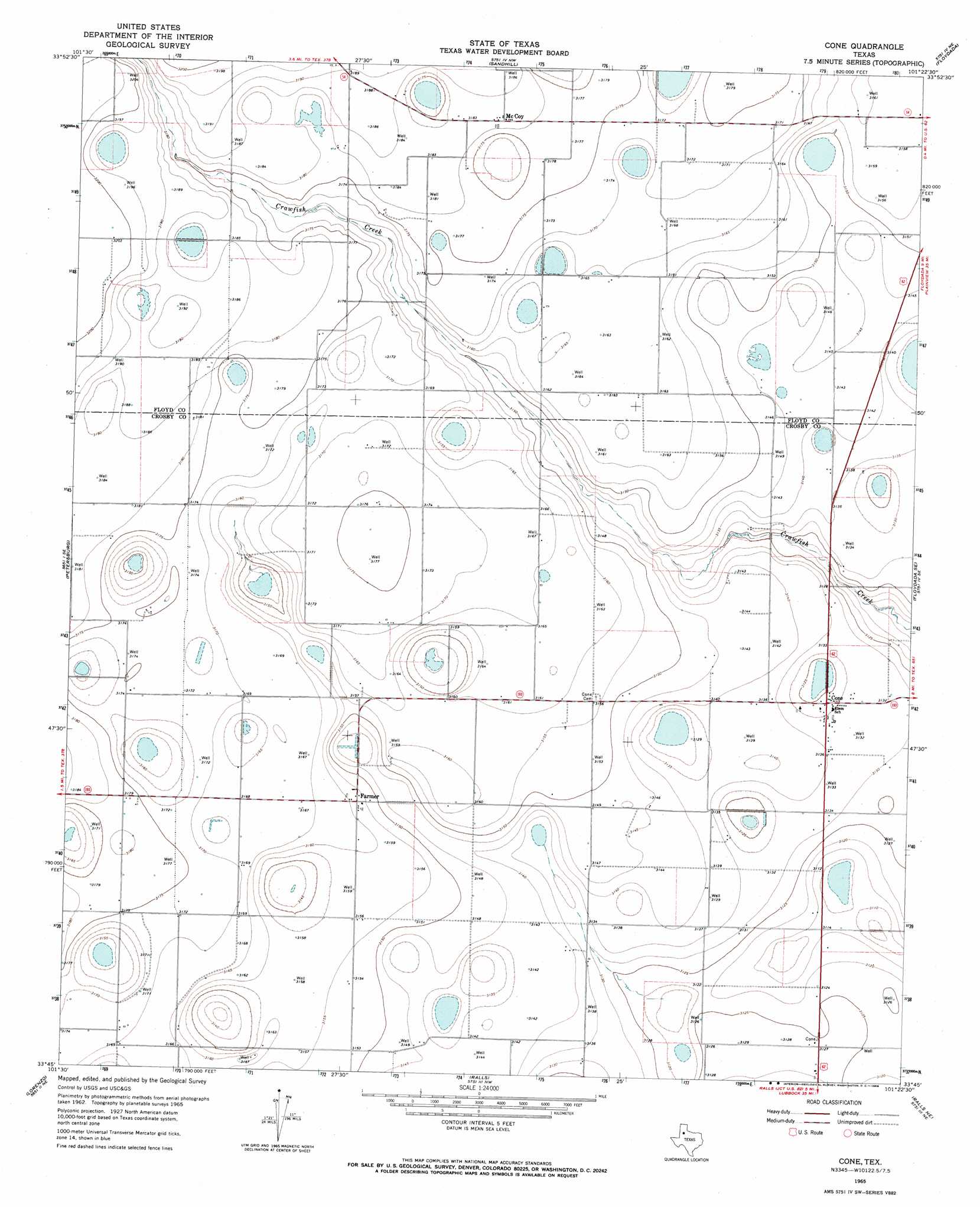
Cone Topo Map Texas
To zoom in, hover over the map of Cone
USGS Topo Quad 33101g4 - 1:24,000 scale
| Topo Map Name: | Cone |
| USGS Topo Quad ID: | 33101g4 |
| Print Size: | ca. 21 1/4" wide x 27" high |
| Southeast Coordinates: | 33.75° N latitude / 101.375° W longitude |
| Map Center Coordinates: | 33.8125° N latitude / 101.4375° W longitude |
| U.S. State: | TX |
| Filename: | o33101g4.jpg |
| Download Map JPG Image: | Cone topo map 1:24,000 scale |
| Map Type: | Topographic |
| Topo Series: | 7.5´ |
| Map Scale: | 1:24,000 |
| Source of Map Images: | United States Geological Survey (USGS) |
| Alternate Map Versions: |
Cone TX 1965, updated 1968 Download PDF Buy paper map Cone TX 2010 Download PDF Buy paper map Cone TX 2012 Download PDF Buy paper map Cone TX 2016 Download PDF Buy paper map |
1:24,000 Topo Quads surrounding Cone
Happy Union |
Plainview Se |
Lockney |
Lockney Se |
Lockney 4 Sw |
Julia Lake |
Barwise |
Sandhill |
Floydada |
Boothe |
Heckville |
Petersburg |
Cone |
Floydada Se |
Mount Blanco |
Idalou |
Lorenzo |
Ralls |
Ralls Ne |
Crosbyton |
Buffalo Springs Lake |
Acuff |
Savage |
Ralls Se |
Collett Springs |
> Back to 33101e1 at 1:100,000 scale
> Back to 33100a1 at 1:250,000 scale
> Back to U.S. Topo Maps home
Cone topo map: Gazetteer
Cone: Airports
Cone Airport elevation 958m 3143′Cone: Populated Places
Cone elevation 954m 3129′Farmer elevation 963m 3159′
McCoy elevation 970m 3182′
Cone digital topo map on disk
Buy this Cone topo map showing relief, roads, GPS coordinates and other geographical features, as a high-resolution digital map file on DVD: