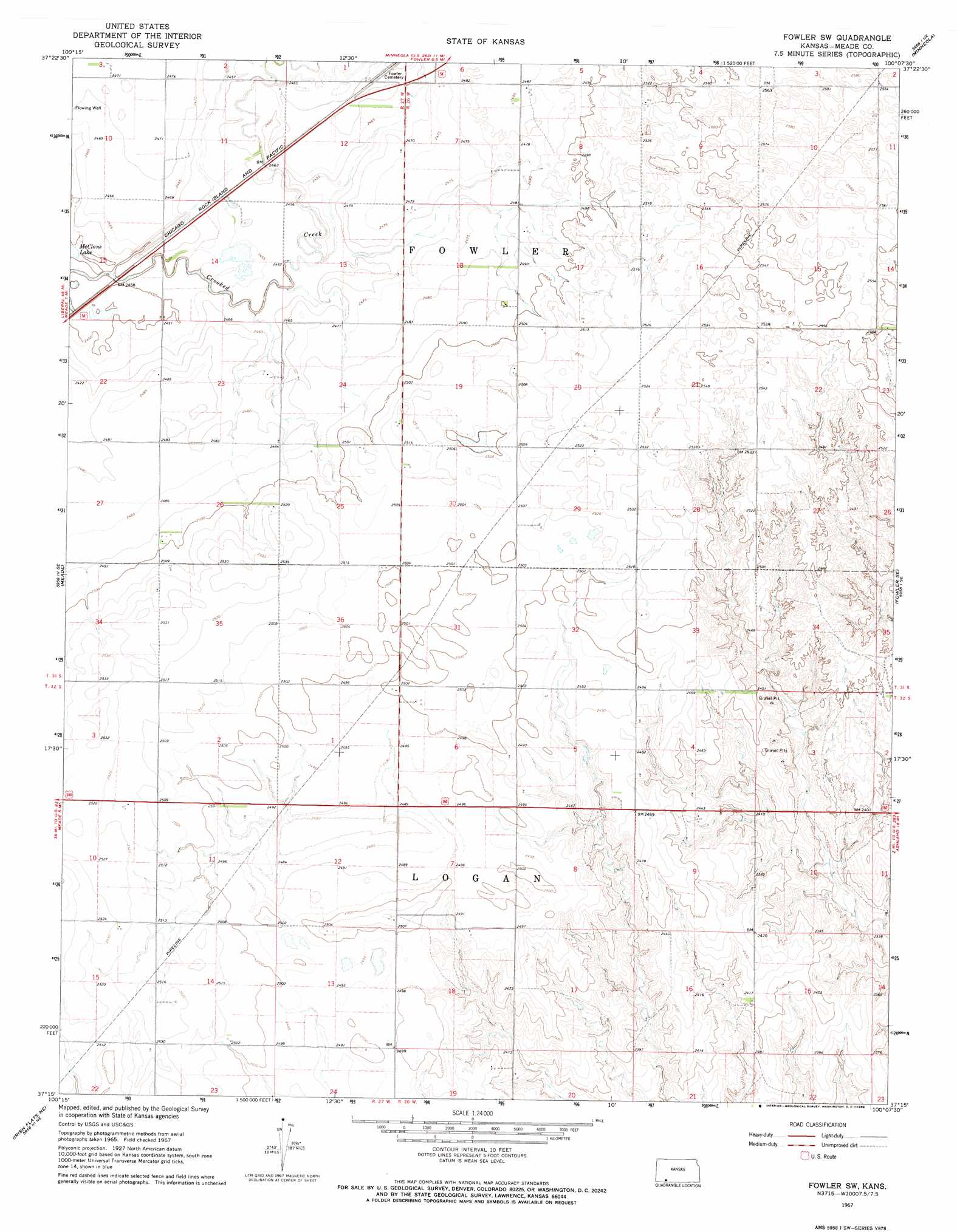
Fowler Sw Topo Map Kansas
To zoom in, hover over the map of Fowler Sw
USGS Topo Quad 37100c2 - 1:24,000 scale
| Topo Map Name: | Fowler Sw |
| USGS Topo Quad ID: | 37100c2 |
| Print Size: | ca. 21 1/4" wide x 27" high |
| Southeast Coordinates: | 37.25° N latitude / 100.125° W longitude |
| Map Center Coordinates: | 37.3125° N latitude / 100.1875° W longitude |
| U.S. State: | KS |
| Filename: | o37100c2.jpg |
| Download Map JPG Image: | Fowler Sw topo map 1:24,000 scale |
| Map Type: | Topographic |
| Topo Series: | 7.5´ |
| Map Scale: | 1:24,000 |
| Source of Map Images: | United States Geological Survey (USGS) |
| Alternate Map Versions: |
Fowler SW KS 1967, updated 1968 Download PDF Buy paper map Fowler SW KS 2010 Download PDF Buy paper map Fowler SW KS 2012 Download PDF Buy paper map Fowler SW KS 2016 Download PDF Buy paper map |
1:24,000 Topo Quads surrounding Fowler Sw
Montezuma |
Montezuma Se |
Ensign Sw |
Ensign Se |
Fort Dodge Sw |
Meade Nw |
Meade Ne |
Fowler |
Minneola |
Bloom |
Missler |
Meade |
Fowler Sw |
Fowler Se |
Bloom Sw |
Lake Meade |
Irish Flats Ne |
Proffitt Lake Nw |
Proffitt Lake |
Ashland Nw |
Irish Flats |
Irish Flats Se |
Proffitt Lake Sw |
Mount Helen |
Englewood |
> Back to 37100a1 at 1:100,000 scale
> Back to 37100a1 at 1:250,000 scale
> Back to U.S. Topo Maps home
Fowler Sw digital topo map on disk
Buy this Fowler Sw topo map showing relief, roads, GPS coordinates and other geographical features, as a high-resolution digital map file on DVD: