Harris Draw East Topo Map Kansas
To zoom in, hover over the map of Harris Draw East
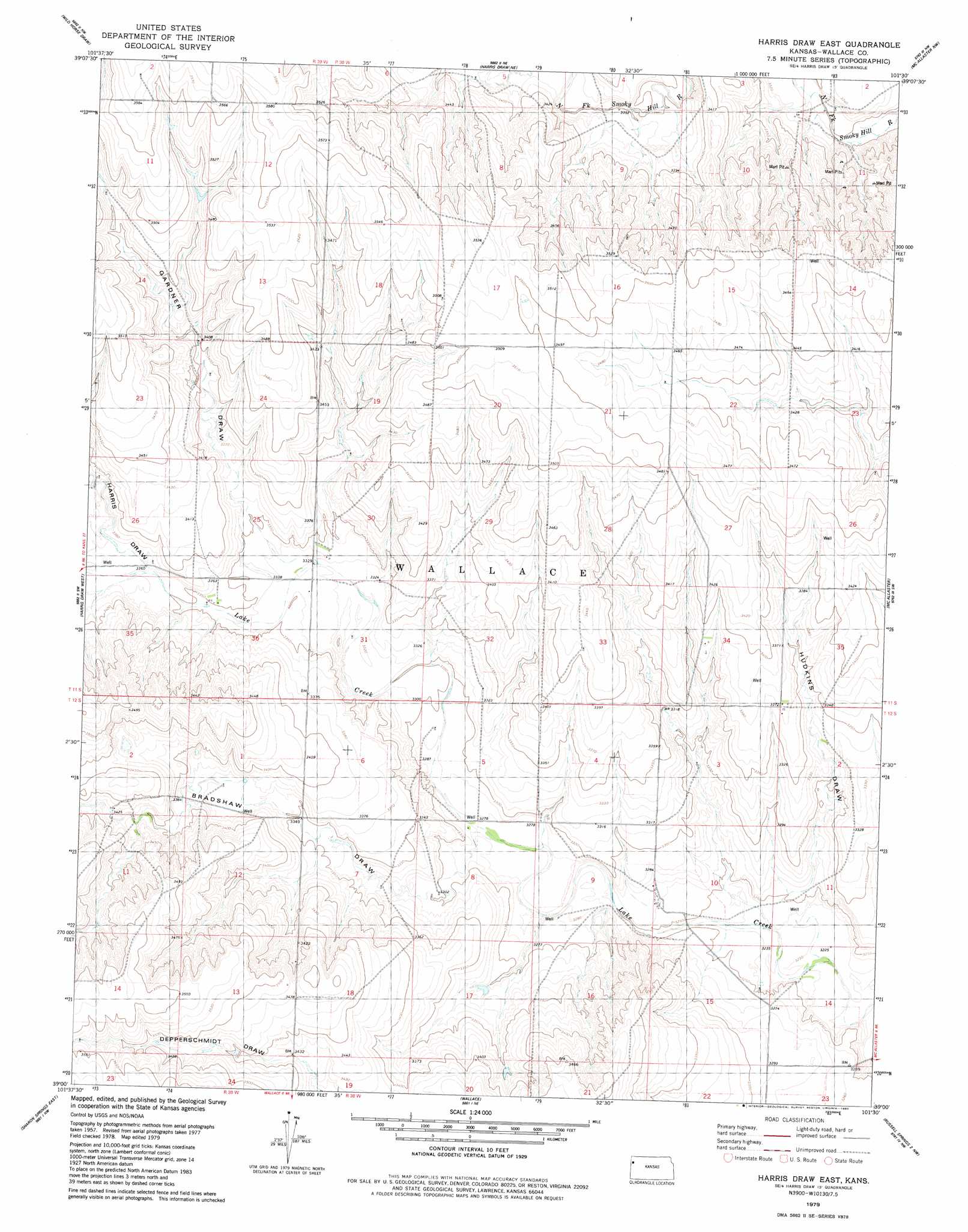
USGS Topo Quad 39101a5 - 1:24,000 scale
| Topo Map Name: | Harris Draw East |
| USGS Topo Quad ID: | 39101a5 |
| Print Size: | ca. 21 1/4" wide x 27" high |
| Southeast Coordinates: | 39° N latitude / 101.5° W longitude |
| Map Center Coordinates: | 39.0625° N latitude / 101.5625° W longitude |
| U.S. State: | KS |
| Filename: | o39101a5.jpg |
| Download Map JPG Image: | Harris Draw East topo map 1:24,000 scale |
| Map Type: | Topographic |
| Topo Series: | 7.5´ |
| Map Scale: | 1:24,000 |
| Source of Map Images: | United States Geological Survey (USGS) |
| Alternate Map Versions: |
Harris Draw East KS 1979, updated 1980 Download PDF Buy paper map Harris Draw East KS 2009 Download PDF Buy paper map Harris Draw East KS 2012 Download PDF Buy paper map Harris Draw East KS 2015 Download PDF Buy paper map |
1:24,000 Topo Quads surrounding Harris Draw East
Ruleton Se |
Goodland |
Edson |
Brewster |
Brewster Se |
Horsethief Draw Ne |
Wild Horse Draw |
Harris Draw Ne |
Mcallaster Nw |
Mcallaster Ne |
Horsethief Draw Se |
Harris Draw West |
Harris Draw East |
Mcallaster |
Mcallaster Se |
Sharon Springs West |
Sharon Springs East |
Wallace |
Russell Springs 2 Nw |
Russell Springs 2 Ne |
Spring Valley Ranch |
South Flats |
Harrison Flats |
Russell Springs 2 Sw |
Russell Springs 2 Se |
> Back to 39101a1 at 1:100,000 scale
> Back to 39100a1 at 1:250,000 scale
> Back to U.S. Topo Maps home
Harris Draw East topo map: Gazetteer
Harris Draw East: Valleys
Bradshaw Draw elevation 998m 3274′Gardner Draw elevation 1017m 3336′
Harris Draw elevation 1026m 3366′
Hudkins Draw elevation 991m 3251′
Harris Draw East digital topo map on disk
Buy this Harris Draw East topo map showing relief, roads, GPS coordinates and other geographical features, as a high-resolution digital map file on DVD: