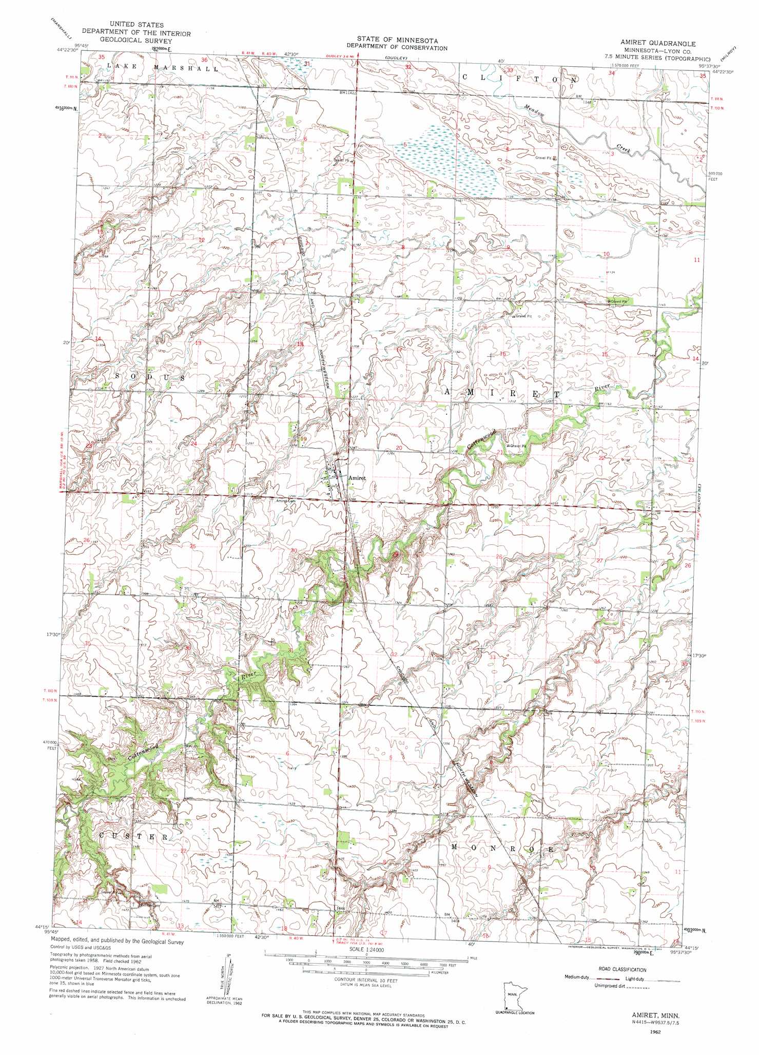
Amiret Topo Map Minnesota
To zoom in, hover over the map of Amiret
USGS Topo Quad 44095c6 - 1:24,000 scale
| Topo Map Name: | Amiret |
| USGS Topo Quad ID: | 44095c6 |
| Print Size: | ca. 21 1/4" wide x 27" high |
| Southeast Coordinates: | 44.25° N latitude / 95.625° W longitude |
| Map Center Coordinates: | 44.3125° N latitude / 95.6875° W longitude |
| U.S. State: | MN |
| Filename: | o44095c6.jpg |
| Download Map JPG Image: | Amiret topo map 1:24,000 scale |
| Map Type: | Topographic |
| Topo Series: | 7.5´ |
| Map Scale: | 1:24,000 |
| Source of Map Images: | United States Geological Survey (USGS) |
| Alternate Map Versions: |
Amiret MN 1962, updated 1964 Download PDF Buy paper map Amiret MN 2010 Download PDF Buy paper map Amiret MN 2013 Download PDF Buy paper map Amiret MN 2016 Download PDF Buy paper map |
1:24,000 Topo Quads surrounding Amiret
Minneota |
Green Valley |
Cottonwood |
School Grove Lake |
Echo |
Lynd |
Marshall |
Dudley |
Milroy |
Lucan |
Russell |
Marshall Se |
Amiret |
Milroy Se |
Wabasso Sw |
Current Lake |
Balaton |
Tracy West |
Tracy East |
Walnut Grove |
Balaton Sw |
Hadley |
Currie |
Dovray |
Westbrook |
> Back to 44095a1 at 1:100,000 scale
> Back to 44094a1 at 1:250,000 scale
> Back to U.S. Topo Maps home
Amiret topo map: Gazetteer
Amiret: Dams
Griffith-Glynn Farm Pond Dam elevation 426m 1397′Amiret: Populated Places
Amiret elevation 388m 1272′Amiret: Post Offices
Amiret Post Office elevation 388m 1272′Amiret digital topo map on disk
Buy this Amiret topo map showing relief, roads, GPS coordinates and other geographical features, as a high-resolution digital map file on DVD: