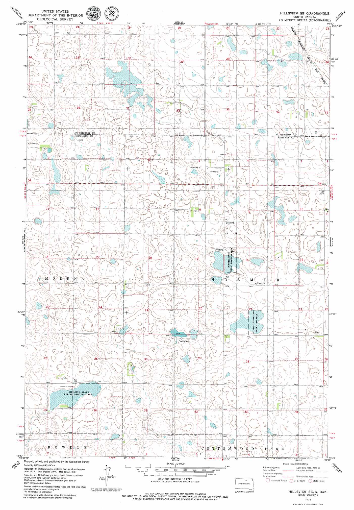
Hillsview Se Topo Map South Dakota
To zoom in, hover over the map of Hillsview Se
USGS Topo Quad 45099e5 - 1:24,000 scale
| Topo Map Name: | Hillsview Se |
| USGS Topo Quad ID: | 45099e5 |
| Print Size: | ca. 21 1/4" wide x 27" high |
| Southeast Coordinates: | 45.5° N latitude / 99.5° W longitude |
| Map Center Coordinates: | 45.5625° N latitude / 99.5625° W longitude |
| U.S. State: | SD |
| Filename: | o45099e5.jpg |
| Download Map JPG Image: | Hillsview Se topo map 1:24,000 scale |
| Map Type: | Topographic |
| Topo Series: | 7.5´ |
| Map Scale: | 1:24,000 |
| Source of Map Images: | United States Geological Survey (USGS) |
| Alternate Map Versions: |
Hillsview SE SD 1978, updated 1978 Download PDF Buy paper map Hillsview SE SD 2012 Download PDF Buy paper map Hillsview SE SD 2015 Download PDF Buy paper map |
1:24,000 Topo Quads surrounding Hillsview Se
Mutske Lake |
Eureka West |
Eureka East |
Schumacher Lake Sw |
Schumacher Lake |
Flat Lake |
Feinstein Lake |
Hillsview |
Hosmer Nw |
Hosmer Ne |
Java Se |
Bowdle-Hosmer Lake |
Hillsview Se |
Hosmer |
Hosmer Se |
Spring Lake |
Bowdle |
Gretna |
Roscoe Nw |
Roscoe |
Hoven Municipal Airport |
Bowdle Sw |
Bowdle Se |
Roscoe Sw |
Loyalton |
> Back to 45099e1 at 1:100,000 scale
> Back to 45098a1 at 1:250,000 scale
> Back to U.S. Topo Maps home
Hillsview Se topo map: Gazetteer
Hillsview Se: Parks
Heilman State Public Shooting Area elevation 572m 1876′Hosmer State Public Shooting Area elevation 548m 1797′
Hillsview Se digital topo map on disk
Buy this Hillsview Se topo map showing relief, roads, GPS coordinates and other geographical features, as a high-resolution digital map file on DVD:
Eastern North Dakota & Eastern South Dakota
Buy digital topo maps: Eastern North Dakota & Eastern South Dakota