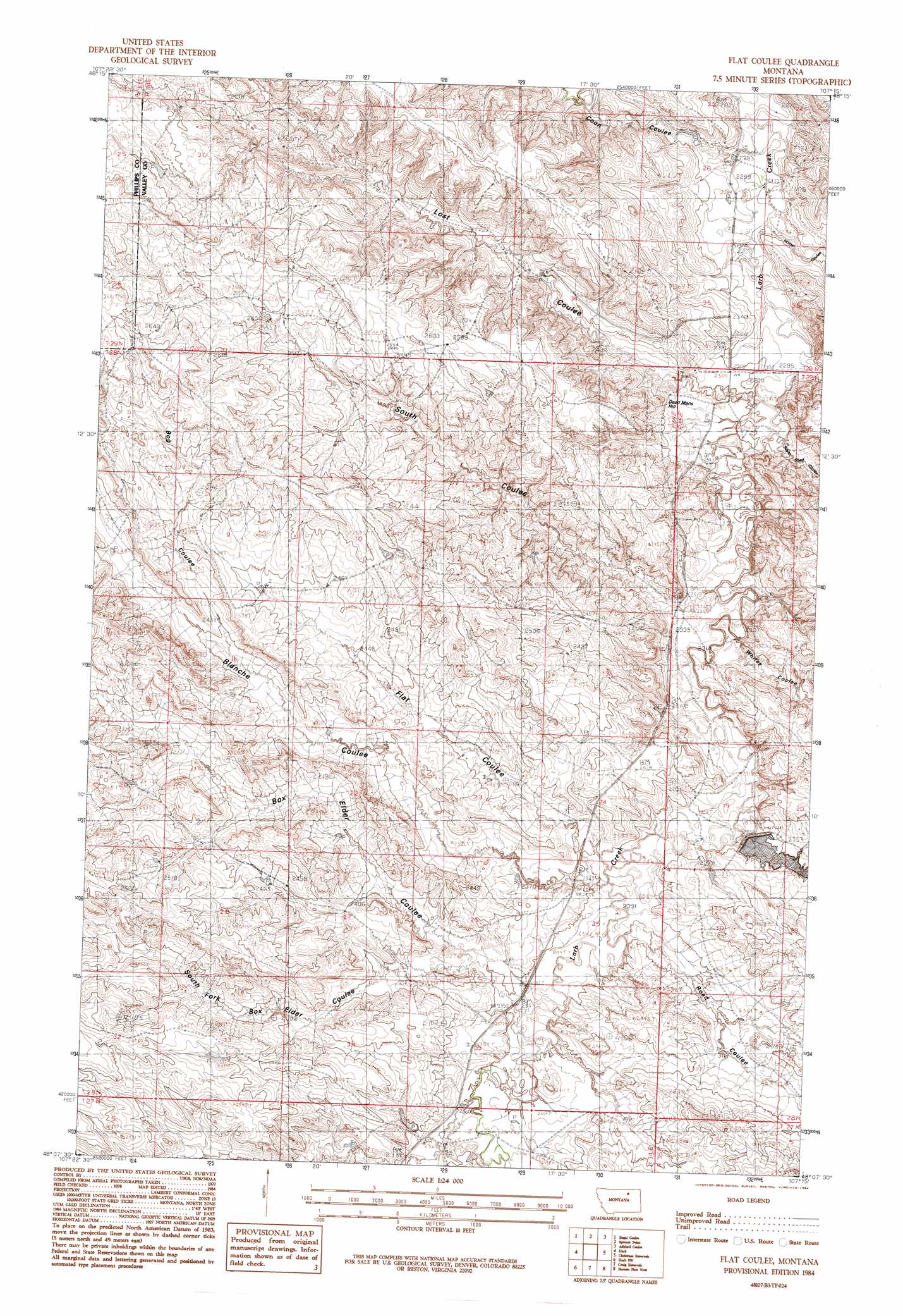
Flat Coulee Topo Map Montana
To zoom in, hover over the map of Flat Coulee
USGS Topo Quad 48107b3 - 1:24,000 scale
| Topo Map Name: | Flat Coulee |
| USGS Topo Quad ID: | 48107b3 |
| Print Size: | ca. 21 1/4" wide x 27" high |
| Southeast Coordinates: | 48.125° N latitude / 107.25° W longitude |
| Map Center Coordinates: | 48.1875° N latitude / 107.3125° W longitude |
| U.S. State: | MT |
| Filename: | o48107b3.jpg |
| Download Map JPG Image: | Flat Coulee topo map 1:24,000 scale |
| Map Type: | Topographic |
| Topo Series: | 7.5´ |
| Map Scale: | 1:24,000 |
| Source of Map Images: | United States Geological Survey (USGS) |
| Alternate Map Versions: |
Flat Coulee MT 1984, updated 1984 Download PDF Buy paper map Flat Coulee MT 2011 Download PDF Buy paper map Flat Coulee MT 2014 Download PDF Buy paper map |
1:24,000 Topo Quads surrounding Flat Coulee
Bowdoin |
Robinson Ranch |
Saco |
Hinsdale Nw |
Hinsdale |
Pinks |
Regal Coulee |
Spencer Point |
Ashford Coulee |
Hinsdale Se |
Johnson Dam |
Harb |
Flat Coulee |
Christmas Reservoir |
Hardpan Coulee |
Content |
Harb Sw |
Craig Reservoir |
Burnett Flats West |
Burnett Flats East |
Buckley Lake |
White Horse Coulee |
Niles Coulee |
Triple Crossing Res. West |
Triple Crossing Res. East |
> Back to 48107a1 at 1:100,000 scale
> Back to 48106a1 at 1:250,000 scale
> Back to U.S. Topo Maps home
Flat Coulee topo map: Gazetteer
Flat Coulee: Dams
Fisher Dam elevation 733m 2404′Pippen Dam elevation 767m 2516′
Flat Coulee: Populated Places
Larb (historical) elevation 782m 2565′Flat Coulee: Post Offices
Larb Post Office (historical) elevation 782m 2565′Flat Coulee: Summits
Dead Mans Hill elevation 729m 2391′Flat Coulee: Valleys
Blanche Coulee elevation 709m 2326′Bog Coulee elevation 744m 2440′
Box Elder Coulee elevation 714m 2342′
Coal Bank Coulee elevation 716m 2349′
Coon Coulee elevation 694m 2276′
Flat Coulee elevation 717m 2352′
Home Coulee elevation 695m 2280′
Lost Coulee elevation 699m 2293′
Road Coulee elevation 709m 2326′
South Coulee elevation 702m 2303′
South Fork Box Elder Coulee elevation 717m 2352′
South Shed Coulee elevation 699m 2293′
Whites Coulee elevation 703m 2306′
Flat Coulee digital topo map on disk
Buy this Flat Coulee topo map showing relief, roads, GPS coordinates and other geographical features, as a high-resolution digital map file on DVD:
Eastern Montana & Western North Dakota
Buy digital topo maps: Eastern Montana & Western North Dakota