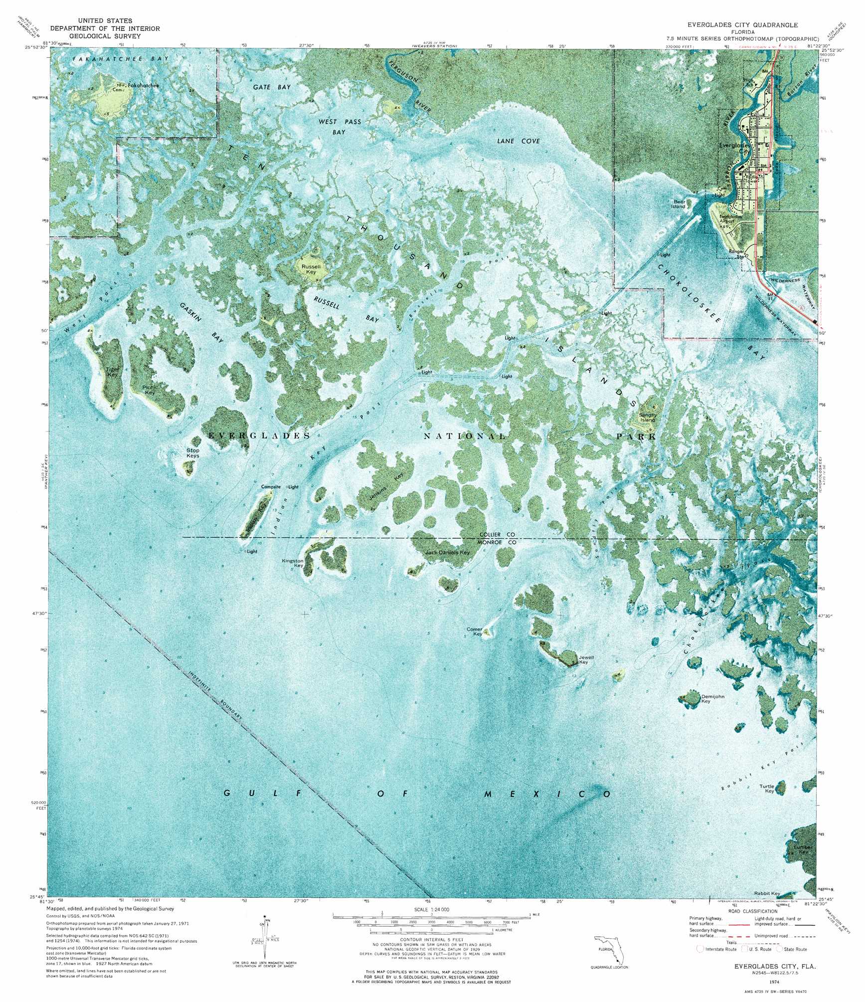
Everglades City Topo Map Florida
To zoom in, hover over the map of Everglades City
USGS Topo Quad 25081g4 - 1:24,000 scale
| Topo Map Name: | Everglades City |
| USGS Topo Quad ID: | 25081g4 |
| Print Size: | ca. 21 1/4" wide x 27" high |
| Southeast Coordinates: | 25.75° N latitude / 81.375° W longitude |
| Map Center Coordinates: | 25.8125° N latitude / 81.4375° W longitude |
| U.S. State: | FL |
| Filename: | P25081G4.jpg |
| Download Map JPG Image: | Everglades City topo map 1:24,000 scale |
| Map Type: | Orthophoto |
| Topo Series: | 7.5´ |
| Map Scale: | 1:24,000 |
| Source of Map Images: | United States Geological Survey (USGS) |
| Alternate Map Versions: |
Everglades City FL 1974, updated 1976 Download PDF Buy paper map Everglades City FL 1974, updated 1976 Download PDF Buy paper map Everglades City FL 2012 Download PDF Buy paper map Everglades City FL 2015 Download PDF Buy paper map |
1:24,000 Topo Quads surrounding Everglades City
Belle Meade |
Belle Meade Se |
Deep Lake Sw |
Deep Lake |
Immokalee 4 Sw |
Marco Island |
Royal Palm Hammock |
Weavers Station |
Ochopee |
Burns Lake |
Cape Romano |
Panther Key |
Everglades City |
Chokoloskee |
Gator Hook Swamp |
Pavilion Key |
Alligator Bay |
|||
Plover Key |
Lostmans River Ranger Station |
> Back to 25081e1 at 1:100,000 scale
> Back to 25080a1 at 1:250,000 scale
> Back to U.S. Topo Maps home
Everglades City topo map: Gazetteer
Everglades City: Airports
Everglades Airport elevation 1m 3′Everglades City: Bays
Gaskin Bay elevation 0m 0′Gate Bay elevation 0m 0′
Lane Cove elevation 0m 0′
Russell Bay elevation 0m 0′
West Pass Bay elevation 0m 0′
Everglades City: Channels
Chokoloskee Pass elevation 0m 0′Everglades Channel elevation 0m 0′
Indian Key Pass elevation 0m 0′
Russell Pass elevation 0m 0′
Sandfly Pass elevation 0m 0′
West Pass elevation 0m 0′
Everglades City: Islands
Bear Island elevation 0m 0′Comer Key elevation 0m 0′
Demijohn Key elevation 0m 0′
Indian Key elevation 0m 0′
Jack Daniels Key elevation 0m 0′
Jenkins Key elevation 0m 0′
Jewell Key elevation 0m 0′
Kingston Key elevation 0m 0′
Picnic Key elevation 0m 0′
Rabbit Key elevation 0m 0′
Russell Key elevation 2m 6′
Sandfly Island elevation 1m 3′
Stop Keys elevation 0m 0′
Ten Thousand Islands elevation 0m 0′
Tiger Key elevation 0m 0′
Turtle Key elevation 0m 0′
Everglades City: Lakes
Lake Placid elevation 0m 0′Everglades City: Populated Places
Everglades City elevation 0m 0′Fakahatchee elevation 2m 6′
Everglades City: Streams
Barron River elevation 0m 0′Ferguson River elevation 0m 0′
Halfway Creek elevation 0m 0′
Everglades City digital topo map on disk
Buy this Everglades City topo map showing relief, roads, GPS coordinates and other geographical features, as a high-resolution digital map file on DVD: