Maria Estella Well Topo Map Texas
To zoom in, hover over the map of Maria Estella Well
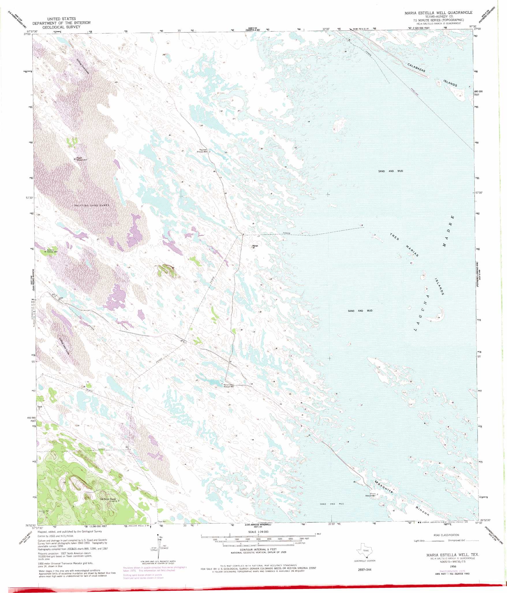
USGS Topo Quad 26097h5 - 1:24,000 scale
| Topo Map Name: | Maria Estella Well |
| USGS Topo Quad ID: | 26097h5 |
| Print Size: | ca. 21 1/4" wide x 27" high |
| Southeast Coordinates: | 26.875° N latitude / 97.5° W longitude |
| Map Center Coordinates: | 26.9375° N latitude / 97.5625° W longitude |
| U.S. State: | TX |
| Filename: | o26097h5.jpg |
| Download Map JPG Image: | Maria Estella Well topo map 1:24,000 scale |
| Map Type: | Topographic |
| Topo Series: | 7.5´ |
| Map Scale: | 1:24,000 |
| Source of Map Images: | United States Geological Survey (USGS) |
| Alternate Map Versions: |
Maria Estella Well TX 1956, updated 1957 Download PDF Buy paper map Maria Estella Well TX 1956, updated 1978 Download PDF Buy paper map Maria Estella Well TX 2010 Download PDF Buy paper map Maria Estella Well TX 2013 Download PDF Buy paper map Maria Estella Well TX 2016 Download PDF Buy paper map |
1:24,000 Topo Quads surrounding Maria Estella Well
Sarita |
La Parra Ranch |
La Parra Ranch Ne |
Yarborough Pass |
|
Turcotte |
La Parra Ranch Sw |
La Parra Ranch Se |
Potrero Cortado |
|
Armstrong |
San Pedro Ranch |
Maria Estella Well |
Potrero Lopeno Nw |
|
Norias |
Saltillo Well |
Los Amigos Windmill |
Potrero Lopeno Sw |
Potrero Lopino Se |
Rudolph |
Rosita Lake |
Rosita Lake Ne |
South Of Potrero Lopeno Nw |
South Of Potrero Lopeno Ne |
> Back to 26097e1 at 1:100,000 scale
> Back to 26096a1 at 1:250,000 scale
> Back to U.S. Topo Maps home
Maria Estella Well topo map: Gazetteer
Maria Estella Well: Islands
Calabazas Islands elevation 2m 6′Tres Marias elevation 1m 3′
Maria Estella Well: Wells
Baladora Artesian Well elevation 5m 16′Magueyal Artesian Well elevation 3m 9′
Maria Estella Artesian Well elevation 3m 9′
Mogote Artesian Well elevation 4m 13′
Rincon Artesian Well elevation 2m 6′
Maria Estella Well digital topo map on disk
Buy this Maria Estella Well topo map showing relief, roads, GPS coordinates and other geographical features, as a high-resolution digital map file on DVD: