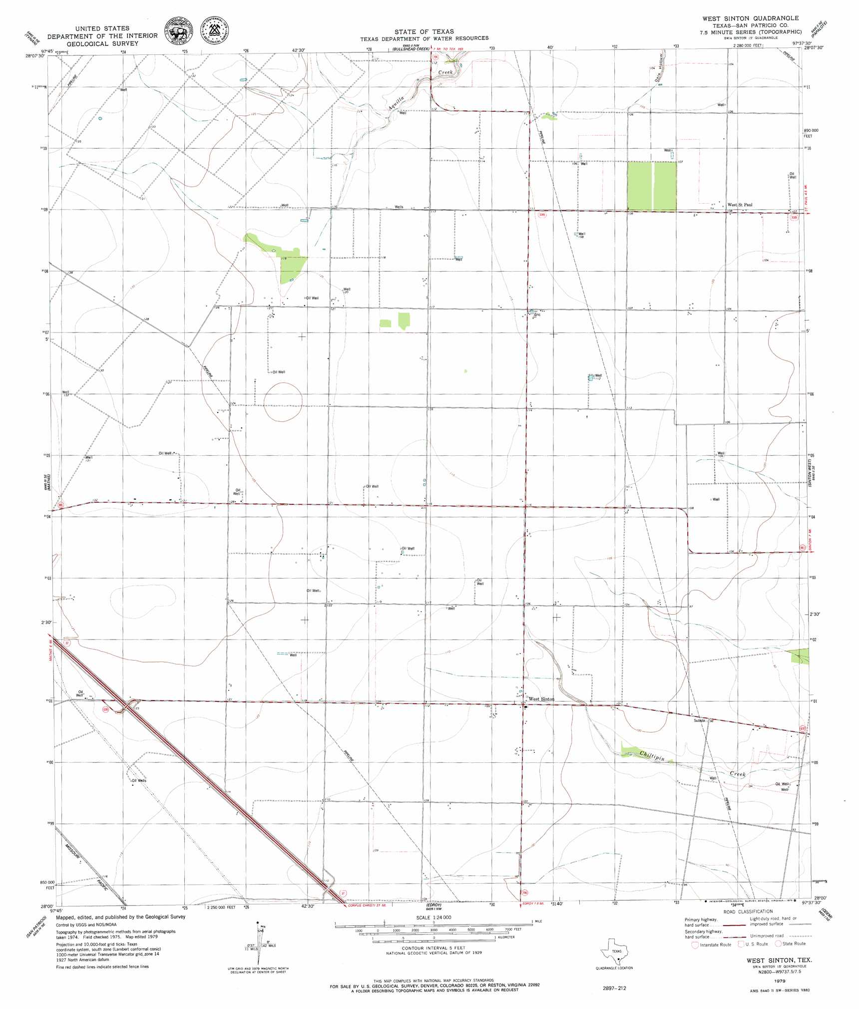
West Sinton Topo Map Texas
To zoom in, hover over the map of West Sinton
USGS Topo Quad 28097a6 - 1:24,000 scale
| Topo Map Name: | West Sinton |
| USGS Topo Quad ID: | 28097a6 |
| Print Size: | ca. 21 1/4" wide x 27" high |
| Southeast Coordinates: | 28° N latitude / 97.625° W longitude |
| Map Center Coordinates: | 28.0625° N latitude / 97.6875° W longitude |
| U.S. State: | TX |
| Filename: | o28097a6.jpg |
| Download Map JPG Image: | West Sinton topo map 1:24,000 scale |
| Map Type: | Topographic |
| Topo Series: | 7.5´ |
| Map Scale: | 1:24,000 |
| Source of Map Images: | United States Geological Survey (USGS) |
| Alternate Map Versions: |
West Sinton TX 1979, updated 1979 Download PDF Buy paper map West Sinton TX 2010 Download PDF Buy paper map West Sinton TX 2013 Download PDF Buy paper map West Sinton TX 2016 Download PDF Buy paper map |
1:24,000 Topo Quads surrounding West Sinton
Mulos Hills |
Clareville |
Skidmore |
Burkes Ridge |
Refugio Sw |
Dinero |
Tynan |
Bullshead Creek |
Papalote |
Cranell |
Sandia |
Mathis |
West Sinton |
Sinton West |
Sinton East |
Orange Grove |
San Patricio |
Edroy |
Odem |
Taft |
Agua Dulce |
Banquete |
Robstown |
Annaville |
Corpus Christi |
> Back to 28097a1 at 1:100,000 scale
> Back to 28096a1 at 1:250,000 scale
> Back to U.S. Topo Maps home
West Sinton topo map: Gazetteer
West Sinton: Populated Places
West Saint Paul elevation 32m 104′West Sinton elevation 32m 104′
West Sinton digital topo map on disk
Buy this West Sinton topo map showing relief, roads, GPS coordinates and other geographical features, as a high-resolution digital map file on DVD: