Agua Dulce Topo Map Texas
To zoom in, hover over the map of Agua Dulce
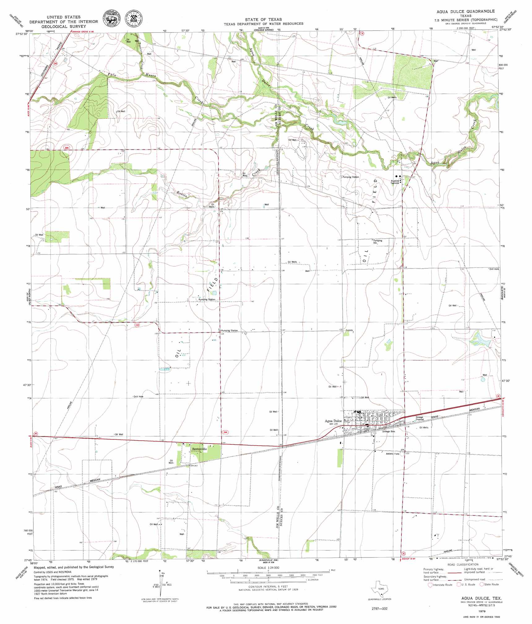
USGS Topo Quad 27097g8 - 1:24,000 scale
| Topo Map Name: | Agua Dulce |
| USGS Topo Quad ID: | 27097g8 |
| Print Size: | ca. 21 1/4" wide x 27" high |
| Southeast Coordinates: | 27.75° N latitude / 97.875° W longitude |
| Map Center Coordinates: | 27.8125° N latitude / 97.9375° W longitude |
| U.S. State: | TX |
| Filename: | o27097g8.jpg |
| Download Map JPG Image: | Agua Dulce topo map 1:24,000 scale |
| Map Type: | Topographic |
| Topo Series: | 7.5´ |
| Map Scale: | 1:24,000 |
| Source of Map Images: | United States Geological Survey (USGS) |
| Alternate Map Versions: |
Agua Dulce TX 1979, updated 1979 Download PDF Buy paper map Agua Dulce TX 2010 Download PDF Buy paper map Agua Dulce TX 2013 Download PDF Buy paper map Agua Dulce TX 2016 Download PDF Buy paper map |
1:24,000 Topo Quads surrounding Agua Dulce
Anna Rose |
Midway |
Sandia |
Mathis |
West Sinton |
Shaeffer Ranch |
San Diego Ne |
Orange Grove |
San Patricio |
Edroy |
San Diego |
Alice North |
Agua Dulce |
Banquete |
Robstown |
Ben Bolt Nw |
Alice South |
Kingsville Nw |
Driscoll West |
Driscoll East |
Palito Blanco |
Ben Bolt Se |
Kingsville West |
Kingsville East |
Concordia |
> Back to 27097e1 at 1:100,000 scale
> Back to 27096a1 at 1:250,000 scale
> Back to U.S. Topo Maps home
Agua Dulce topo map: Gazetteer
Agua Dulce: Populated Places
Agua Dulce elevation 38m 124′Bentonville elevation 45m 147′
Harvest Acres Colonia elevation 43m 141′
Palo Hueco Estates Colonia elevation 46m 150′
Water City Estates Colonia elevation 43m 141′
Agua Dulce: Streams
Palo Hueco Creek elevation 32m 104′Rosita Creek elevation 30m 98′
Tecolate Creek elevation 40m 131′
Tecolote Creek elevation 40m 131′
Agua Dulce digital topo map on disk
Buy this Agua Dulce topo map showing relief, roads, GPS coordinates and other geographical features, as a high-resolution digital map file on DVD: