Three Oaks Topo Map Texas
To zoom in, hover over the map of Three Oaks
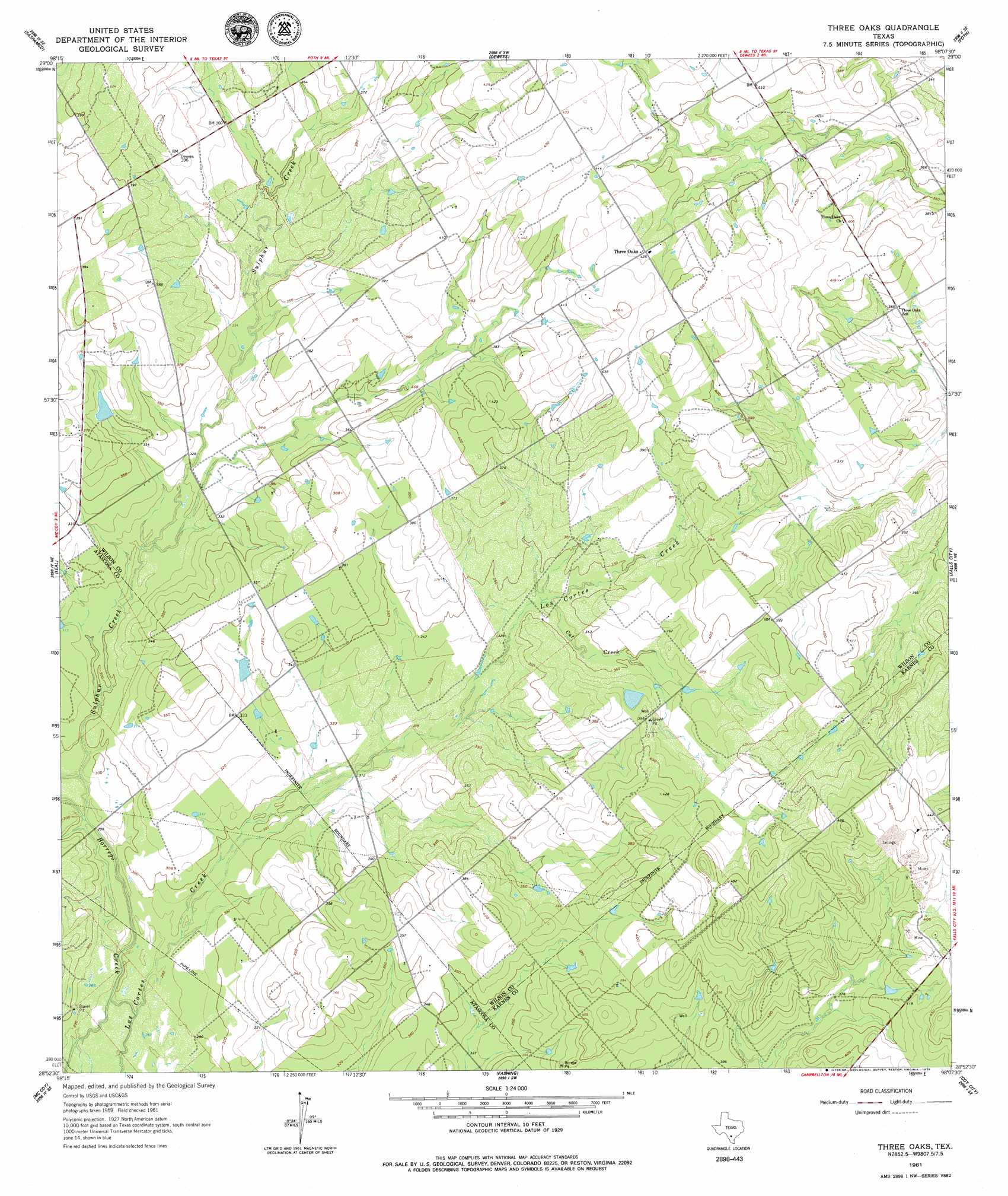
USGS Topo Quad 28098h2 - 1:24,000 scale
| Topo Map Name: | Three Oaks |
| USGS Topo Quad ID: | 28098h2 |
| Print Size: | ca. 21 1/4" wide x 27" high |
| Southeast Coordinates: | 28.875° N latitude / 98.125° W longitude |
| Map Center Coordinates: | 28.9375° N latitude / 98.1875° W longitude |
| U.S. State: | TX |
| Filename: | o28098h2.jpg |
| Download Map JPG Image: | Three Oaks topo map 1:24,000 scale |
| Map Type: | Topographic |
| Topo Series: | 7.5´ |
| Map Scale: | 1:24,000 |
| Source of Map Images: | United States Geological Survey (USGS) |
| Alternate Map Versions: |
Three Oaks TX 1961, updated 1964 Download PDF Buy paper map Three Oaks TX 1961, updated 1979 Download PDF Buy paper map Three Oaks TX 2010 Download PDF Buy paper map Three Oaks TX 2012 Download PDF Buy paper map Three Oaks TX 2016 Download PDF Buy paper map |
1:24,000 Topo Quads surrounding Three Oaks
Losoya |
Saspamco |
Floresville |
Marcelinas Hills |
Stockdale |
Leming |
Saspamco Se |
Dewees |
Poth |
Kosciusko |
Pleasanton |
Leal |
Three Oaks |
Falls City |
Karnes City |
Christine East |
Mccoy |
Fashing |
Coy City |
Lenz |
Caballos Creek |
Whitsett |
Peggy |
Pawnee |
Monteola |
> Back to 28098e1 at 1:100,000 scale
> Back to 28098a1 at 1:250,000 scale
> Back to U.S. Topo Maps home
Three Oaks topo map: Gazetteer
Three Oaks: Dams
Grimes Lake Dam elevation 106m 347′Tessman Lake Dam elevation 118m 387′
Uranium Lake Dam elevation 134m 439′
Three Oaks: Populated Places
Three Oaks elevation 129m 423′Three Oaks: Reservoirs
Grimes Lake elevation 106m 347′Tessman Lake elevation 118m 387′
Uranium Lake elevation 134m 439′
Three Oaks: Streams
Cat Creek elevation 102m 334′Sulphur Creek elevation 88m 288′
Three Oaks digital topo map on disk
Buy this Three Oaks topo map showing relief, roads, GPS coordinates and other geographical features, as a high-resolution digital map file on DVD: