Schattel Topo Map Texas
To zoom in, hover over the map of Schattel
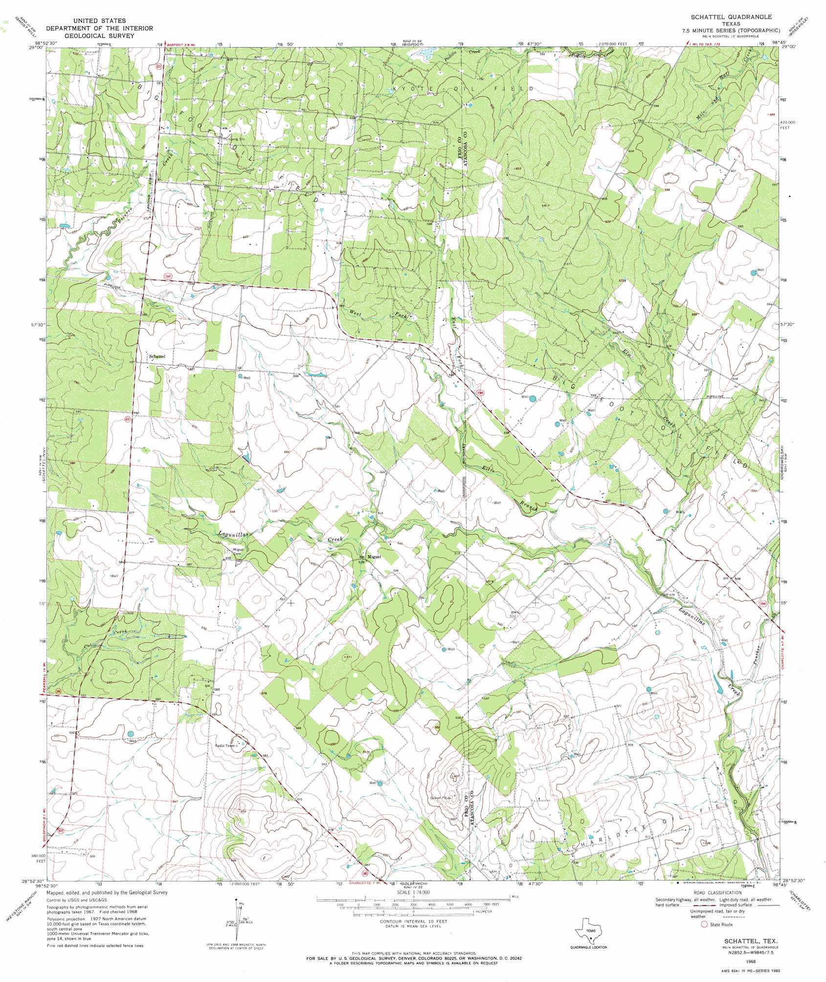
USGS Topo Quad 28098h7 - 1:24,000 scale
| Topo Map Name: | Schattel |
| USGS Topo Quad ID: | 28098h7 |
| Print Size: | ca. 21 1/4" wide x 27" high |
| Southeast Coordinates: | 28.875° N latitude / 98.75° W longitude |
| Map Center Coordinates: | 28.9375° N latitude / 98.8125° W longitude |
| U.S. State: | TX |
| Filename: | o28098h7.jpg |
| Download Map JPG Image: | Schattel topo map 1:24,000 scale |
| Map Type: | Topographic |
| Topo Series: | 7.5´ |
| Map Scale: | 1:24,000 |
| Source of Map Images: | United States Geological Survey (USGS) |
| Alternate Map Versions: |
Schattel TX 1968, updated 1971 Download PDF Buy paper map Schattel TX 2010 Download PDF Buy paper map Schattel TX 2012 Download PDF Buy paper map Schattel TX 2016 Download PDF Buy paper map |
1:24,000 Topo Quads surrounding Schattel
Biry |
Devine |
Lytle |
Somerset |
Thelma |
Moore |
Ghost Hill |
Bigfoot |
Rossville |
Poteet |
Pearsall North |
Schattel Nw |
Schattel |
Dobrowolski |
Jourdanton |
Pearsall South |
Keystone Ranch |
Goldfinch |
Charlotte |
Christine West |
Dilley Ne |
Las Flores |
Hindes |
San Miguel Ranch |
Cross Ne |
> Back to 28098e1 at 1:100,000 scale
> Back to 28098a1 at 1:250,000 scale
> Back to U.S. Topo Maps home
Schattel topo map: Gazetteer
Schattel: Dams
Kyote Lake Dam elevation 180m 590′Schattel: Oilfields
Kyote Oil Field elevation 181m 593′Schattel: Populated Places
Miguel elevation 160m 524′Schattel elevation 184m 603′
Schattel: Reservoirs
Kyote Lake elevation 180m 590′Schattel: Streams
East Fork Ellis Branch elevation 159m 521′Ellis Branch elevation 146m 479′
Elm Creek elevation 143m 469′
Panther Creek elevation 140m 459′
West Fork Ellis Branch elevation 159m 521′
Schattel digital topo map on disk
Buy this Schattel topo map showing relief, roads, GPS coordinates and other geographical features, as a high-resolution digital map file on DVD: