Aermotor Draw Topo Map Texas
To zoom in, hover over the map of Aermotor Draw
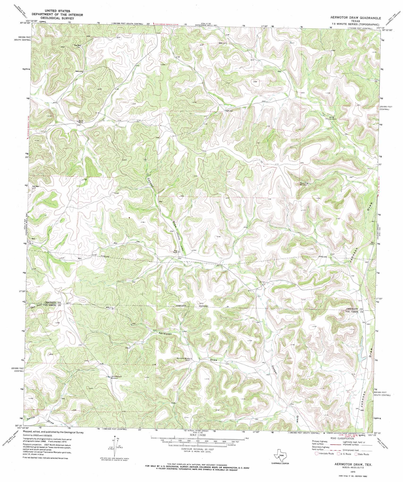
USGS Topo Quad 30101c3 - 1:24,000 scale
| Topo Map Name: | Aermotor Draw |
| USGS Topo Quad ID: | 30101c3 |
| Print Size: | ca. 21 1/4" wide x 27" high |
| Southeast Coordinates: | 30.25° N latitude / 101.25° W longitude |
| Map Center Coordinates: | 30.3125° N latitude / 101.3125° W longitude |
| U.S. State: | TX |
| Filename: | o30101c3.jpg |
| Download Map JPG Image: | Aermotor Draw topo map 1:24,000 scale |
| Map Type: | Topographic |
| Topo Series: | 7.5´ |
| Map Scale: | 1:24,000 |
| Source of Map Images: | United States Geological Survey (USGS) |
| Alternate Map Versions: |
Aermotor Draw TX 1970, updated 1973 Download PDF Buy paper map Aermotor Draw TX 2010 Download PDF Buy paper map Aermotor Draw TX 2012 Download PDF Buy paper map Aermotor Draw TX 2016 Download PDF Buy paper map |
1:24,000 Topo Quads surrounding Aermotor Draw
Burnt Canyon |
Mitchell Canyon |
Hunt Ranch |
Baggett Ranch |
Ozona Se |
Prince Albert Draw |
Howards Well |
Howards Well Ne |
Harrell Canyon |
Wild Horse Canyon |
Antone Canyon |
Howards Well Sw |
Aermotor Draw |
Indian Draw |
Brushy Draw |
Pandale |
Divide Well Draw |
Steel Star Draw |
Bee Canyon |
Juno |
Little Fielder Draw |
Everett Canyon |
Blue Hills |
Sycamore Canyon |
Deaton Draw |
> Back to 30101a1 at 1:100,000 scale
> Back to 30100a1 at 1:250,000 scale
> Back to U.S. Topo Maps home
Aermotor Draw digital topo map on disk
Buy this Aermotor Draw topo map showing relief, roads, GPS coordinates and other geographical features, as a high-resolution digital map file on DVD: