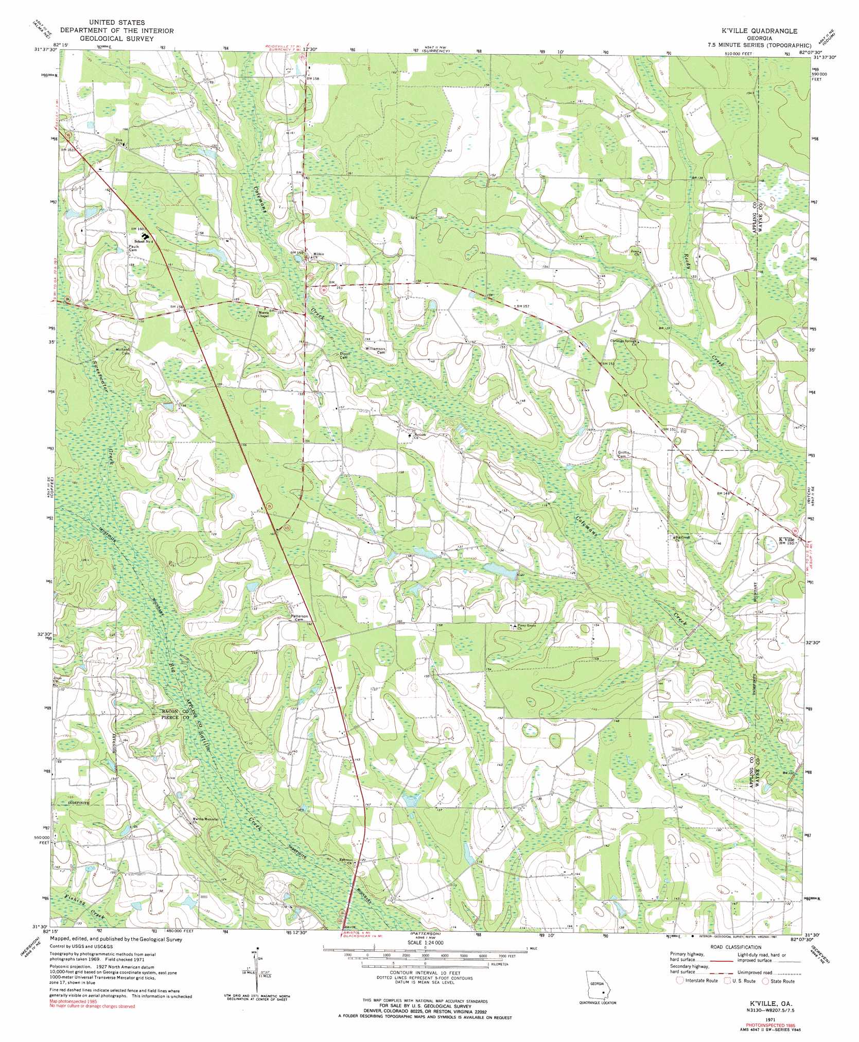
K'Ville Topo Map Georgia
To zoom in, hover over the map of K'Ville
USGS Topo Quad 31082e2 - 1:24,000 scale
| Topo Map Name: | K'Ville |
| USGS Topo Quad ID: | 31082e2 |
| Print Size: | ca. 21 1/4" wide x 27" high |
| Southeast Coordinates: | 31.5° N latitude / 82.125° W longitude |
| Map Center Coordinates: | 31.5625° N latitude / 82.1875° W longitude |
| U.S. State: | GA |
| Filename: | o31082e2.jpg |
| Download Map JPG Image: | K'Ville topo map 1:24,000 scale |
| Map Type: | Topographic |
| Topo Series: | 7.5´ |
| Map Scale: | 1:24,000 |
| Source of Map Images: | United States Geological Survey (USGS) |
| Alternate Map Versions: |
K'ville GA 1971, updated 1974 Download PDF Buy paper map K'ville GA 1971, updated 1991 Download PDF Buy paper map K'Ville GA 2011 Download PDF Buy paper map K'Ville GA 2014 Download PDF Buy paper map |
1:24,000 Topo Quads surrounding K'Ville
Pine Grove |
Baxley |
Altamaha Sw |
Altamaha Se |
Glennville Sw |
Alma Nw |
Alma Ne |
Surrency |
Odum |
Jesup Nw |
Alma |
Coffee |
K'Ville |
Ritch |
Jesup West |
Crawley |
Mershon |
Patterson |
Screven |
Mckinnon |
Dixie Union |
Blackshear West |
Blackshear East |
Patterson Se |
Hortense |
> Back to 31082e1 at 1:100,000 scale
> Back to 31082a1 at 1:250,000 scale
> Back to U.S. Topo Maps home
K'Ville topo map: Gazetteer
K'Ville: Crossings
Moody Ford elevation 33m 108′K'Ville: Populated Places
K'Ville elevation 45m 147′K'Ville: Streams
Sweetwater Creek elevation 32m 104′K'Ville digital topo map on disk
Buy this K'Ville topo map showing relief, roads, GPS coordinates and other geographical features, as a high-resolution digital map file on DVD: